Property Record
Maider Rd, Clay, NY 13041
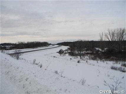

This Property Is For Sale
Property Detail
Maider Rd
Syracuse, NY
FL 23 1164873
312489-023-000-0001-006-000-0000
ONONDAGA
Agriculturalland
New York
02 - SINGL
6.000
B and X Area of moderate flood hazard, usually the area between the limits of the 100-year and 500-year floods.
86.11 AC
2025
NE Outer Onondaga County
2024
Syracuse
011241
NEARBY LISTINGS FOR SALE OR LEASE
-
-
-
-
-
No Photo
-
View all Clay listings for sale on LoopNet.com
DEMOGRAPHICS near Maider Rd
1 mile
3 mile
5 mile
2025 Total Population
262
21,450
53,266
2030 Population
263
21,396
52,904
Pop Growth 2025-2030
+ 0.38%
(0.25%)
(0.68%)
Average Age
46
42
42
2025 Total Households
113
8,697
21,610
HH Growth 2025-2030
0.00%
(0.33%)
(0.76%)
Median Household Inc
$87,500
$99,716
$99,466
Avg Household Size
2.30
2.40
2.40
2025 Avg HH Vehicles
2.00
2.00
2.00
Median Home Value
$219,444
$234,751
$235,222
Median Year Built
1970
1986
1982
Nearby Places
Map Layers
Map Styles
 Street
 Aerial
Transit
 Traffic
 Biking
Places
Listings with unknown addresses are not visible on the map
- Restaurants
- Banks
- Shops
- Fitness
- Groceries
PUBLIC TRANSPORTATION
AIRPORT
Syracuse Hancock International
Drive
Walk
Distance
Syracuse Hancock International
24 min
17.6 mi
Freight Ports
Albany, NY Port
Drive
Walk
Distance
Albany, NY Port
187 min
157.7 mi
Nearby Properties
Address
Land Use
TOTAL SIZE
Lot Size
Zoning
Address
Land Use
TOTAL SIZE
Lot Size
Zoning
2,520 SF
16.28 AC
FED
Address
Land Use
TOTAL SIZE
Lot Size
Zoning
28,800 SF
4.72 AC
PUD
Address
Land Use
TOTAL SIZE
Lot Size
Zoning
28,800 SF
3.19 AC
PUD
Address
Land Use
TOTAL SIZE
Lot Size
Zoning
10,330 SF
241.94 AC
PUD
Address
Land Use
TOTAL SIZE
Lot Size
Zoning
5,371 SF
154.56 AC
PUD
Address
Land Use
TOTAL SIZE
Lot Size
Zoning
65,320 SF
12.97 AC
C-1
Address
Land Use
TOTAL SIZE
Lot Size
Zoning
30,000 SF
34.12 AC
R-2
Address
Land Use
TOTAL SIZE
Lot Size
Zoning
12,312 SF
40.32 AC
05 - COMME
Address
Land Use
TOTAL SIZE
Lot Size
Zoning
6,880 SF
2.03 AC
C-1
Address
Land Use
TOTAL SIZE
Lot Size
Zoning
62,496 SF
26.34 AC
04 - FARM
Address
Land Use
TOTAL SIZE
Lot Size
Zoning
4,368 SF
6.37 AC
R-4
Address
Land Use
TOTAL SIZE
Lot Size
Zoning
5,736 SF
1.08 AC
PUD
Address
Land Use
TOTAL SIZE
Lot Size
Zoning
4,428 SF
58.31 AC
Address
Land Use
TOTAL SIZE
Lot Size
Zoning
3,776 SF
1.50 AC
MR
Address
Land Use
TOTAL SIZE
Lot Size
Zoning
12.90 AC
R-1
Address
Land Use
TOTAL SIZE
Lot Size
Zoning
74,012 SF
58.67 AC
04 - FARM
Address
Land Use
TOTAL SIZE
Lot Size
Zoning
7,350 SF
128.54 AC
02 - SINGL
Address
Land Use
TOTAL SIZE
Lot Size
Zoning
4,346 SF
1.09 AC
PUD
Address
Land Use
TOTAL SIZE
Lot Size
Zoning
1,800 SF
24 AC
I
Address
Land Use
TOTAL SIZE
Lot Size
Zoning
720 SF
5.49 AC
RMH-1
Address
Land Use
TOTAL SIZE
Lot Size
Zoning
183,715 SF
18.21 AC
05 - COMME
Address
Land Use
TOTAL SIZE
Lot Size
Zoning
12,500 SF
3.31 AC
C-1
Address
Land Use
TOTAL SIZE
Lot Size
Zoning
75,000 SF
14.90 AC
04
Address
Land Use
TOTAL SIZE
Lot Size
Zoning
22.10 AC
PUD
Address
Land Use
TOTAL SIZE
Lot Size
Zoning
13,440 SF
28.56 AC
I
Address
Land Use
TOTAL SIZE
Lot Size
Zoning
10,200 SF
7 AC
I
Address
Land Use
TOTAL SIZE
Lot Size
Zoning
28,711 SF
32.84 AC
05 - COMME
Address
Land Use
TOTAL SIZE
Lot Size
Zoning
28,711 SF
32.64 AC
05 - COMME
Address
Land Use
TOTAL SIZE
Lot Size
Zoning
727,525 SF
121.04 AC
05 - COMME
Address
Land Use
TOTAL SIZE
Lot Size
Zoning
151,721 SF
16.70 AC
05 - COMME
The World's #1 Commercial Real Estate Marketplace
Connect with us
© 2026 CoStar Group
The information above has been obtained from sources believed reliable. While we do not doubt its accuracy we have not verified it and make no guarantee, warranty or representation about it. It is your responsibility to independently confirm its accuracy and completeness. Any projections, opinions, assumptions, or estimates used are for example only and do not represent the current or future performance of the property. The value of this transaction to you depends on tax and other factors which should be evaluated by your tax, financial, and legal advisors. You and your advisors should conduct a careful, independent investigation of the property to determine to your satisfaction the suitability of the property for your needs.