Property Record
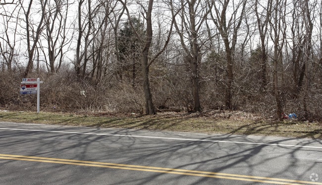
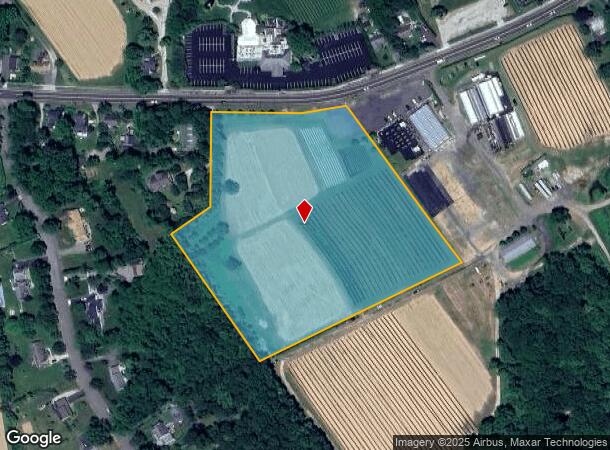
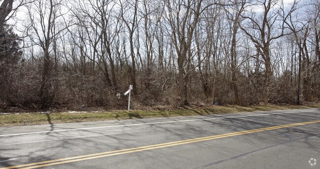
Main Rd, Quogue, NY 11959
NEARBY LISTINGS FOR SALE OR LEASE
Property Detail
Main Rd
Nassau County-Suffolk County, NY
N X MAIN RD & ANO E & S XCONKLIN W X COHEN & ANO
0600-067-00-03-00-022-001
Suffolk
Agriculturalland
New York
X
22
36103C0478H
8.92 AC
2024
Eastern Suffolk
2024
Long Island (New York)
190605
DEMOGRAPHICS near Main Rd
1 Mile
3 Mile
5 Mile
2024 Total Population
974
12,531
33,172
2029 Population
931
12,351
33,058
Pop Growth 2024-2029
(4.41%)
(1.44%)
(0.34%)
Average Age
46
42
42
2024 Total Households
372
4,374
11,798
HH Growth 2024-2029
(4.57%)
(1.94%)
(0.57%)
Median Household Inc
$132,353
$96,701
$79,933
Avg Household Size
2.50
2.80
2.70
2024 Avg HH Vehicles
2.00
2.00
2.00
Median Home Value
$687,500
$513,106
$487,705
Median Year Built
1969
1979
1980
Nearby Places
- Restaurants
- Banks
- Shops
- Fitness
- Groceries
PUBLIC TRANSPORTATION
COMMUTER RAIL
Riverhead Station (Greenport Branch - Long Island Rail Road)
DRIVE
WALK
Distance
Riverhead Station (Greenport Branch - Long Island Rail Road)
9 min
4.2 mi
Mattituck Station (Greenport Branch - Long Island Rail Road)
DRIVE
WALK
Distance
Mattituck Station (Greenport Branch - Long Island Rail Road)
10 min
5.5 mi
AIRPORT
Long Island MacArthur
DRIVE
WALK
Distance
Long Island MacArthur
51 min
32.9 mi
Freight Ports
Port of New Haven
DRIVE
WALK
Distance
Port of New Haven
154 min
63.3 mi
Nearby Properties
Address
Land Use
TOTAL SIZE
Lot Size
Zoning
Address
Land Use
TOTAL SIZE
Lot Size
Zoning
51.70 AC
R15
Address
Land Use
TOTAL SIZE
Lot Size
Zoning
222 AC
H2O
Address
Land Use
TOTAL SIZE
Lot Size
Zoning
81.70 AC
R60
Address
Land Use
TOTAL SIZE
Lot Size
Zoning
3,468 SF
17.70 AC
CR60
Address
Land Use
TOTAL SIZE
Lot Size
Zoning
108,504 SF
31.20 AC
SC
Address
Land Use
TOTAL SIZE
Lot Size
Zoning
113,634 SF
27.49 AC
04
Address
Land Use
TOTAL SIZE
Lot Size
Zoning
28.97 AC
R40
Address
Land Use
TOTAL SIZE
Lot Size
Zoning
73,651 SF
8.50 AC
3
Address
Land Use
TOTAL SIZE
Lot Size
Zoning
14,520 SF
21.20 AC
04
Address
Land Use
TOTAL SIZE
Lot Size
Zoning
274.40 AC
05
Address
Land Use
TOTAL SIZE
Lot Size
Zoning
4.20 AC
R10
Address
Land Use
TOTAL SIZE
Lot Size
Zoning
197.40 AC
OSC
Address
Land Use
TOTAL SIZE
Lot Size
Zoning
12,988 SF
1.01 AC
R15
Address
Land Use
TOTAL SIZE
Lot Size
Zoning
13.47 AC
R40
Address
Land Use
TOTAL SIZE
Lot Size
Zoning
29.93 AC
RA80
Address
Land Use
TOTAL SIZE
Lot Size
Zoning
2,679 SF
0.78 AC
VB
Address
Land Use
TOTAL SIZE
Lot Size
Zoning
67,350 SF
6.80 AC
03
Address
Land Use
TOTAL SIZE
Lot Size
Zoning
21.30 AC
H2O
Address
Land Use
TOTAL SIZE
Lot Size
Zoning
1,421 SF
0.66 AC
OD
Address
Land Use
TOTAL SIZE
Lot Size
Zoning
1,736 SF
1.90 AC
R40
Address
Land Use
TOTAL SIZE
Lot Size
Zoning
149.95 AC
APZ
Address
Land Use
TOTAL SIZE
Lot Size
Zoning
1,142 SF
1.25 AC
RWB
Address
Land Use
TOTAL SIZE
Lot Size
Zoning
3,964 SF
1.10 AC
R40
Address
Land Use
TOTAL SIZE
Lot Size
Zoning
2.82 AC
R40
Address
Land Use
TOTAL SIZE
Lot Size
Zoning
1,688 SF
34.47 AC
09
Address
Land Use
TOTAL SIZE
Lot Size
Zoning
15,476 SF
3.70 AC
DC3
Address
Land Use
TOTAL SIZE
Lot Size
Zoning
66,307 SF
11.09 AC
03
Address
Land Use
TOTAL SIZE
Lot Size
Zoning
2,049 SF
0.63 AC
R15
Address
Land Use
TOTAL SIZE
Lot Size
Zoning
3.80 AC
CRC
Address
Land Use
TOTAL SIZE
Lot Size
Zoning
6,352 SF
2.45 AC
R15
The World's #1 Commercial Real Estate Marketplace
Connect with us
© 2025 CoStar Group
The information above has been obtained from sources believed reliable. While we do not doubt its accuracy we have not verified it and make no guarantee, warranty or representation about it. It is your responsibility to independently confirm its accuracy and completeness. Any projections, opinions, assumptions, or estimates used are for example only and do not represent the current or future performance of the property. The value of this transaction to you depends on tax and other factors which should be evaluated by your tax, financial, and legal advisors. You and your advisors should conduct a careful, independent investigation of the property to determine to your satisfaction the suitability of the property for your needs.