Property Record
Rikard Circle At Main St, Gilbert, SC 29054

Property Detail
Rikard Circle At Main St
006200-06-017
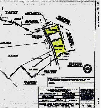
PARCEL A B & C
Commercialacreage
LEXINGTON
RD
South Carolina
B and X Area of moderate flood hazard, usually the area between the limits of the 100-year and 500-year floods.
4.31 AC
2025
Outlying Lexington County
2024
Columbia
021306
Columbia, SC
NEARBY LISTINGS FOR SALE OR LEASE
-
-
View all Gilbert listings for sale on LoopNet.com
DEMOGRAPHICS near Rikard Circle At Main St
1 mile
3 mile
5 mile
2024 Total Population
758
5,471
14,744
2029 Population
812
5,829
15,622
Pop Growth 2024-2029
+ 7.12%
+ 6.54%
+ 5.95%
Average Age
39
40
40
2024 Total Households
287
2,086
5,556
HH Growth 2024-2029
+ 7.32%
+ 6.71%
+ 6.12%
Median Household Inc
$47,999
$66,000
$76,830
Avg Household Size
2.60
2.60
2.60
2024 Avg HH Vehicles
2.00
2.00
2.00
Median Home Value
$252,941
$239,814
$252,765
Median Year Built
1996
1995
1995
Nearby Places
Map Layers
Map Styles
 Street
 Aerial
Transit
 Traffic
 Biking
Places
Listings with unknown addresses are not visible on the map
- Restaurants
- Banks
- Shops
- Fitness
- Groceries
PUBLIC TRANSPORTATION
AIRPORT
Columbia Metro
Drive
Walk
Distance
Columbia Metro
42 min
22.0 mi
Freight Ports
North Charleston Terminal
Drive
Walk
Distance
North Charleston Terminal
144 min
121.7 mi
SALE & LEASE HISTORY
LISTING DATE
SALE/LEASE

Sep 24, 2016
For Sale
Nearby Properties
Address
Land Use
TOTAL SIZE
Lot Size
Zoning
Address
Land Use
TOTAL SIZE
Lot Size
Zoning
468.99 AC
RD
Address
Land Use
TOTAL SIZE
Lot Size
Zoning
28,111 SF
7.01 AC
ID
Address
Land Use
TOTAL SIZE
Lot Size
Zoning
10,640 SF
1.63 AC
RD
Address
Land Use
TOTAL SIZE
Lot Size
Zoning
1,950 SF
8.90 AC
RD
Address
Land Use
TOTAL SIZE
Lot Size
Zoning
10,289 SF
2.82 AC
RD
Address
Land Use
TOTAL SIZE
Lot Size
Zoning
9,600 SF
4.84 AC
ID
Address
Land Use
TOTAL SIZE
Lot Size
Zoning
6,500 SF
5 AC
RD
Address
Land Use
TOTAL SIZE
Lot Size
Zoning
8,000 SF
0.67 AC
ID
Address
Land Use
TOTAL SIZE
Lot Size
Zoning
1,000 SF
1.85 AC
ID
Address
Land Use
TOTAL SIZE
Lot Size
Zoning
3,068 SF
0.96 AC
ID
Address
Land Use
TOTAL SIZE
Lot Size
Zoning
120.38 AC
RD
Address
Land Use
TOTAL SIZE
Lot Size
Zoning
5,440 SF
4 AC
C
Address
Land Use
TOTAL SIZE
Lot Size
Zoning
10,400 SF
6 AC
LM
Address
Land Use
TOTAL SIZE
Lot Size
Zoning
4,800 SF
1.83 AC
LR
Address
Land Use
TOTAL SIZE
Lot Size
Zoning
2,220 SF
11.90 AC
Address
Land Use
TOTAL SIZE
Lot Size
Zoning
2,940 SF
0.99 AC
ID
Address
Land Use
TOTAL SIZE
Lot Size
Zoning
1,490 SF
4.39 AC
RD
Address
Land Use
TOTAL SIZE
Lot Size
Zoning
2,950 SF
9.45 AC
RD
Address
Land Use
TOTAL SIZE
Lot Size
Zoning
2,088 SF
2.45 AC
C
Address
Land Use
TOTAL SIZE
Lot Size
Zoning
57.62 AC
RD
Address
Land Use
TOTAL SIZE
Lot Size
Zoning
1,706 SF
2.25 AC
RD
Address
Land Use
TOTAL SIZE
Lot Size
Zoning
4,950 SF
1.92 AC
RD
Address
Land Use
TOTAL SIZE
Lot Size
Zoning
1,500 SF
9.04 AC
RD
Address
Land Use
TOTAL SIZE
Lot Size
Zoning
840 SF
1.46 AC
RD
Address
Land Use
TOTAL SIZE
Lot Size
Zoning
2,324 SF
16.39 AC
RD
Address
Land Use
TOTAL SIZE
Lot Size
Zoning
3,564 SF
2.16 AC
C
Address
Land Use
TOTAL SIZE
Lot Size
Zoning
2,160 SF
1.65 AC
RD
Address
Land Use
TOTAL SIZE
Lot Size
Zoning
1,373 SF
5.70 AC
RD
Address
Land Use
TOTAL SIZE
Lot Size
Zoning
8,280 SF
3 AC
Address
Land Use
TOTAL SIZE
Lot Size
Zoning
10.28 AC
RD
The World's #1 Commercial Real Estate Marketplace
Connect with us
© 2026 CoStar Group
The information above has been obtained from sources believed reliable. While we do not doubt its accuracy we have not verified it and make no guarantee, warranty or representation about it. It is your responsibility to independently confirm its accuracy and completeness. Any projections, opinions, assumptions, or estimates used are for example only and do not represent the current or future performance of the property. The value of this transaction to you depends on tax and other factors which should be evaluated by your tax, financial, and legal advisors. You and your advisors should conduct a careful, independent investigation of the property to determine to your satisfaction the suitability of the property for your needs.