Property Record
Main St, Gonzales, LA 70737


NEARBY LISTINGS FOR SALE OR LEASE
Property Detail
Main St
Baton Rouge, LA
10S Vl
20006-867
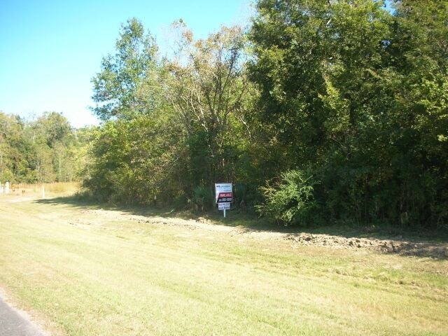
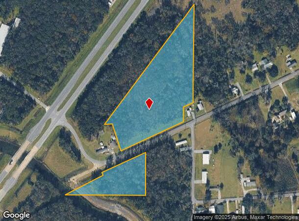
6.38 AC. NE1/4 SEC. 26-10-3, TRACT 1 2.00 AC. NE1/4 SEC. 26-10-3, TRACT 2
Agriculturalland
Ascension
AE
Louisiana
22063C0475E
8.38 AC
2024
Ascension Parish
2024
Baton Rouge
030404
DEMOGRAPHICS near Main St
1 Mile
3 Mile
5 Mile
2024 Total Population
1,201
6,437
27,559
2029 Population
1,283
6,990
30,030
Pop Growth 2024-2029
+ 6.83%
+ 8.59%
+ 8.97%
Average Age
38
38
40
2024 Total Households
441
2,370
10,302
HH Growth 2024-2029
+ 7.03%
+ 8.82%
+ 9.20%
Median Household Inc
$68,863
$76,956
$67,930
Avg Household Size
2.70
2.70
2.60
2024 Avg HH Vehicles
2.00
2.00
2.00
Median Home Value
$166,666
$220,817
$211,013
Median Year Built
1995
1999
1997
Nearby Places
Map Layers
Map Styles
 Street
 Aerial
- Restaurants
- Banks
- Shops
- Fitness
- Groceries
PUBLIC TRANSPORTATION
AIRPORT
Baton Rouge Metro Ryan Field
DRIVE
WALK
Distance
Baton Rouge Metro Ryan Field
43 min
36.1 mi
Freight Ports
Port of Greater Baton Rouge
DRIVE
WALK
Distance
Port of Greater Baton Rouge
39 min
31.3 mi
Nearby Properties
Address
Land Use
TOTAL SIZE
Lot Size
Zoning
Address
Land Use
TOTAL SIZE
Lot Size
Zoning
13.30 AC
PUDSPUD
Address
Land Use
TOTAL SIZE
Lot Size
Zoning
699.06 AC
R
Address
Land Use
TOTAL SIZE
Lot Size
Zoning
90.24 AC
IND
Address
Land Use
TOTAL SIZE
Lot Size
Zoning
Address
Land Use
TOTAL SIZE
Lot Size
Zoning
3.60 AC
Address
Land Use
TOTAL SIZE
Lot Size
Zoning
20.22 AC
MU
Address
Land Use
TOTAL SIZE
Lot Size
Zoning
232.23 AC
Address
Land Use
TOTAL SIZE
Lot Size
Zoning
111.50 AC
PUDSPUD
Address
Land Use
TOTAL SIZE
Lot Size
Zoning
Address
Land Use
TOTAL SIZE
Lot Size
Zoning
2.01 AC
CC
Address
Land Use
TOTAL SIZE
Lot Size
Zoning
3.57 AC
R
Address
Land Use
TOTAL SIZE
Lot Size
Zoning
Address
Land Use
TOTAL SIZE
Lot Size
Zoning
2.76 AC
R
Address
Land Use
TOTAL SIZE
Lot Size
Zoning
Address
Land Use
TOTAL SIZE
Lot Size
Zoning
Address
Land Use
TOTAL SIZE
Lot Size
Zoning
Address
Land Use
TOTAL SIZE
Lot Size
Zoning
Address
Land Use
TOTAL SIZE
Lot Size
Zoning
Address
Land Use
TOTAL SIZE
Lot Size
Zoning
2.36 AC
MU
Address
Land Use
TOTAL SIZE
Lot Size
Zoning
Address
Land Use
TOTAL SIZE
Lot Size
Zoning
1.75 AC
Address
Land Use
TOTAL SIZE
Lot Size
Zoning
16.08 AC
R
Address
Land Use
TOTAL SIZE
Lot Size
Zoning
19.65 AC
R
Address
Land Use
TOTAL SIZE
Lot Size
Zoning
3.75 AC
MU
Address
Land Use
TOTAL SIZE
Lot Size
Zoning
Address
Land Use
TOTAL SIZE
Lot Size
Zoning
3.88 AC
Address
Land Use
TOTAL SIZE
Lot Size
Zoning
Address
Land Use
TOTAL SIZE
Lot Size
Zoning
7.67 AC
Address
Land Use
TOTAL SIZE
Lot Size
Zoning
24.99 AC
The World's #1 Commercial Real Estate Marketplace
Connect with us
© 2026 CoStar Group
The information above has been obtained from sources believed reliable. While we do not doubt its accuracy we have not verified it and make no guarantee, warranty or representation about it. It is your responsibility to independently confirm its accuracy and completeness. Any projections, opinions, assumptions, or estimates used are for example only and do not represent the current or future performance of the property. The value of this transaction to you depends on tax and other factors which should be evaluated by your tax, financial, and legal advisors. You and your advisors should conduct a careful, independent investigation of the property to determine to your satisfaction the suitability of the property for your needs.