Property Record
350 Main St, Jean, NV 89019

Property Detail
350 Main St
Las Vegas-Henderson-North Las Vegas, NV
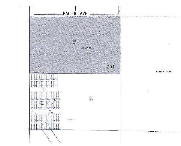
SURVEY FILE 27 PAGE 75 PAR 8
202-25-201-001
CLARK
Vacantlandnec
Nevada
RU
8
A Areas with a 1% annual chance of flooding and a 26% chance of flooding over the life of a 30-year mortgage.
19.85 AC
2026
Outlying S Clark County
2026
Las Vegas
005876
NEARBY LISTINGS FOR SALE OR LEASE
-
-
View all Jean listings for sale on LoopNet.com
DEMOGRAPHICS near 350 Main St
1 mile
3 mile
5 mile
2025 Total Population
193
226
226
2030 Population
214
251
251
Pop Growth 2025-2030
+ 10.88%
+ 11.06%
+ 11.06%
Average Age
47
47
47
2025 Total Households
83
97
97
HH Growth 2025-2030
+ 10.84%
+ 11.34%
+ 11.34%
Median Household Inc
$28,624
$28,437
$28,437
Avg Household Size
2.30
2.40
2.40
2025 Avg HH Vehicles
2.00
2.00
2.00
Median Home Value
$277,777
$281,817
$281,817
Median Year Built
1989
1989
1989
Nearby Places
Map Layers
Map Styles
 Street
 Aerial
Layers
 Traffic
 Biking
Places
Listings with unknown addresses are not visible on the map
- Restaurants
- Banks
- Shops
- Fitness
- Groceries
PUBLIC TRANSPORTATION
AIRPORT
Harry Reid International
Drive
Walk
Distance
Harry Reid International
43 min
33.0 mi
Freight Ports
Port of Long Beach
Drive
Walk
Distance
Port of Long Beach
292 min
260.3 mi
Nearby Properties
Address
Land Use
TOTAL SIZE
Lot Size
Zoning
Address
Land Use
TOTAL SIZE
Lot Size
Zoning
11,924 SF
410.81 AC
RU
Address
Land Use
TOTAL SIZE
Lot Size
Zoning
37.50 AC
RU
Address
Land Use
TOTAL SIZE
Lot Size
Zoning
2,508 SF
2.50 AC
RU
Address
Land Use
TOTAL SIZE
Lot Size
Zoning
1,080 SF
3.33 AC
C2
Address
Land Use
TOTAL SIZE
Lot Size
Zoning
4.01 AC
RU
Address
Land Use
TOTAL SIZE
Lot Size
Zoning
1.66 AC
C2
Address
Land Use
TOTAL SIZE
Lot Size
Zoning
2,159 SF
0.85 AC
C2
Address
Land Use
TOTAL SIZE
Lot Size
Zoning
4.61 AC
RU
Address
Land Use
TOTAL SIZE
Lot Size
Zoning
2.27 AC
RU
Address
Land Use
TOTAL SIZE
Lot Size
Zoning
4.77 AC
RU
Address
Land Use
TOTAL SIZE
Lot Size
Zoning
1,464 SF
0.25 AC
C2
Address
Land Use
TOTAL SIZE
Lot Size
Zoning
0.50 AC
C2
Address
Land Use
TOTAL SIZE
Lot Size
Zoning
0.93 AC
RT
Address
Land Use
TOTAL SIZE
Lot Size
Zoning
0.84 AC
RT
Address
Land Use
TOTAL SIZE
Lot Size
Zoning
0.84 AC
RT
The World's #1 Commercial Real Estate Marketplace
Connect with us
© 2026 CoStar Group
The information above has been obtained from sources believed reliable. While we do not doubt its accuracy we have not verified it and make no guarantee, warranty or representation about it. It is your responsibility to independently confirm its accuracy and completeness. Any projections, opinions, assumptions, or estimates used are for example only and do not represent the current or future performance of the property. The value of this transaction to you depends on tax and other factors which should be evaluated by your tax, financial, and legal advisors. You and your advisors should conduct a careful, independent investigation of the property to determine to your satisfaction the suitability of the property for your needs.