Property Record
Main St, Hesperia, CA 92345

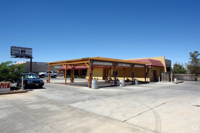

Property Detail
Main St
Riverside-San Bernardino-Ontario, CA
TOWN OF HESPER1A LOTS 31 AND 32 BLK 266 EX WATER RTS AND EX 1/2 1NT M1N RTS WITHOUT SURFACE ENTRY
0413-034-20
SAN BERNARDINO
Vacantlandnec
California
B and X Area of moderate flood hazard, usually the area between the limits of the 100-year and 500-year floods.
31,32
2025
0.13 AC
2025
Mojave River Valley
010019
Inland Empire (California)
NEARBY LISTINGS FOR SALE OR LEASE
-
-
View all Hesperia listings for sale on LoopNet.com
DEMOGRAPHICS near Main St
1 mile
3 mile
5 mile
2024 Total Population
9,515
63,151
146,556
2029 Population
9,660
64,018
148,934
Pop Growth 2024-2029
+ 1.52%
+ 1.37%
+ 1.62%
Average Age
36
36
37
2024 Total Households
2,932
18,393
44,590
HH Growth 2024-2029
+ 1.43%
+ 1.33%
+ 1.55%
Median Household Inc
$52,510
$70,155
$73,847
Avg Household Size
3.20
3.40
3.20
2024 Avg HH Vehicles
2.00
2.00
2.00
Median Home Value
$344,572
$389,600
$400,887
Median Year Built
1979
1985
1988
Nearby Places
Map Layers
Map Styles
 Street
 Aerial
Transit
 Traffic
 Biking
Places
Listings with unknown addresses are not visible on the map
- Restaurants
- Banks
- Shops
- Fitness
- Groceries
PUBLIC TRANSPORTATION
COMMUTER RAIL
Drive
Walk
Distance
17 min
9.0 mi
AIRPORT
Ontario International
Drive
Walk
Distance
Ontario International
51 min
41.2 mi
Freight Ports
Port of Long Beach
Drive
Walk
Distance
Port of Long Beach
112 min
93.1 mi
Nearby Properties
Address
Land Use
TOTAL SIZE
Lot Size
Zoning
Address
Land Use
TOTAL SIZE
Lot Size
Zoning
213,482 SF
19.98 AC
Address
Land Use
TOTAL SIZE
Lot Size
Zoning
158,417 SF
9.66 AC
Address
Land Use
TOTAL SIZE
Lot Size
Zoning
174,855 SF
15.46 AC
Address
Land Use
TOTAL SIZE
Lot Size
Zoning
142,661 SF
14.21 AC
Address
Land Use
TOTAL SIZE
Lot Size
Zoning
80,080 SF
4.88 AC
Address
Land Use
TOTAL SIZE
Lot Size
Zoning
119,525 SF
6.42 AC
Address
Land Use
TOTAL SIZE
Lot Size
Zoning
125,694 SF
10.51 AC
Address
Land Use
TOTAL SIZE
Lot Size
Zoning
65,440 SF
12.70 AC
Address
Land Use
TOTAL SIZE
Lot Size
Zoning
41,249 SF
4.84 AC
Address
Land Use
TOTAL SIZE
Lot Size
Zoning
98,624 SF
8.23 AC
Address
Land Use
TOTAL SIZE
Lot Size
Zoning
59,841 SF
3.99 AC
Address
Land Use
TOTAL SIZE
Lot Size
Zoning
102,120 SF
11 AC
Address
Land Use
TOTAL SIZE
Lot Size
Zoning
70,023 SF
4.52 AC
Address
Land Use
TOTAL SIZE
Lot Size
Zoning
69,000 SF
3.17 AC
Address
Land Use
TOTAL SIZE
Lot Size
Zoning
152,482 SF
14.72 AC
R3
Address
Land Use
TOTAL SIZE
Lot Size
Zoning
86,852 SF
4.86 AC
Address
Land Use
TOTAL SIZE
Lot Size
Zoning
29,988 SF
3.21 AC
Address
Land Use
TOTAL SIZE
Lot Size
Zoning
41,640 SF
4.06 AC
Address
Land Use
TOTAL SIZE
Lot Size
Zoning
36,231 SF
3.71 AC
Address
Land Use
TOTAL SIZE
Lot Size
Zoning
82,584 SF
4.91 AC
Address
Land Use
TOTAL SIZE
Lot Size
Zoning
78,412 SF
4 AC
Address
Land Use
TOTAL SIZE
Lot Size
Zoning
37,601 SF
11.80 AC
Address
Land Use
TOTAL SIZE
Lot Size
Zoning
54,134 SF
5.10 AC
Address
Land Use
TOTAL SIZE
Lot Size
Zoning
35,290 SF
6.20 AC
Address
Land Use
TOTAL SIZE
Lot Size
Zoning
97,236 SF
3.91 AC
Address
Land Use
TOTAL SIZE
Lot Size
Zoning
Address
Land Use
TOTAL SIZE
Lot Size
Zoning
37,907 SF
1.24 AC
Address
Land Use
TOTAL SIZE
Lot Size
Zoning
68,877 SF
4.25 AC
Address
Land Use
TOTAL SIZE
Lot Size
Zoning
88,870 SF
5.97 AC
Address
Land Use
TOTAL SIZE
Lot Size
Zoning
41,278 SF
18.34 AC
The World's #1 Commercial Real Estate Marketplace
Connect with us
© 2026 CoStar Group
The information above has been obtained from sources believed reliable. While we do not doubt its accuracy we have not verified it and make no guarantee, warranty or representation about it. It is your responsibility to independently confirm its accuracy and completeness. Any projections, opinions, assumptions, or estimates used are for example only and do not represent the current or future performance of the property. The value of this transaction to you depends on tax and other factors which should be evaluated by your tax, financial, and legal advisors. You and your advisors should conduct a careful, independent investigation of the property to determine to your satisfaction the suitability of the property for your needs.