Property Record
Main St, Millis, MA 02054
Save to a Folder
{{folder.Name}}
{{folder.ListingIds.length}} Properties
{{folder.ListingIds.length}} Property
Create a New Folder
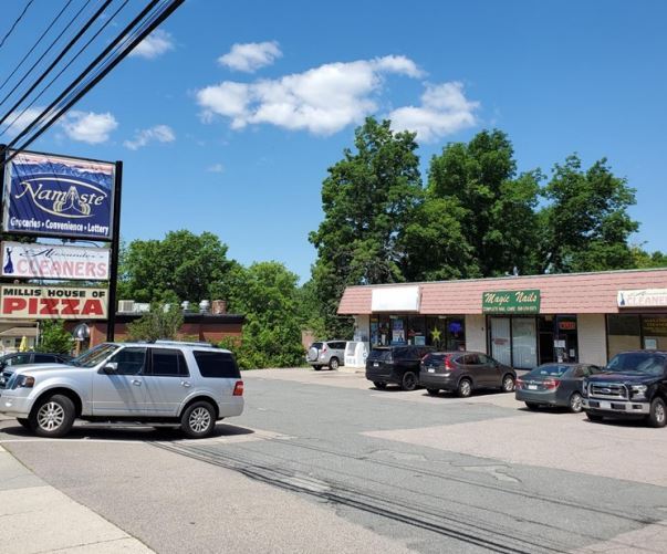
Property Detail
Main St
MILL-000021-000000-000022A
NORFOLK
Taxexempt
Massachusetts
AE The base floodplain where base flood elevations are provided. AE Zones are now used on new format FIRMs instead of A1-A30 Zones.
0.15 AC
0
I-95 Corridor South
2025
Boston
407101
Boston-Cambridge-Newton, MA-NH
NEARBY LISTINGS FOR SALE OR LEASE
DEMOGRAPHICS near Main St
1 mile
3 mile
5 mile
2025 Total Population
4,785
23,280
67,996
2030 Population
4,966
24,467
70,642
Pop Growth 2025-2030
+ 3.78%
+ 5.10%
+ 3.89%
Average Age
43
42
42
2025 Total Households
1,967
8,640
23,975
HH Growth 2025-2030
+ 3.91%
+ 5.14%
+ 4.02%
Median Household Inc
$121,490
$163,150
$176,198
Avg Household Size
2.40
2.70
2.80
2025 Avg HH Vehicles
2.00
2.00
2.00
Median Home Value
$628,378
$696,797
$733,007
Median Year Built
1974
1977
1977
Nearby Places
Map Layers
Map Styles
 Street
 Aerial
Layers
 Traffic
 Biking
Places
Listings with unknown addresses are not visible on the map
- Restaurants
- Banks
- Shops
- Fitness
- Groceries
PUBLIC TRANSPORTATION
COMMUTER RAIL
Norfolk (Franklin Line - Massachusetts Bay Transportation Authority Commuter Rail (Purple Line))
Drive
Walk
Distance
Norfolk (Franklin Line - Massachusetts Bay Transportation Authority Commuter Rail (Purple Line))
10 min
5.3 mi
Franklin (Franklin Line - Massachusetts Bay Transportation Authority Commuter Rail (Purple Line))
Drive
Walk
Distance
Franklin (Franklin Line - Massachusetts Bay Transportation Authority Commuter Rail (Purple Line))
10 min
5.9 mi
AIRPORT
General Edward Lawrence Logan International
Drive
Walk
Distance
General Edward Lawrence Logan International
52 min
30.9 mi
Worcester Regional
Drive
Walk
Distance
Worcester Regional
55 min
34.0 mi
Freight Ports
Port of Boston
Drive
Walk
Distance
Port of Boston
51 min
29.2 mi
SALE & LEASE HISTORY
LISTING DATE
SALE/LEASE

Jun 30, 2021
For Lease
Nearby Properties
Address
Land Use
TOTAL SIZE
Lot Size
Zoning
Address
Land Use
TOTAL SIZE
Lot Size
Zoning
146,536 SF
3.30 AC
Address
Land Use
TOTAL SIZE
Lot Size
Zoning
239,156 SF
33.83 AC
AR-I
Address
Land Use
TOTAL SIZE
Lot Size
Zoning
231,643 SF
1.01 AC
AR-I
Address
Land Use
TOTAL SIZE
Lot Size
Zoning
138,644 SF
12.89 AC
Address
Land Use
TOTAL SIZE
Lot Size
Zoning
35.16 AC
ARII
Address
Land Use
TOTAL SIZE
Lot Size
Zoning
11.24 AC
ARII
Address
Land Use
TOTAL SIZE
Lot Size
Zoning
157.50 AC
Address
Land Use
TOTAL SIZE
Lot Size
Zoning
5,509 SF
29.52 AC
AR-I
Address
Land Use
TOTAL SIZE
Lot Size
Zoning
109.15 AC
AR-I
Address
Land Use
TOTAL SIZE
Lot Size
Zoning
1,440 SF
6.97 AC
ARII
Address
Land Use
TOTAL SIZE
Lot Size
Zoning
80,860 SF
8.77 AC
Address
Land Use
TOTAL SIZE
Lot Size
Zoning
68,052 SF
10.34 AC
CB
Address
Land Use
TOTAL SIZE
Lot Size
Zoning
71,001 SF
9.33 AC
Address
Land Use
TOTAL SIZE
Lot Size
Zoning
2,108 SF
3.20 AC
Address
Land Use
TOTAL SIZE
Lot Size
Zoning
43 AC
ARII
Address
Land Use
TOTAL SIZE
Lot Size
Zoning
60,000 SF
6.93 AC
INDI
Address
Land Use
TOTAL SIZE
Lot Size
Zoning
58,342 SF
2.65 AC
AR-I
Address
Land Use
TOTAL SIZE
Lot Size
Zoning
34,867 SF
3.10 AC
Address
Land Use
TOTAL SIZE
Lot Size
Zoning
11,085 SF
1.40 AC
Address
Land Use
TOTAL SIZE
Lot Size
Zoning
75,416 SF
5.02 AC
INDI
Address
Land Use
TOTAL SIZE
Lot Size
Zoning
54,258 SF
24.15 AC
ARII
Address
Land Use
TOTAL SIZE
Lot Size
Zoning
63,715 SF
6.19 AC
CB
Address
Land Use
TOTAL SIZE
Lot Size
Zoning
4.84 AC
CB
Address
Land Use
TOTAL SIZE
Lot Size
Zoning
288,182 SF
17.60 AC
Address
Land Use
TOTAL SIZE
Lot Size
Zoning
4,646 SF
118 AC
Address
Land Use
TOTAL SIZE
Lot Size
Zoning
13,087 SF
1.10 AC
Address
Land Use
TOTAL SIZE
Lot Size
Zoning
15,383 SF
2.68 AC
Address
Land Use
TOTAL SIZE
Lot Size
Zoning
24,568 SF
8 AC
AR-I
Address
Land Use
TOTAL SIZE
Lot Size
Zoning
50,100 SF
3.62 AC
CB
Address
Land Use
TOTAL SIZE
Lot Size
Zoning
27,540 SF
6.25 AC
CB
The World's #1 Commercial Real Estate Marketplace
Connect with us
© 2026 CoStar Group
The information above has been obtained from sources believed reliable. While we do not doubt its accuracy we have not verified it and make no guarantee, warranty or representation about it. It is your responsibility to independently confirm its accuracy and completeness. Any projections, opinions, assumptions, or estimates used are for example only and do not represent the current or future performance of the property. The value of this transaction to you depends on tax and other factors which should be evaluated by your tax, financial, and legal advisors. You and your advisors should conduct a careful, independent investigation of the property to determine to your satisfaction the suitability of the property for your needs.