Property Record
Main St, Oceanport, NJ 07757

Property Detail
Main St
Lakewood-New Brunswick, NJ
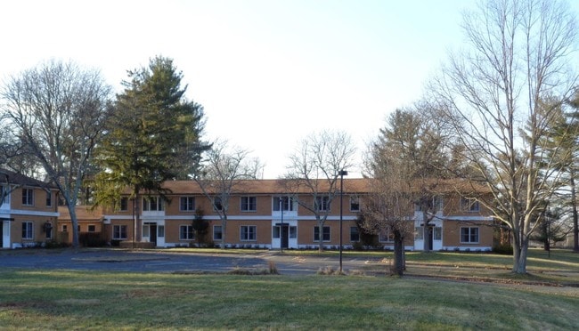
FACILITY NAME: HOSPITAL
38-00110-0000-00004
MONMOUTH
Governmentalpublicusegeneral
New Jersey
MZ
4
D Areas with possible but undetermined flood hazards.
77.44 AC
0
Oceanport
2025
Northern New Jersey
805300
NEARBY LISTINGS FOR SALE OR LEASE
DEMOGRAPHICS near Main St
1 mile
3 mile
5 mile
2025 Total Population
5,973
76,150
154,532
2030 Population
5,953
76,084
155,415
Pop Growth 2025-2030
(0.33%)
(0.09%)
+ 0.57%
Average Age
44
41
42
2025 Total Households
2,547
28,402
60,000
HH Growth 2025-2030
(0.63%)
(0.27%)
+ 0.49%
Median Household Inc
$107,219
$102,216
$110,954
Avg Household Size
2.30
2.50
2.50
2025 Avg HH Vehicles
2.00
2.00
2.00
Median Home Value
$542,926
$683,286
$734,346
Median Year Built
1975
1968
1970
Nearby Places
Map Layers
Map Styles
 Street
 Aerial
Transit
 Traffic
 Biking
Places
Listings with unknown addresses are not visible on the map
- Restaurants
- Banks
- Shops
- Fitness
- Groceries
PUBLIC TRANSPORTATION
COMMUTER RAIL
Little Silver (North Jersey Coast Line - NJ Transit Commuter Rail (NJ Transit))
Drive
Walk
Distance
Little Silver (North Jersey Coast Line - NJ Transit Commuter Rail (NJ Transit))
3 min
1.5 mi
Long Branch (North Jersey Coast Line - NJ Transit Commuter Rail (NJ Transit))
Drive
Walk
Distance
Long Branch (North Jersey Coast Line - NJ Transit Commuter Rail (NJ Transit))
8 min
3.6 mi
AIRPORT
Newark Liberty International
Drive
Walk
Distance
Newark Liberty International
57 min
44.5 mi
Freight Ports
New York Container Terminal
Drive
Walk
Distance
New York Container Terminal
51 min
36.5 mi
SALE & LEASE HISTORY
LISTING DATE
SALE/LEASE

Sep 24, 2016
For Sale
Sep 23, 2016
For Sale
Sep 23, 2016
For Sale
Jul 25, 2017
For Sale
Nearby Properties
Address
Land Use
TOTAL SIZE
Lot Size
Zoning
Address
Land Use
TOTAL SIZE
Lot Size
Zoning
13.75 AC
M
Address
Land Use
TOTAL SIZE
Lot Size
Zoning
221.56 AC
CONREC
Address
Land Use
TOTAL SIZE
Lot Size
Zoning
75.16 AC
MF08
Address
Land Use
TOTAL SIZE
Lot Size
Zoning
110,803 SF
51.49 AC
I
Address
Land Use
TOTAL SIZE
Lot Size
Zoning
Address
Land Use
TOTAL SIZE
Lot Size
Zoning
136.40 AC
B2
Address
Land Use
TOTAL SIZE
Lot Size
Zoning
22,877 SF
10.35 AC
IC
Address
Land Use
TOTAL SIZE
Lot Size
Zoning
84,653 SF
20.79 AC
C50
Address
Land Use
TOTAL SIZE
Lot Size
Zoning
16,276 SF
162.59 AC
R-1
Address
Land Use
TOTAL SIZE
Lot Size
Zoning
2,446 SF
21.62 AC
R-5
Address
Land Use
TOTAL SIZE
Lot Size
Zoning
293,262 SF
28.40 AC
HC
Address
Land Use
TOTAL SIZE
Lot Size
Zoning
24.45 AC
MF08
Address
Land Use
TOTAL SIZE
Lot Size
Zoning
314,569 SF
22.05 AC
R-4
Address
Land Use
TOTAL SIZE
Lot Size
Zoning
251,314 SF
53.63 AC
R-1A
Address
Land Use
TOTAL SIZE
Lot Size
Zoning
35.98 AC
MF08
Address
Land Use
TOTAL SIZE
Lot Size
Zoning
178,315 SF
24.54 AC
C50
Address
Land Use
TOTAL SIZE
Lot Size
Zoning
2.19 AC
BG
Address
Land Use
TOTAL SIZE
Lot Size
Zoning
27 AC
MF08
Address
Land Use
TOTAL SIZE
Lot Size
Zoning
153,160 SF
10.12 AC
OB01
Address
Land Use
TOTAL SIZE
Lot Size
Zoning
14.23 AC
R-4
Address
Land Use
TOTAL SIZE
Lot Size
Zoning
181,867 SF
31.90 AC
RA
Address
Land Use
TOTAL SIZE
Lot Size
Zoning
77.36 AC
B2
Address
Land Use
TOTAL SIZE
Lot Size
Zoning
157,580 SF
14.95 AC
R-4
Address
Land Use
TOTAL SIZE
Lot Size
Zoning
142,311 SF
40.82 AC
I
Address
Land Use
TOTAL SIZE
Lot Size
Zoning
12,269 SF
3.60 AC
OVERLAY
Address
Land Use
TOTAL SIZE
Lot Size
Zoning
14.99 AC
MF08
Address
Land Use
TOTAL SIZE
Lot Size
Zoning
108,629 SF
12.05 AC
HC
Address
Land Use
TOTAL SIZE
Lot Size
Zoning
132,378 SF
8.10 AC
OB01
Address
Land Use
TOTAL SIZE
Lot Size
Zoning
14.73 AC
MF08
Address
Land Use
TOTAL SIZE
Lot Size
Zoning
101,880 SF
6 AC
SF05
The World's #1 Commercial Real Estate Marketplace
Connect with us
© 2026 CoStar Group
The information above has been obtained from sources believed reliable. While we do not doubt its accuracy we have not verified it and make no guarantee, warranty or representation about it. It is your responsibility to independently confirm its accuracy and completeness. Any projections, opinions, assumptions, or estimates used are for example only and do not represent the current or future performance of the property. The value of this transaction to you depends on tax and other factors which should be evaluated by your tax, financial, and legal advisors. You and your advisors should conduct a careful, independent investigation of the property to determine to your satisfaction the suitability of the property for your needs.