Property Record
Mall Dr, Steubenville, OH 43952
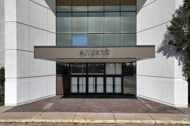
Current Lease Availabilities
Property Detail
Mall Dr
Weirton-Steubenville, WV-OH
2-6-12 46-C LD 0.763A MAP08-28A0-010B0
08-01636-001
JEFFERSON
Commercialnec
Ohio
B and X Area of moderate flood hazard, usually the area between the limits of the 100-year and 500-year floods.
0.76 AC
2025
Ohio North Area
2025
Other Market Areas
001400
NEARBY LISTINGS FOR SALE OR LEASE
DEMOGRAPHICS near Mall Dr
1 mile
3 mile
5 mile
2025 Total Population
3,857
23,081
40,316
2030 Population
3,722
22,614
39,442
Pop Growth 2025-2030
(3.50%)
(2.02%)
(2.17%)
Average Age
47
42
42
2025 Total Households
1,634
9,251
16,700
HH Growth 2025-2030
(3.79%)
(2.36%)
(2.37%)
Median Household Inc
$63,695
$54,888
$53,798
Avg Household Size
2.10
2.20
2.20
2025 Avg HH Vehicles
2.00
2.00
2.00
Median Home Value
$165,053
$137,559
$136,198
Median Year Built
1960
1957
1958
Nearby Places
Map Layers
Map Styles
 Street
 Aerial
Transit
 Traffic
 Biking
Places
Listings with unknown addresses are not visible on the map
- Restaurants
- Banks
- Shops
- Fitness
- Groceries
PUBLIC TRANSPORTATION
AIRPORT
Pittsburgh International
Drive
Walk
Distance
Pittsburgh International
55 min
34.3 mi
Freight Ports
Port of Toledo
Drive
Walk
Distance
Port of Toledo
271 min
229.6 mi
Nearby Properties
Address
Land Use
TOTAL SIZE
Lot Size
Zoning
Address
Land Use
TOTAL SIZE
Lot Size
Zoning
23.40 AC
Address
Land Use
TOTAL SIZE
Lot Size
Zoning
4,556 SF
37.50 AC
Address
Land Use
TOTAL SIZE
Lot Size
Zoning
17.22 AC
Address
Land Use
TOTAL SIZE
Lot Size
Zoning
122.88 AC
Address
Land Use
TOTAL SIZE
Lot Size
Zoning
4,000 SF
6.13 AC
Address
Land Use
TOTAL SIZE
Lot Size
Zoning
6,674 SF
74.94 AC
Address
Land Use
TOTAL SIZE
Lot Size
Zoning
74,134 SF
156.68 AC
Address
Land Use
TOTAL SIZE
Lot Size
Zoning
26.33 AC
Address
Land Use
TOTAL SIZE
Lot Size
Zoning
207,741 SF
14.08 AC
Address
Land Use
TOTAL SIZE
Lot Size
Zoning
321,963 SF
35.09 AC
Address
Land Use
TOTAL SIZE
Lot Size
Zoning
3,600 SF
29 AC
Address
Land Use
TOTAL SIZE
Lot Size
Zoning
Address
Land Use
TOTAL SIZE
Lot Size
Zoning
13,948 SF
1.57 AC
Address
Land Use
TOTAL SIZE
Lot Size
Zoning
1,040 SF
580.81 AC
Address
Land Use
TOTAL SIZE
Lot Size
Zoning
14,976 SF
4.13 AC
Address
Land Use
TOTAL SIZE
Lot Size
Zoning
3.86 AC
Address
Land Use
TOTAL SIZE
Lot Size
Zoning
49,486 SF
9.61 AC
Address
Land Use
TOTAL SIZE
Lot Size
Zoning
134,390 SF
54.80 AC
Address
Land Use
TOTAL SIZE
Lot Size
Zoning
6,300 SF
108.70 AC
Address
Land Use
TOTAL SIZE
Lot Size
Zoning
10,488 SF
3.17 AC
Address
Land Use
TOTAL SIZE
Lot Size
Zoning
37,028 SF
13.92 AC
Address
Land Use
TOTAL SIZE
Lot Size
Zoning
125,738 SF
14.59 AC
Address
Land Use
TOTAL SIZE
Lot Size
Zoning
6,058 SF
16.04 AC
Address
Land Use
TOTAL SIZE
Lot Size
Zoning
26,200 SF
4.48 AC
Address
Land Use
TOTAL SIZE
Lot Size
Zoning
14,784 SF
1.80 AC
Address
Land Use
TOTAL SIZE
Lot Size
Zoning
29,781 SF
4.50 AC
Address
Land Use
TOTAL SIZE
Lot Size
Zoning
79,725 SF
5.88 AC
Address
Land Use
TOTAL SIZE
Lot Size
Zoning
35,311 SF
3.87 AC
Address
Land Use
TOTAL SIZE
Lot Size
Zoning
11,828 SF
2.51 AC
Address
Land Use
TOTAL SIZE
Lot Size
Zoning
12,882 SF
1.01 AC
The World's #1 Commercial Real Estate Marketplace
Connect with us
© 2026 CoStar Group
The information above has been obtained from sources believed reliable. While we do not doubt its accuracy we have not verified it and make no guarantee, warranty or representation about it. It is your responsibility to independently confirm its accuracy and completeness. Any projections, opinions, assumptions, or estimates used are for example only and do not represent the current or future performance of the property. The value of this transaction to you depends on tax and other factors which should be evaluated by your tax, financial, and legal advisors. You and your advisors should conduct a careful, independent investigation of the property to determine to your satisfaction the suitability of the property for your needs.