Property Record
Maple Hill Rd, Auburn, ME 04210

Property Detail
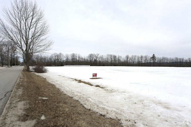
Maple Hill Rd
Lewiston-Auburn, ME
ANDROSCOGGIN
AUBN-000389-000000-000030
Maine
Vacantlandnec
30
B and X Area of moderate flood hazard, usually the area between the limits of the 100-year and 500-year floods.
47.14 AC
2025
Portland Surrounding
2025
Other Market Areas
010400
NEARBY LISTINGS FOR SALE OR LEASE
-
-
View all Auburn listings for sale on LoopNet.com
DEMOGRAPHICS near Maple Hill Rd
1 mile
3 mile
5 mile
2025 Total Population
529
2,968
19,211
2030 Population
560
3,105
19,674
Pop Growth 2025-2030
+ 5.86%
+ 4.62%
+ 2.41%
Average Age
45
44
42
2025 Total Households
154
976
7,372
HH Growth 2025-2030
+ 5.84%
+ 4.51%
+ 2.37%
Median Household Inc
$108,333
$98,295
$69,166
Avg Household Size
2.40
2.50
2.30
2025 Avg HH Vehicles
2.00
2.00
2.00
Median Home Value
$370,833
$341,044
$279,953
Median Year Built
1968
1977
1966
Nearby Places
Map Layers
Map Styles
 Street
 Aerial
Layers
 Traffic
 Biking
Places
Listings with unknown addresses are not visible on the map
- Restaurants
- Banks
- Shops
- Fitness
- Groceries
Nearby Properties
Address
Land Use
TOTAL SIZE
Lot Size
Zoning
Address
Land Use
TOTAL SIZE
Lot Size
Zoning
295,277 SF
124.77 AC
Address
Land Use
TOTAL SIZE
Lot Size
Zoning
93.89 AC
Address
Land Use
TOTAL SIZE
Lot Size
Zoning
Address
Land Use
TOTAL SIZE
Lot Size
Zoning
Address
Land Use
TOTAL SIZE
Lot Size
Zoning
6,273 SF
140.70 AC
Address
Land Use
TOTAL SIZE
Lot Size
Zoning
Address
Land Use
TOTAL SIZE
Lot Size
Zoning
42,568 SF
8.12 AC
Address
Land Use
TOTAL SIZE
Lot Size
Zoning
14,593 SF
56.33 AC
Address
Land Use
TOTAL SIZE
Lot Size
Zoning
19,132 SF
6.12 AC
Address
Land Use
TOTAL SIZE
Lot Size
Zoning
220.50 AC
Address
Land Use
TOTAL SIZE
Lot Size
Zoning
3.23 AC
2
Address
Land Use
TOTAL SIZE
Lot Size
Zoning
3.01 AC
2
Address
Land Use
TOTAL SIZE
Lot Size
Zoning
23,582 SF
11.39 AC
Address
Land Use
TOTAL SIZE
Lot Size
Zoning
3.10 AC
2
Address
Land Use
TOTAL SIZE
Lot Size
Zoning
24,305 SF
16.66 AC
Address
Land Use
TOTAL SIZE
Lot Size
Zoning
15,300 SF
3.85 AC
Address
Land Use
TOTAL SIZE
Lot Size
Zoning
3,445 SF
8.19 AC
2
Address
Land Use
TOTAL SIZE
Lot Size
Zoning
8.44 AC
Address
Land Use
TOTAL SIZE
Lot Size
Zoning
14,486 SF
6.80 AC
Address
Land Use
TOTAL SIZE
Lot Size
Zoning
23.50 AC
2
Address
Land Use
TOTAL SIZE
Lot Size
Zoning
620 SF
28 AC
2
Address
Land Use
TOTAL SIZE
Lot Size
Zoning
7,985 SF
11.59 AC
Address
Land Use
TOTAL SIZE
Lot Size
Zoning
8,800 SF
1.13 AC
Address
Land Use
TOTAL SIZE
Lot Size
Zoning
220.50 AC
Address
Land Use
TOTAL SIZE
Lot Size
Zoning
19.30 AC
Address
Land Use
TOTAL SIZE
Lot Size
Zoning
8,338 SF
1.81 AC
Address
Land Use
TOTAL SIZE
Lot Size
Zoning
8,900 SF
0.72 AC
Address
Land Use
TOTAL SIZE
Lot Size
Zoning
4,896 SF
2.66 AC
Address
Land Use
TOTAL SIZE
Lot Size
Zoning
Address
Land Use
TOTAL SIZE
Lot Size
Zoning
1.84 AC
2
The World's #1 Commercial Real Estate Marketplace
Connect with us
© 2026 CoStar Group
The information above has been obtained from sources believed reliable. While we do not doubt its accuracy we have not verified it and make no guarantee, warranty or representation about it. It is your responsibility to independently confirm its accuracy and completeness. Any projections, opinions, assumptions, or estimates used are for example only and do not represent the current or future performance of the property. The value of this transaction to you depends on tax and other factors which should be evaluated by your tax, financial, and legal advisors. You and your advisors should conduct a careful, independent investigation of the property to determine to your satisfaction the suitability of the property for your needs.