Property Record
Maple St, West Bridgewater, MA 02379
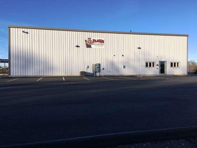

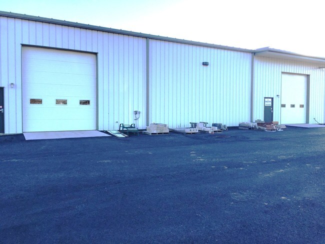
Property Detail
Maple St
Boston-Cambridge-Newton, MA-NH
PLYMOUTH
WBRI-000066-000000-000999
Massachusetts
Stateproperty
999
AE The base floodplain where base flood elevations are provided. AE Zones are now used on new format FIRMs instead of A1-A30 Zones.
1,266.47 AC
0
Route 3 South
2025
Boston
524101
NEARBY LISTINGS FOR SALE OR LEASE
DEMOGRAPHICS near Maple St
1 mile
3 mile
5 mile
2025 Total Population
471
19,053
74,418
2030 Population
489
19,472
75,336
Pop Growth 2025-2030
+ 3.82%
+ 2.20%
+ 1.23%
Average Age
40
42
41
2025 Total Households
166
7,171
25,811
HH Growth 2025-2030
+ 3.61%
+ 2.20%
+ 1.27%
Median Household Inc
$130,242
$111,747
$109,104
Avg Household Size
2.80
2.60
2.70
2025 Avg HH Vehicles
2.00
2.00
2.00
Median Home Value
$609,550
$592,164
$540,643
Median Year Built
1969
1975
1973
Nearby Places
Map Layers
Map Styles
 Street
 Aerial
Layers
 Traffic
 Biking
Places
Listings with unknown addresses are not visible on the map
- Restaurants
- Banks
- Shops
- Fitness
- Groceries
PUBLIC TRANSPORTATION
COMMUTER RAIL
Campello (Middleborough/Lakeville Line - Massachusetts Bay Transportation Authority Commuter Rail (Purple Line))
Drive
Walk
Distance
Campello (Middleborough/Lakeville Line - Massachusetts Bay Transportation Authority Commuter Rail (Purple Line))
11 min
5.1 mi
Bridgewater (Middleborough/Lakeville Line - Massachusetts Bay Transportation Authority Commuter Rail (Purple Line))
Drive
Walk
Distance
Bridgewater (Middleborough/Lakeville Line - Massachusetts Bay Transportation Authority Commuter Rail (Purple Line))
14 min
6.5 mi
AIRPORT
General Edward Lawrence Logan International
Drive
Walk
Distance
General Edward Lawrence Logan International
43 min
30.4 mi
Rhode Island Tf Green International
Drive
Walk
Distance
Rhode Island Tf Green International
59 min
36.4 mi
Freight Ports
Port of Boston
Drive
Walk
Distance
Port of Boston
40 min
28.2 mi
SALE & LEASE HISTORY
LISTING DATE
SALE/LEASE

Sep 25, 2016
For Lease
Nearby Properties
Address
Land Use
TOTAL SIZE
Lot Size
Zoning
Address
Land Use
TOTAL SIZE
Lot Size
Zoning
349,800 SF
30.82 AC
Address
Land Use
TOTAL SIZE
Lot Size
Zoning
216,489 SF
49.60 AC
Address
Land Use
TOTAL SIZE
Lot Size
Zoning
21.12 AC
Address
Land Use
TOTAL SIZE
Lot Size
Zoning
109,960 SF
28.02 AC
Address
Land Use
TOTAL SIZE
Lot Size
Zoning
558,011 SF
82.11 AC
Address
Land Use
TOTAL SIZE
Lot Size
Zoning
67.01 AC
Address
Land Use
TOTAL SIZE
Lot Size
Zoning
210,600 SF
19.86 AC
Address
Land Use
TOTAL SIZE
Lot Size
Zoning
312,000 SF
30.61 AC
Address
Land Use
TOTAL SIZE
Lot Size
Zoning
Address
Land Use
TOTAL SIZE
Lot Size
Zoning
211,030 SF
19.27 AC
Address
Land Use
TOTAL SIZE
Lot Size
Zoning
80,429 SF
16.68 AC
Address
Land Use
TOTAL SIZE
Lot Size
Zoning
101,871 SF
82.25 AC
Address
Land Use
TOTAL SIZE
Lot Size
Zoning
44,138 SF
27.41 AC
Address
Land Use
TOTAL SIZE
Lot Size
Zoning
15.90 AC
Address
Land Use
TOTAL SIZE
Lot Size
Zoning
88,200 SF
8.98 AC
Address
Land Use
TOTAL SIZE
Lot Size
Zoning
128,963 SF
83.17 AC
Address
Land Use
TOTAL SIZE
Lot Size
Zoning
68,700 SF
19 AC
Address
Land Use
TOTAL SIZE
Lot Size
Zoning
12,396 SF
4.66 AC
Address
Land Use
TOTAL SIZE
Lot Size
Zoning
144,604 SF
25.03 AC
Address
Land Use
TOTAL SIZE
Lot Size
Zoning
102,008 SF
11.22 AC
Address
Land Use
TOTAL SIZE
Lot Size
Zoning
40,000 SF
9.27 AC
Address
Land Use
TOTAL SIZE
Lot Size
Zoning
108,270 SF
11.95 AC
Address
Land Use
TOTAL SIZE
Lot Size
Zoning
88,088 SF
11 AC
Address
Land Use
TOTAL SIZE
Lot Size
Zoning
18,400 SF
7.67 AC
Address
Land Use
TOTAL SIZE
Lot Size
Zoning
31,171 SF
7.44 AC
Address
Land Use
TOTAL SIZE
Lot Size
Zoning
19.84 AC
Address
Land Use
TOTAL SIZE
Lot Size
Zoning
13.81 AC
Address
Land Use
TOTAL SIZE
Lot Size
Zoning
67,540 SF
5.51 AC
Address
Land Use
TOTAL SIZE
Lot Size
Zoning
108,500 SF
16.26 AC
Address
Land Use
TOTAL SIZE
Lot Size
Zoning
67,600 SF
14.03 AC
The World's #1 Commercial Real Estate Marketplace
Connect with us
© 2026 CoStar Group
The information above has been obtained from sources believed reliable. While we do not doubt its accuracy we have not verified it and make no guarantee, warranty or representation about it. It is your responsibility to independently confirm its accuracy and completeness. Any projections, opinions, assumptions, or estimates used are for example only and do not represent the current or future performance of the property. The value of this transaction to you depends on tax and other factors which should be evaluated by your tax, financial, and legal advisors. You and your advisors should conduct a careful, independent investigation of the property to determine to your satisfaction the suitability of the property for your needs.