Property Record
Marie Olson Dr, Chesapeake, VA 23321

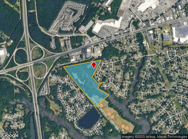
Property Detail
Marie Olson Dr
0150000001324
D-3 WATTS ESTATE 32.7 AC
Taxexempt
CHESAPEAKE
R15S: RESI
Virginia
AE The base floodplain where base flood elevations are provided. AE Zones are now used on new format FIRMs instead of A1-A30 Zones.
32.70 AC
0
Western Branch
2025
Hampton Roads
021505
Virginia Beach-Chesapeake-Norfolk, VA-NC
NEARBY LISTINGS FOR SALE OR LEASE
-
-
-
-
-
-
-
-
No Photo
-
View all Chesapeake listings for sale on LoopNet.com
DEMOGRAPHICS near Marie Olson Dr
1 mile
3 mile
5 mile
2024 Total Population
4,740
45,359
117,810
2029 Population
4,842
46,159
119,961
Pop Growth 2024-2029
+ 2.15%
+ 1.76%
+ 1.83%
Average Age
40
39
40
2024 Total Households
1,747
16,803
45,307
HH Growth 2024-2029
+ 2.35%
+ 1.71%
+ 1.77%
Median Household Inc
$111,470
$97,227
$83,582
Avg Household Size
2.70
2.70
2.50
2024 Avg HH Vehicles
2.00
2.00
2.00
Median Home Value
$368,930
$357,845
$320,682
Median Year Built
1991
1986
1980
Nearby Places
Map Layers
Map Styles
 Street
 Aerial
Transit
 Traffic
 Biking
Places
Listings with unknown addresses are not visible on the map
- Restaurants
- Banks
- Shops
- Fitness
- Groceries
PUBLIC TRANSPORTATION
COMMUTER RAIL
Norfolk (Northeast Regional - Amtrak)
Drive
Walk
Distance
Norfolk (Northeast Regional - Amtrak)
19 min
9.7 mi
AIRPORT
Norfolk International
Drive
Walk
Distance
Norfolk International
31 min
16.1 mi
Newport News/Williamsburg International
Drive
Walk
Distance
Newport News/Williamsburg International
39 min
28.2 mi
Freight Ports
Virginia Port Authority - Portsmouth
Drive
Walk
Distance
Virginia Port Authority - Portsmouth
19 min
8.6 mi
Nearby Properties
Address
Land Use
TOTAL SIZE
Lot Size
Zoning
Address
Land Use
TOTAL SIZE
Lot Size
Zoning
637,266 SF
73.24 AC
PUD: PLANN
Address
Land Use
TOTAL SIZE
Lot Size
Zoning
285,162 SF
101.91 AC
R10S: RESI
Address
Land Use
TOTAL SIZE
Lot Size
Zoning
359,146 SF
16.95 AC
RMF1: MULT
Address
Land Use
TOTAL SIZE
Lot Size
Zoning
71,039 SF
22.69 AC
R10S: RESI
Address
Land Use
TOTAL SIZE
Lot Size
Zoning
1,684 SF
23.36 AC
RMF1: MULT
Address
Land Use
TOTAL SIZE
Lot Size
Zoning
88,346 SF
31.49 AC
HEAVY INDU
Address
Land Use
TOTAL SIZE
Lot Size
Zoning
206,652 SF
64.32 AC
A1: AGRICU
Address
Land Use
TOTAL SIZE
Lot Size
Zoning
73,039 SF
11.68 AC
RMF1: MULT
Address
Land Use
TOTAL SIZE
Lot Size
Zoning
150,000 SF
21.52 AC
HEAVY INDU
Address
Land Use
TOTAL SIZE
Lot Size
Zoning
121,200 SF
9.81 AC
PUD: PLANN
Address
Land Use
TOTAL SIZE
Lot Size
Zoning
235,968 SF
13.25 AC
RMF1: MULT
Address
Land Use
TOTAL SIZE
Lot Size
Zoning
222,810 SF
42.16 AC
MULTI: MUL
Address
Land Use
TOTAL SIZE
Lot Size
Zoning
274,700 SF
24.69 AC
UR
Address
Land Use
TOTAL SIZE
Lot Size
Zoning
224,077 SF
27.30 AC
B2: GENERA
Address
Land Use
TOTAL SIZE
Lot Size
Zoning
178,266 SF
24.84 AC
B2: GENERA
Address
Land Use
TOTAL SIZE
Lot Size
Zoning
205,470 SF
12.39 AC
URM
Address
Land Use
TOTAL SIZE
Lot Size
Zoning
114,956 SF
12.28 AC
B2: GENERA
Address
Land Use
TOTAL SIZE
Lot Size
Zoning
42,666 SF
7.72 AC
RMF1: MULT
Address
Land Use
TOTAL SIZE
Lot Size
Zoning
130,114 SF
20.96 AC
B2: GENERA
Address
Land Use
TOTAL SIZE
Lot Size
Zoning
91,005 SF
26.77 AC
M1: LIGHT
Address
Land Use
TOTAL SIZE
Lot Size
Zoning
174,400 SF
10.97 AC
URM
Address
Land Use
TOTAL SIZE
Lot Size
Zoning
201,612 SF
12.54 AC
IL
Address
Land Use
TOTAL SIZE
Lot Size
Zoning
53,200 SF
2.25 AC
B2: GENERA
Address
Land Use
TOTAL SIZE
Lot Size
Zoning
119,232 SF
7.22 AC
M1: LIGHT
Address
Land Use
TOTAL SIZE
Lot Size
Zoning
85,824 SF
3.18 AC
LIGHT INDU
Address
Land Use
TOTAL SIZE
Lot Size
Zoning
135,309 SF
17.51 AC
B2: GENERA
Address
Land Use
TOTAL SIZE
Lot Size
Zoning
118,090 SF
9.71 AC
B2: GENERA
The World's #1 Commercial Real Estate Marketplace
Connect with us
© 2026 CoStar Group
The information above has been obtained from sources believed reliable. While we do not doubt its accuracy we have not verified it and make no guarantee, warranty or representation about it. It is your responsibility to independently confirm its accuracy and completeness. Any projections, opinions, assumptions, or estimates used are for example only and do not represent the current or future performance of the property. The value of this transaction to you depends on tax and other factors which should be evaluated by your tax, financial, and legal advisors. You and your advisors should conduct a careful, independent investigation of the property to determine to your satisfaction the suitability of the property for your needs.