No Photo
Property Record
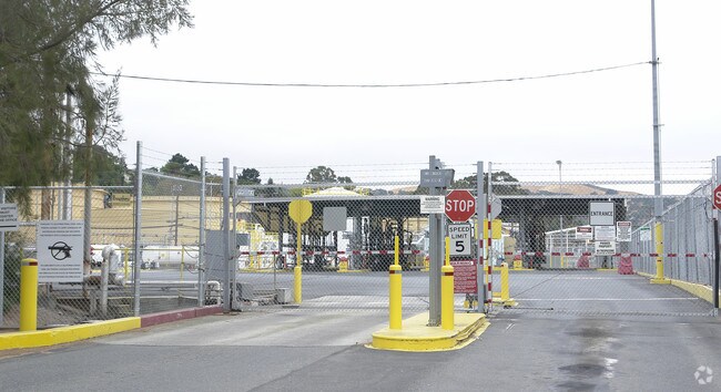
Marina Vis, Martinez, CA 94553


Property Detail
Marina Vis
378-040-005-1
RO LAS JUNTAS TRS B,C&D&TR ADJ
Heavyindustrial
CONTRA COSTA
AE The base floodplain where base flood elevations are provided. AE Zones are now used on new format FIRMs instead of A1-A30 Zones.
California
2025
135.96 AC
2025
Martinez/Pacheco/Hercules
317000
East Bay/Oakland
187,998 SF
Oakland-Fremont-Berkeley, CA
NEARBY LISTINGS FOR SALE OR LEASE
-
-
View all Martinez listings for sale on LoopNet.com
DEMOGRAPHICS near Marina Vis
1 mile
3 mile
5 mile
2025 Total Population
6,085
40,467
87,333
2030 Population
6,159
40,778
87,809
Pop Growth 2025-2030
+ 1.22%
+ 0.77%
+ 0.55%
Average Age
43
43
43
2025 Total Households
2,535
16,376
34,790
HH Growth 2025-2030
+ 1.42%
+ 0.84%
+ 0.59%
Median Household Inc
$91,017
$115,537
$123,660
Avg Household Size
2.10
2.40
2.40
2025 Avg HH Vehicles
2.00
2.00
2.00
Median Home Value
$682,449
$738,457
$774,744
Median Year Built
1948
1972
1976
Nearby Places
Map Layers
Map Styles
 Street
 Aerial
Transit
 Traffic
 Biking
Places
Listings with unknown addresses are not visible on the map
- Restaurants
- Banks
- Shops
- Fitness
- Groceries
PUBLIC TRANSPORTATION
COMMUTER RAIL
Martinez (California Zephyr - Capitol Corridor Joint Powers Authority, Capitol Corridor - Capitol Corridor Joint Powers Authority, Coast Starlight - Capitol Corridor Joint Powers Authority, San Joaquins - Capitol Corridor Joint Powers Authority)
Drive
Walk
Distance
Martinez (California Zephyr - Capitol Corridor Joint Powers Authority, Capitol Corridor - Capitol Corridor Joint Powers Authority, Coast Starlight - Capitol Corridor Joint Powers Authority, San Joaquins - Capitol Corridor Joint Powers Authority)
2 min
1.1 mi
AIRPORT
Metro Oakland International
Drive
Walk
Distance
Metro Oakland International
46 min
34.2 mi
Freight Ports
Port of Richmond
Drive
Walk
Distance
Port of Richmond
38 min
24.9 mi
Nearby Properties
Address
Land Use
TOTAL SIZE
Lot Size
Zoning
Address
Land Use
TOTAL SIZE
Lot Size
Zoning
228,197 SF
294.92 AC
HI
Address
Land Use
TOTAL SIZE
Lot Size
Zoning
28,948 SF
63.56 AC
HI
Address
Land Use
TOTAL SIZE
Lot Size
Zoning
9,000 SF
137.45 AC
Address
Land Use
TOTAL SIZE
Lot Size
Zoning
12.82 AC
Address
Land Use
TOTAL SIZE
Lot Size
Zoning
66,196 SF
40.92 AC
HI
Address
Land Use
TOTAL SIZE
Lot Size
Zoning
54,870 SF
34.53 AC
HI
Address
Land Use
TOTAL SIZE
Lot Size
Zoning
70,000 SF
25.77 AC
Address
Land Use
TOTAL SIZE
Lot Size
Zoning
9,840 SF
5.85 AC
Address
Land Use
TOTAL SIZE
Lot Size
Zoning
15.34 AC
Address
Land Use
TOTAL SIZE
Lot Size
Zoning
66.32 AC
Address
Land Use
TOTAL SIZE
Lot Size
Zoning
68.97 AC
Address
Land Use
TOTAL SIZE
Lot Size
Zoning
7.08 AC
Address
Land Use
TOTAL SIZE
Lot Size
Zoning
49,519 SF
2.04 AC
Address
Land Use
TOTAL SIZE
Lot Size
Zoning
3.07 AC
Address
Land Use
TOTAL SIZE
Lot Size
Zoning
71,000 SF
1.23 AC
Address
Land Use
TOTAL SIZE
Lot Size
Zoning
19.90 AC
Address
Land Use
TOTAL SIZE
Lot Size
Zoning
3,612 SF
4.74 AC
Address
Land Use
TOTAL SIZE
Lot Size
Zoning
22.30 AC
Address
Land Use
TOTAL SIZE
Lot Size
Zoning
51,500 SF
5.92 AC
Address
Land Use
TOTAL SIZE
Lot Size
Zoning
204.82 AC
HI
Address
Land Use
TOTAL SIZE
Lot Size
Zoning
13.74 AC
HI
Address
Land Use
TOTAL SIZE
Lot Size
Zoning
22,176 SF
15.14 AC
Address
Land Use
TOTAL SIZE
Lot Size
Zoning
32,928 SF
7.56 AC
Address
Land Use
TOTAL SIZE
Lot Size
Zoning
126,248 SF
3.34 AC
Address
Land Use
TOTAL SIZE
Lot Size
Zoning
54,874 SF
0.57 AC
Address
Land Use
TOTAL SIZE
Lot Size
Zoning
70,326 SF
7.67 AC
Address
Land Use
TOTAL SIZE
Lot Size
Zoning
86,222 SF
39.83 AC
Address
Land Use
TOTAL SIZE
Lot Size
Zoning
13.63 AC
Address
Land Use
TOTAL SIZE
Lot Size
Zoning
14,800 SF
74.08 AC
The World's #1 Commercial Real Estate Marketplace
Connect with us
© 2026 CoStar Group
The information above has been obtained from sources believed reliable. While we do not doubt its accuracy we have not verified it and make no guarantee, warranty or representation about it. It is your responsibility to independently confirm its accuracy and completeness. Any projections, opinions, assumptions, or estimates used are for example only and do not represent the current or future performance of the property. The value of this transaction to you depends on tax and other factors which should be evaluated by your tax, financial, and legal advisors. You and your advisors should conduct a careful, independent investigation of the property to determine to your satisfaction the suitability of the property for your needs.