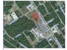
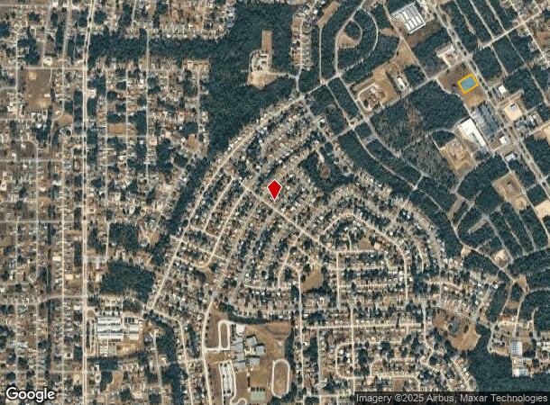
Property Record
4005 Sw 143Rd Lane Rd, Ocala, FL 34473
NEARBY LISTINGS FOR SALE OR LEASE
Property Detail
4005 Sw 143Rd Lane Rd
Ocala, FL
Marion Square Development
8002-003-107
SEC 14 TWP 17 RGE 21 PLAT BOOK Z PAGE 099 MARION SQUARE DEVELOPMENT (A REPLAT OF TRACT C MARION OAKS UNIT TWO) BLK A LOT 7
Commercialacreage
Marion
X
Florida
12083C0720D
7
2024
1.02 AC
2024
Outlying Marion County
001013
Ocala
DEMOGRAPHICS near 4005 Sw 143Rd Lane Rd
1 Mile
3 Mile
5 Mile
2024 Total Population
5,675
22,422
44,609
2029 Population
6,474
25,911
51,260
Pop Growth 2024-2029
+ 14.08%
+ 15.56%
+ 14.91%
Average Age
39
42
44
2024 Total Households
2,078
8,270
17,308
HH Growth 2024-2029
+ 13.91%
+ 15.26%
+ 14.56%
Median Household Inc
$54,761
$64,655
$65,603
Avg Household Size
2.70
2.60
2.50
2024 Avg HH Vehicles
2.00
2.00
2.00
Median Home Value
$187,137
$184,322
$199,458
Median Year Built
1995
2003
2002
Nearby Places
Map Layers
Map Styles
 Street
 Aerial
- Restaurants
- Banks
- Shops
- Fitness
- Groceries
SALE & LEASE HISTORY
LISTING DATE
SALE/LEASE

Sep 28, 2021
For Sale
Nearby Properties
Address
Land Use
TOTAL SIZE
Lot Size
Zoning
Address
Land Use
TOTAL SIZE
Lot Size
Zoning
64.26 AC
PUD
Address
Land Use
TOTAL SIZE
Lot Size
Zoning
115,843 SF
40.89 AC
GU
Address
Land Use
TOTAL SIZE
Lot Size
Zoning
80,705 SF
63.12 AC
PUD
Address
Land Use
TOTAL SIZE
Lot Size
Zoning
8,243 SF
33.70 AC
PRV
Address
Land Use
TOTAL SIZE
Lot Size
Zoning
103,764 SF
14.50 AC
R1
Address
Land Use
TOTAL SIZE
Lot Size
Zoning
16,191 SF
2.84 AC
B4
Address
Land Use
TOTAL SIZE
Lot Size
Zoning
12,994 SF
1.98 AC
B2
Address
Land Use
TOTAL SIZE
Lot Size
Zoning
67,524 SF
12.52 AC
B5
Address
Land Use
TOTAL SIZE
Lot Size
Zoning
59,024 SF
9.99 AC
B2
Address
Land Use
TOTAL SIZE
Lot Size
Zoning
61,453 SF
18.94 AC
B4
Address
Land Use
TOTAL SIZE
Lot Size
Zoning
9,580 SF
1.45 AC
B2
Address
Land Use
TOTAL SIZE
Lot Size
Zoning
26,223 SF
15.27 AC
B2
Address
Land Use
TOTAL SIZE
Lot Size
Zoning
15,289 SF
9.73 AC
A1
Address
Land Use
TOTAL SIZE
Lot Size
Zoning
1,104 SF
47.36 AC
PUD
Address
Land Use
TOTAL SIZE
Lot Size
Zoning
32,198 SF
4.86 AC
R1
Address
Land Use
TOTAL SIZE
Lot Size
Zoning
60,080 SF
5.48 AC
B2
Address
Land Use
TOTAL SIZE
Lot Size
Zoning
4.31 AC
B2
Address
Land Use
TOTAL SIZE
Lot Size
Zoning
8,395 SF
6.56 AC
B4
Address
Land Use
TOTAL SIZE
Lot Size
Zoning
12,219 SF
356.48 AC
A1
Address
Land Use
TOTAL SIZE
Lot Size
Zoning
16,054 SF
4.76 AC
B2
Address
Land Use
TOTAL SIZE
Lot Size
Zoning
10,179 SF
2.89 AC
B2
Address
Land Use
TOTAL SIZE
Lot Size
Zoning
8,410 SF
0.46 AC
B2
Address
Land Use
TOTAL SIZE
Lot Size
Zoning
21,708 SF
2.76 AC
B2
Address
Land Use
TOTAL SIZE
Lot Size
Zoning
18,344 SF
5.35 AC
R1
Address
Land Use
TOTAL SIZE
Lot Size
Zoning
14,700 SF
2.06 AC
B2
Address
Land Use
TOTAL SIZE
Lot Size
Zoning
11,243 SF
6.20 AC
B2
Address
Land Use
TOTAL SIZE
Lot Size
Zoning
476.36 AC
A1
Address
Land Use
TOTAL SIZE
Lot Size
Zoning
6,606 SF
2,623.64 AC
A1
Address
Land Use
TOTAL SIZE
Lot Size
Zoning
6,186 SF
1.67 AC
B2
The World's #1 Commercial Real Estate Marketplace
Connect with us
© 2025 CoStar Group
The information above has been obtained from sources believed reliable. While we do not doubt its accuracy we have not verified it and make no guarantee, warranty or representation about it. It is your responsibility to independently confirm its accuracy and completeness. Any projections, opinions, assumptions, or estimates used are for example only and do not represent the current or future performance of the property. The value of this transaction to you depends on tax and other factors which should be evaluated by your tax, financial, and legal advisors. You and your advisors should conduct a careful, independent investigation of the property to determine to your satisfaction the suitability of the property for your needs.