Property Record
Martin Luther King Jr Pkwy Se, Wilson, NC 27893
NEARBY LISTINGS FOR SALE OR LEASE
Property Detail
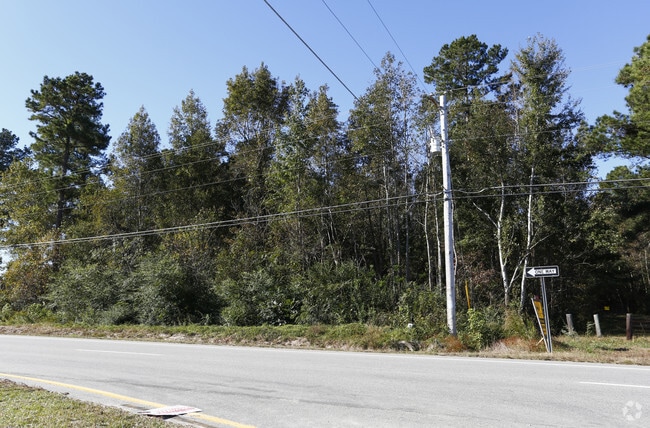
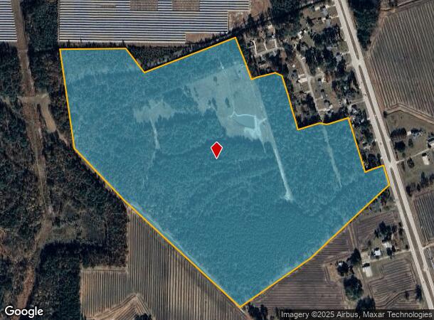
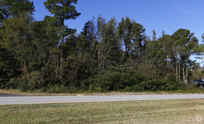
Martin Luther King Jr Pkwy Se
Wilson, NC
Plat Of Eastwood
3730-38-5998.000
M L KING JR PKWY SE 88.96AC
Residentialacreage
Wilson
X
North Carolina
3720373000K
88.96 AC
2024
Rocky Mount/Wilson
2025
Other Market Areas
000200
DEMOGRAPHICS near Martin Luther King Jr Pkwy Se
1 Mile
3 Mile
5 Mile
2024 Total Population
322
12,096
34,447
2029 Population
321
12,377
34,672
Pop Growth 2024-2029
(0.31%)
+ 2.32%
+ 0.65%
Average Age
38
39
41
2024 Total Households
126
4,821
14,216
HH Growth 2024-2029
0.00%
+ 2.36%
+ 0.60%
Median Household Inc
$31,562
$27,157
$35,125
Avg Household Size
2.50
2.40
2.30
2024 Avg HH Vehicles
1.00
1.00
1.00
Median Home Value
$158,620
$97,916
$118,795
Median Year Built
1983
1978
1975
Nearby Places
Map Layers
Map Styles
 Street
 Aerial
- Restaurants
- Banks
- Shops
- Fitness
- Groceries
PUBLIC TRANSPORTATION
COMMUTER RAIL
Wilson (Carolinian - Amtrak, Palmetto - Amtrak)
DRIVE
WALK
Distance
Wilson (Carolinian - Amtrak, Palmetto - Amtrak)
6 min
3.3 mi
AIRPORT
Pitt-Greenville
DRIVE
WALK
Distance
Pitt-Greenville
42 min
35.0 mi
Freight Ports
Port of Morehead City
DRIVE
WALK
Distance
Port of Morehead City
164 min
115.7 mi
Nearby Properties
Address
Land Use
TOTAL SIZE
Lot Size
Zoning
Address
Land Use
TOTAL SIZE
Lot Size
Zoning
59,785 SF
64.85 AC
AR
Address
Land Use
TOTAL SIZE
Lot Size
Zoning
6,704 SF
75.58 AC
ICD
Address
Land Use
TOTAL SIZE
Lot Size
Zoning
259,000 SF
69.97 AC
HI
Address
Land Use
TOTAL SIZE
Lot Size
Zoning
10,152 SF
29.71 AC
ICD
Address
Land Use
TOTAL SIZE
Lot Size
Zoning
77,125 SF
2.98 AC
GC
Address
Land Use
TOTAL SIZE
Lot Size
Zoning
90,035 SF
91.87 AC
ICD
Address
Land Use
TOTAL SIZE
Lot Size
Zoning
80,000 SF
101.30 AC
HI
Address
Land Use
TOTAL SIZE
Lot Size
Zoning
25,888 SF
73.36 AC
LI
Address
Land Use
TOTAL SIZE
Lot Size
Zoning
192,420 SF
34.36 AC
HI
Address
Land Use
TOTAL SIZE
Lot Size
Zoning
75,622 SF
9.13 AC
ICD
Address
Land Use
TOTAL SIZE
Lot Size
Zoning
20,705 SF
7.88 AC
GR6
Address
Land Use
TOTAL SIZE
Lot Size
Zoning
6,600 SF
707.94 AC
M2
Address
Land Use
TOTAL SIZE
Lot Size
Zoning
7,552 SF
51.19 AC
HI
Address
Land Use
TOTAL SIZE
Lot Size
Zoning
129,404 SF
2.61 AC
HI
Address
Land Use
TOTAL SIZE
Lot Size
Zoning
9,548 SF
33.53 AC
LI
Address
Land Use
TOTAL SIZE
Lot Size
Zoning
1,654 SF
376.89 AC
HI
Address
Land Use
TOTAL SIZE
Lot Size
Zoning
195,718 SF
36.18 AC
HI
Address
Land Use
TOTAL SIZE
Lot Size
Zoning
13,798 SF
1.88 AC
NMX
Address
Land Use
TOTAL SIZE
Lot Size
Zoning
51,620 SF
5.71 AC
GR6
Address
Land Use
TOTAL SIZE
Lot Size
Zoning
4,347 SF
228.61 AC
HI
Address
Land Use
TOTAL SIZE
Lot Size
Zoning
13,248 SF
14.90 AC
RMX
Address
Land Use
TOTAL SIZE
Lot Size
Zoning
12,073 SF
5.37 AC
GC
Address
Land Use
TOTAL SIZE
Lot Size
Zoning
86,826 SF
26.27 AC
HI
Address
Land Use
TOTAL SIZE
Lot Size
Zoning
1,140 SF
72.70 AC
OS
Address
Land Use
TOTAL SIZE
Lot Size
Zoning
52,500 SF
30.14 AC
HI
Address
Land Use
TOTAL SIZE
Lot Size
Zoning
1,798 SF
9.51 AC
RMX
Address
Land Use
TOTAL SIZE
Lot Size
Zoning
7,856 SF
187.14 AC
OS
Address
Land Use
TOTAL SIZE
Lot Size
Zoning
3,675 SF
34 AC
HI
Address
Land Use
TOTAL SIZE
Lot Size
Zoning
4,753 SF
59.25 AC
HI
Address
Land Use
TOTAL SIZE
Lot Size
Zoning
202,700 SF
12.78 AC
HI
The World's #1 Commercial Real Estate Marketplace
Connect with us
© 2025 CoStar Group
The information above has been obtained from sources believed reliable. While we do not doubt its accuracy we have not verified it and make no guarantee, warranty or representation about it. It is your responsibility to independently confirm its accuracy and completeness. Any projections, opinions, assumptions, or estimates used are for example only and do not represent the current or future performance of the property. The value of this transaction to you depends on tax and other factors which should be evaluated by your tax, financial, and legal advisors. You and your advisors should conduct a careful, independent investigation of the property to determine to your satisfaction the suitability of the property for your needs.