Property Record
Massasoit Ave, Bristol, RI 02809
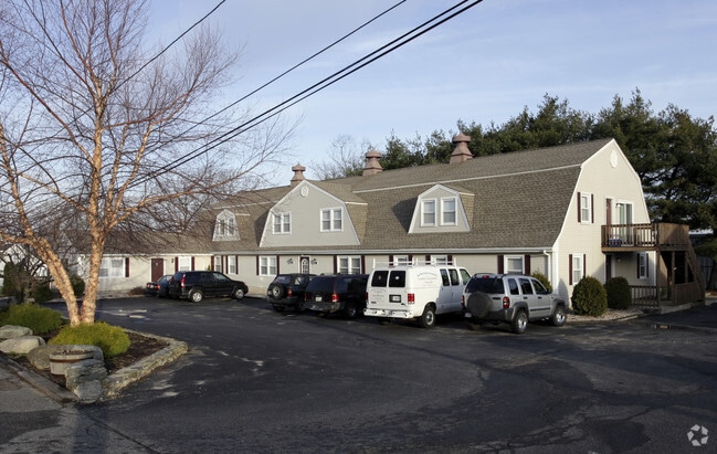
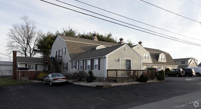
Property Detail
Massasoit Ave
BRIS-000158-000000-000014
BRISTOL
Vacantlandnec
Rhode Island
R-20
14
B and X Area of moderate flood hazard, usually the area between the limits of the 100-year and 500-year floods.
0.13 AC
2025
Bristol County
2025
Providence
030902
Providence-Warwick, RI-MA
NEARBY LISTINGS FOR SALE OR LEASE
-
-
View all Bristol listings for sale on LoopNet.com
DEMOGRAPHICS near Massasoit Ave
1 mile
3 mile
5 mile
2025 Total Population
9,261
25,777
79,478
2030 Population
9,059
25,450
78,881
Pop Growth 2025-2030
(2.18%)
(1.27%)
(0.75%)
Average Age
41
44
43
2025 Total Households
3,636
10,219
33,163
HH Growth 2025-2030
(2.17%)
(1.19%)
(0.61%)
Median Household Inc
$79,321
$93,821
$83,764
Avg Household Size
2.10
2.20
2.30
2025 Avg HH Vehicles
2.00
2.00
2.00
Median Home Value
$464,624
$515,135
$478,140
Median Year Built
1955
1966
1955
Nearby Places
Map Layers
Map Styles
 Street
 Aerial
Transit
 Traffic
 Biking
Places
Listings with unknown addresses are not visible on the map
- Restaurants
- Banks
- Shops
- Fitness
- Groceries
PUBLIC TRANSPORTATION
AIRPORT
Rhode Island Tf Green International
Drive
Walk
Distance
Rhode Island Tf Green International
38 min
23.7 mi
Freight Ports
Port of Davisville, RI
Drive
Walk
Distance
Port of Davisville, RI
54 min
36.0 mi
Nearby Properties
Address
Land Use
TOTAL SIZE
Lot Size
Zoning
Address
Land Use
TOTAL SIZE
Lot Size
Zoning
113,253 SF
85.69 AC
HPC
Address
Land Use
TOTAL SIZE
Lot Size
Zoning
17,500 SF
7.12 AC
EI
Address
Land Use
TOTAL SIZE
Lot Size
Zoning
159,363 SF
14.19 AC
R-10
Address
Land Use
TOTAL SIZE
Lot Size
Zoning
3,512 SF
30.88 AC
EI
Address
Land Use
TOTAL SIZE
Lot Size
Zoning
2,080 SF
11.01 AC
R-15
Address
Land Use
TOTAL SIZE
Lot Size
Zoning
18,236 SF
10.24 AC
LB
Address
Land Use
TOTAL SIZE
Lot Size
Zoning
4.40 AC
B
Address
Land Use
TOTAL SIZE
Lot Size
Zoning
44.10 AC
R-40
Address
Land Use
TOTAL SIZE
Lot Size
Zoning
4,152 SF
1.71 AC
W
Address
Land Use
TOTAL SIZE
Lot Size
Zoning
63,730 SF
12.97 AC
M
Address
Land Use
TOTAL SIZE
Lot Size
Zoning
38,176 SF
0.97 AC
R-6
Address
Land Use
TOTAL SIZE
Lot Size
Zoning
35.50 AC
R-40
Address
Land Use
TOTAL SIZE
Lot Size
Zoning
49.31 AC
R-40
Address
Land Use
TOTAL SIZE
Lot Size
Zoning
27,264 SF
0.26 AC
LB
Address
Land Use
TOTAL SIZE
Lot Size
Zoning
36,324 SF
24 AC
R-40
Address
Land Use
TOTAL SIZE
Lot Size
Zoning
61,332 SF
6.43 AC
R-6
Address
Land Use
TOTAL SIZE
Lot Size
Zoning
80,232 SF
1.32 AC
M
Address
Land Use
TOTAL SIZE
Lot Size
Zoning
4.80 AC
GB
Address
Land Use
TOTAL SIZE
Lot Size
Zoning
120,540 SF
6.33 AC
M
Address
Land Use
TOTAL SIZE
Lot Size
Zoning
5,028 SF
5.31 AC
R-40
Address
Land Use
TOTAL SIZE
Lot Size
Zoning
4,818 SF
60.80 AC
R-40
Address
Land Use
TOTAL SIZE
Lot Size
Zoning
68,144 SF
7.74 AC
M
Address
Land Use
TOTAL SIZE
Lot Size
Zoning
11,562 SF
7.08 AC
R-6
Address
Land Use
TOTAL SIZE
Lot Size
Zoning
4,144 SF
8.90 AC
R-40
Address
Land Use
TOTAL SIZE
Lot Size
Zoning
10,937 SF
1.02 AC
R-6
Address
Land Use
TOTAL SIZE
Lot Size
Zoning
15,120 SF
6.94 AC
M
Address
Land Use
TOTAL SIZE
Lot Size
Zoning
9,172 SF
7.60 AC
R-40
Address
Land Use
TOTAL SIZE
Lot Size
Zoning
2.79 AC
R10
Address
Land Use
TOTAL SIZE
Lot Size
Zoning
92 AC
R-20
Address
Land Use
TOTAL SIZE
Lot Size
Zoning
2,304 SF
17 AC
R-40
The World's #1 Commercial Real Estate Marketplace
Connect with us
© 2026 CoStar Group
The information above has been obtained from sources believed reliable. While we do not doubt its accuracy we have not verified it and make no guarantee, warranty or representation about it. It is your responsibility to independently confirm its accuracy and completeness. Any projections, opinions, assumptions, or estimates used are for example only and do not represent the current or future performance of the property. The value of this transaction to you depends on tax and other factors which should be evaluated by your tax, financial, and legal advisors. You and your advisors should conduct a careful, independent investigation of the property to determine to your satisfaction the suitability of the property for your needs.