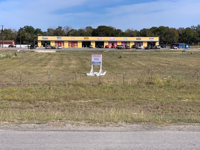
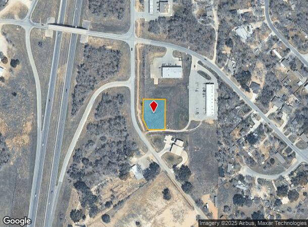
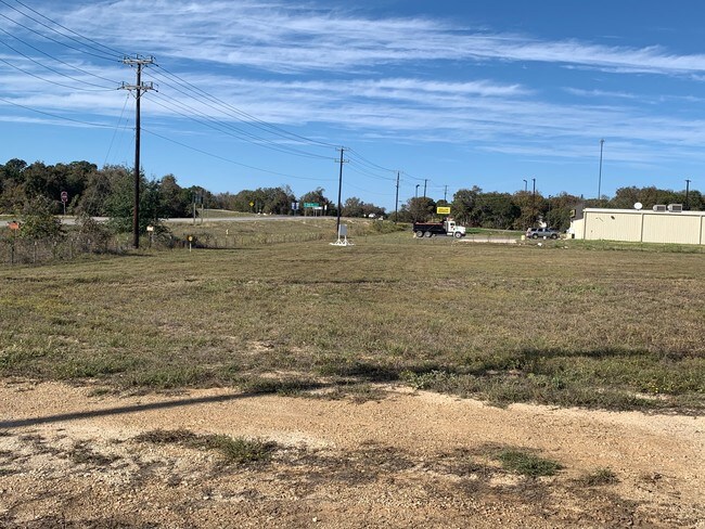
Property Record
Mathis Rd, Elmendorf, TX 78112
Property Detail
Mathis Rd
San Antonio-New Braunfels, TX
Cb 4126B Sandy Oak Strip Mall
04126-222-0160
CB 4126B BLK 122 LOT S IRR 133.5 FT OF 16 SANDY OAK STRIP MALL SUBD 2017 NEW ACCT PER PLAT 9705/113-115 // 2014 SPLIT PER DEEDS 15923/1976 & 16085/152 // 2013 SPLIT PER DEED 15610/2107 // 2013 SPLIT PER DEED 15384/562 // 2012 SPLIT PER DEED 15301/173
Vacantlandnec
Bexar
X
Texas
48029C0745G
16
2024
0.65 AC
2025
South
152202
San Antonio
NEARBY LISTINGS FOR SALE OR LEASE
DEMOGRAPHICS near Mathis Rd
1 mile
3 mile
5 mile
2024 Total Population
977
8,981
17,274
2029 Population
1,036
9,574
18,600
Pop Growth 2024-2029
+ 6.04%
+ 6.60%
+ 7.68%
Average Age
35
36
36
2024 Total Households
289
2,680
5,221
HH Growth 2024-2029
+ 6.23%
+ 6.75%
+ 7.81%
Median Household Inc
$48,214
$43,464
$41,012
Avg Household Size
3.40
3.30
3.20
2024 Avg HH Vehicles
2.00
2.00
2.00
Median Home Value
$144,531
$134,831
$144,122
Median Year Built
1997
1996
1996
Nearby Places
Map Layers
Map Styles
 Street
 Aerial
Transit
 Traffic
 Biking
Places
Listings with unknown addresses are not visible on the map
- Restaurants
- Banks
- Shops
- Fitness
- Groceries
PUBLIC TRANSPORTATION
AIRPORT
San Antonio International
Drive
Walk
Distance
San Antonio International
31 min
27.0 mi
SALE & LEASE HISTORY
LISTING DATE
SALE/LEASE

Nov 15, 2019
For Sale
Nearby Properties
Address
Land Use
TOTAL SIZE
Lot Size
Zoning
Address
Land Use
TOTAL SIZE
Lot Size
Zoning
2,470.32 AC
Address
Land Use
TOTAL SIZE
Lot Size
Zoning
57,863 SF
36.23 AC
Address
Land Use
TOTAL SIZE
Lot Size
Zoning
5,753,521 SF
709.61 AC
Address
Land Use
TOTAL SIZE
Lot Size
Zoning
300.90 AC
Address
Land Use
TOTAL SIZE
Lot Size
Zoning
485.17 AC
Address
Land Use
TOTAL SIZE
Lot Size
Zoning
1,031.59 AC
Address
Land Use
TOTAL SIZE
Lot Size
Zoning
1,440 SF
421.38 AC
Address
Land Use
TOTAL SIZE
Lot Size
Zoning
298.72 AC
Address
Land Use
TOTAL SIZE
Lot Size
Zoning
116,731 SF
9.22 AC
Address
Land Use
TOTAL SIZE
Lot Size
Zoning
6,588 SF
343.70 AC
Address
Land Use
TOTAL SIZE
Lot Size
Zoning
47,314 SF
4.53 AC
Address
Land Use
TOTAL SIZE
Lot Size
Zoning
7,027 SF
242.18 AC
Address
Land Use
TOTAL SIZE
Lot Size
Zoning
8,577 SF
128.28 AC
Address
Land Use
TOTAL SIZE
Lot Size
Zoning
203.51 AC
Address
Land Use
TOTAL SIZE
Lot Size
Zoning
9,673,474 SF
8.35 AC
Address
Land Use
TOTAL SIZE
Lot Size
Zoning
17,500 SF
6.77 AC
Address
Land Use
TOTAL SIZE
Lot Size
Zoning
420 SF
150 AC
Address
Land Use
TOTAL SIZE
Lot Size
Zoning
346,206 SF
2.99 AC
Address
Land Use
TOTAL SIZE
Lot Size
Zoning
295.27 AC
Address
Land Use
TOTAL SIZE
Lot Size
Zoning
298.91 AC
Address
Land Use
TOTAL SIZE
Lot Size
Zoning
21,562 SF
6.88 AC
Address
Land Use
TOTAL SIZE
Lot Size
Zoning
Address
Land Use
TOTAL SIZE
Lot Size
Zoning
112.40 AC
Address
Land Use
TOTAL SIZE
Lot Size
Zoning
9,536 SF
79.43 AC
Address
Land Use
TOTAL SIZE
Lot Size
Zoning
3,672 SF
2.16 AC
Address
Land Use
TOTAL SIZE
Lot Size
Zoning
3,183 SF
2.23 AC
Address
Land Use
TOTAL SIZE
Lot Size
Zoning
56,200 SF
2.90 AC
Address
Land Use
TOTAL SIZE
Lot Size
Zoning
137.89 AC
Address
Land Use
TOTAL SIZE
Lot Size
Zoning
9,920 SF
3.26 AC
Address
Land Use
TOTAL SIZE
Lot Size
Zoning
840 SF
100 AC
The World's #1 Commercial Real Estate Marketplace
Connect with us
© 2026 CoStar Group
The information above has been obtained from sources believed reliable. While we do not doubt its accuracy we have not verified it and make no guarantee, warranty or representation about it. It is your responsibility to independently confirm its accuracy and completeness. Any projections, opinions, assumptions, or estimates used are for example only and do not represent the current or future performance of the property. The value of this transaction to you depends on tax and other factors which should be evaluated by your tax, financial, and legal advisors. You and your advisors should conduct a careful, independent investigation of the property to determine to your satisfaction the suitability of the property for your needs.