Property Record
Mattity Rd, North Smithfield, RI 02896
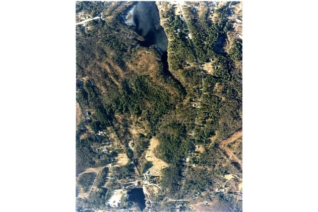


Property Detail
Mattity Rd
NSMI-000010-000000-000218
PROVIDENCE
Timberlandforesttreesagricultural
Rhode Island
RA
218
A Areas with a 1% annual chance of flooding and a 26% chance of flooding over the life of a 30-year mortgage.
124.72 AC
2025
Burrillville/Glocester
2025
Providence
012803
Providence-Warwick, RI-MA
NEARBY LISTINGS FOR SALE OR LEASE
-
-
View all North Smithfield listings for sale on LoopNet.com
DEMOGRAPHICS near Mattity Rd
1 mile
3 mile
5 mile
2025 Total Population
1,076
11,214
54,936
2030 Population
1,124
11,690
56,914
Pop Growth 2025-2030
+ 4.46%
+ 4.24%
+ 3.60%
Average Age
42
41
41
2025 Total Households
372
3,853
21,170
HH Growth 2025-2030
+ 4.57%
+ 4.52%
+ 3.68%
Median Household Inc
$118,867
$115,780
$80,755
Avg Household Size
2.80
2.60
2.40
2025 Avg HH Vehicles
2.00
2.00
2.00
Median Home Value
$588,942
$464,443
$423,799
Median Year Built
1981
1976
1958
Nearby Places
Map Layers
Map Styles
 Street
 Aerial
Layers
 Traffic
 Biking
Places
Listings with unknown addresses are not visible on the map
- Restaurants
- Banks
- Shops
- Fitness
- Groceries
PUBLIC TRANSPORTATION
AIRPORT
Rhode Island Tf Green International
Drive
Walk
Distance
Rhode Island Tf Green International
37 min
22.8 mi
Worcester Regional
Drive
Walk
Distance
Worcester Regional
49 min
33.5 mi
Freight Ports
Port of Davisville, RI
Drive
Walk
Distance
Port of Davisville, RI
48 min
32.1 mi
Nearby Properties
Address
Land Use
TOTAL SIZE
Lot Size
Zoning
Address
Land Use
TOTAL SIZE
Lot Size
Zoning
31.45 AC
M
Address
Land Use
TOTAL SIZE
Lot Size
Zoning
Address
Land Use
TOTAL SIZE
Lot Size
Zoning
123,821 SF
12.40 AC
RA
Address
Land Use
TOTAL SIZE
Lot Size
Zoning
105,802 SF
0.94 AC
Address
Land Use
TOTAL SIZE
Lot Size
Zoning
34.30 AC
M
Address
Land Use
TOTAL SIZE
Lot Size
Zoning
28.39 AC
F5
Address
Land Use
TOTAL SIZE
Lot Size
Zoning
17,748 SF
10.50 AC
REA
Address
Land Use
TOTAL SIZE
Lot Size
Zoning
Address
Land Use
TOTAL SIZE
Lot Size
Zoning
18.32 AC
M
Address
Land Use
TOTAL SIZE
Lot Size
Zoning
21,080 SF
34.04 AC
RA
Address
Land Use
TOTAL SIZE
Lot Size
Zoning
44.50 AC
F5
Address
Land Use
TOTAL SIZE
Lot Size
Zoning
83,475 SF
16.06 AC
Address
Land Use
TOTAL SIZE
Lot Size
Zoning
55,730 SF
8.23 AC
GC
Address
Land Use
TOTAL SIZE
Lot Size
Zoning
78,752 SF
6.26 AC
M
Address
Land Use
TOTAL SIZE
Lot Size
Zoning
25,600 SF
Address
Land Use
TOTAL SIZE
Lot Size
Zoning
72,634 SF
6.80 AC
M
Address
Land Use
TOTAL SIZE
Lot Size
Zoning
6.93 AC
GC
Address
Land Use
TOTAL SIZE
Lot Size
Zoning
19,720 SF
6.89 AC
M
Address
Land Use
TOTAL SIZE
Lot Size
Zoning
9.95 AC
RA
Address
Land Use
TOTAL SIZE
Lot Size
Zoning
54.63 AC
REA
Address
Land Use
TOTAL SIZE
Lot Size
Zoning
2.51 AC
RA
Address
Land Use
TOTAL SIZE
Lot Size
Zoning
40,800 SF
2.88 AC
M
Address
Land Use
TOTAL SIZE
Lot Size
Zoning
5.33 AC
REA
Address
Land Use
TOTAL SIZE
Lot Size
Zoning
3.23 AC
RA
Address
Land Use
TOTAL SIZE
Lot Size
Zoning
69.51 AC
RA
Address
Land Use
TOTAL SIZE
Lot Size
Zoning
Address
Land Use
TOTAL SIZE
Lot Size
Zoning
8.24 AC
F5
Address
Land Use
TOTAL SIZE
Lot Size
Zoning
65,194 SF
8.71 AC
GI
Address
Land Use
TOTAL SIZE
Lot Size
Zoning
6,288 SF
132.43 AC
F5
Address
Land Use
TOTAL SIZE
Lot Size
Zoning
11,509 SF
0.93 AC
REA
The World's #1 Commercial Real Estate Marketplace
Connect with us
© 2026 CoStar Group
The information above has been obtained from sources believed reliable. While we do not doubt its accuracy we have not verified it and make no guarantee, warranty or representation about it. It is your responsibility to independently confirm its accuracy and completeness. Any projections, opinions, assumptions, or estimates used are for example only and do not represent the current or future performance of the property. The value of this transaction to you depends on tax and other factors which should be evaluated by your tax, financial, and legal advisors. You and your advisors should conduct a careful, independent investigation of the property to determine to your satisfaction the suitability of the property for your needs.