Property Record
Maumelle Blvd, Maumelle, AR 72113

Property Detail
Maumelle Blvd
Little Rock-North Little Rock-Conway, AR
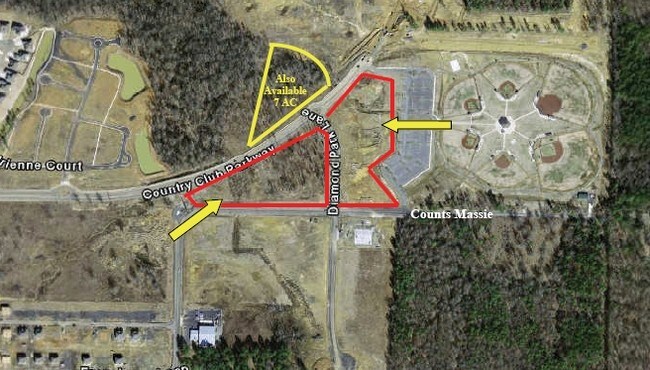
LOT 1R MAUMELLE DIAMOND CENTER
42M-034-01-001-00
PULASKI
Taxexempt
Arkansas
AE The base floodplain where base flood elevations are provided. AE Zones are now used on new format FIRMs instead of A1-A30 Zones.
1r
2025
32.35 AC
2025
Outlying Pulaski County
004309
Little Rock/N Little Rock
4,130 SF
NEARBY LISTINGS FOR SALE OR LEASE
DEMOGRAPHICS near Maumelle Blvd
1 mile
3 mile
5 mile
2025 Total Population
5,824
25,074
47,828
2030 Population
5,910
25,148
47,639
Pop Growth 2025-2030
+ 1.48%
+ 0.30%
(0.40%)
Average Age
36
39
40
2025 Total Households
2,900
11,125
20,765
HH Growth 2025-2030
+ 1.66%
+ 0.40%
(0.30%)
Median Household Inc
$61,824
$71,061
$77,787
Avg Household Size
2.00
2.20
2.30
2025 Avg HH Vehicles
2.00
2.00
2.00
Median Home Value
$317,500
$289,956
$296,337
Median Year Built
2009
2001
1992
Nearby Places
Map Layers
Map Styles
 Street
 Aerial
Layers
 Traffic
 Biking
Places
Listings with unknown addresses are not visible on the map
- Restaurants
- Banks
- Shops
- Fitness
- Groceries
PUBLIC TRANSPORTATION
AIRPORT
Bill and Hillary Clinton Ntl/Adams Field
Drive
Walk
Distance
Bill and Hillary Clinton Ntl/Adams Field
21 min
15.4 mi
Freight Ports
Port of Shreveport
Drive
Walk
Distance
Port of Shreveport
255 min
237.8 mi
SALE & LEASE HISTORY
LISTING DATE
SALE/LEASE

Sep 24, 2016
For Sale
Nearby Properties
Address
Land Use
TOTAL SIZE
Lot Size
Zoning
Address
Land Use
TOTAL SIZE
Lot Size
Zoning
1,160,360 SF
119.55 AC
Address
Land Use
TOTAL SIZE
Lot Size
Zoning
28,414 SF
80.25 AC
Address
Land Use
TOTAL SIZE
Lot Size
Zoning
320,000 SF
91.54 AC
Address
Land Use
TOTAL SIZE
Lot Size
Zoning
89,847 SF
12.77 AC
Address
Land Use
TOTAL SIZE
Lot Size
Zoning
35,712 SF
19.92 AC
Address
Land Use
TOTAL SIZE
Lot Size
Zoning
1,974 SF
14.30 AC
Address
Land Use
TOTAL SIZE
Lot Size
Zoning
80,720 SF
15.62 AC
Address
Land Use
TOTAL SIZE
Lot Size
Zoning
55,997 SF
11.51 AC
Address
Land Use
TOTAL SIZE
Lot Size
Zoning
83,352 SF
6.90 AC
Address
Land Use
TOTAL SIZE
Lot Size
Zoning
77,478 SF
38.22 AC
Address
Land Use
TOTAL SIZE
Lot Size
Zoning
18,904 SF
12.73 AC
Address
Land Use
TOTAL SIZE
Lot Size
Zoning
12,077 SF
27.97 AC
Address
Land Use
TOTAL SIZE
Lot Size
Zoning
484,932 SF
32.85 AC
Address
Land Use
TOTAL SIZE
Lot Size
Zoning
157,500 SF
54.99 AC
Address
Land Use
TOTAL SIZE
Lot Size
Zoning
2,340 SF
37.56 AC
Address
Land Use
TOTAL SIZE
Lot Size
Zoning
192,104 SF
34.51 AC
Address
Land Use
TOTAL SIZE
Lot Size
Zoning
93,503 SF
34.50 AC
Address
Land Use
TOTAL SIZE
Lot Size
Zoning
139,444 SF
7.63 AC
Address
Land Use
TOTAL SIZE
Lot Size
Zoning
42,313 SF
5.17 AC
Address
Land Use
TOTAL SIZE
Lot Size
Zoning
8,624 SF
10.37 AC
Address
Land Use
TOTAL SIZE
Lot Size
Zoning
39,082 SF
3.62 AC
Address
Land Use
TOTAL SIZE
Lot Size
Zoning
188,528 SF
24.29 AC
Address
Land Use
TOTAL SIZE
Lot Size
Zoning
66,619 SF
5.89 AC
Address
Land Use
TOTAL SIZE
Lot Size
Zoning
56,423 SF
Address
Land Use
TOTAL SIZE
Lot Size
Zoning
8,417 SF
101 AC
Address
Land Use
TOTAL SIZE
Lot Size
Zoning
12,346 SF
14.41 AC
Address
Land Use
TOTAL SIZE
Lot Size
Zoning
74,384 SF
16.97 AC
Address
Land Use
TOTAL SIZE
Lot Size
Zoning
38,369 SF
10.04 AC
Address
Land Use
TOTAL SIZE
Lot Size
Zoning
60,966 SF
21.82 AC
Address
Land Use
TOTAL SIZE
Lot Size
Zoning
6,357 SF
10.80 AC
The World's #1 Commercial Real Estate Marketplace
Connect with us
© 2026 CoStar Group
The information above has been obtained from sources believed reliable. While we do not doubt its accuracy we have not verified it and make no guarantee, warranty or representation about it. It is your responsibility to independently confirm its accuracy and completeness. Any projections, opinions, assumptions, or estimates used are for example only and do not represent the current or future performance of the property. The value of this transaction to you depends on tax and other factors which should be evaluated by your tax, financial, and legal advisors. You and your advisors should conduct a careful, independent investigation of the property to determine to your satisfaction the suitability of the property for your needs.