Property Record
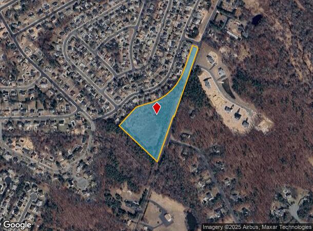
Maxim-Southard Rd, Howell, NJ 07731
NEARBY LISTINGS FOR SALE OR LEASE
Property Detail
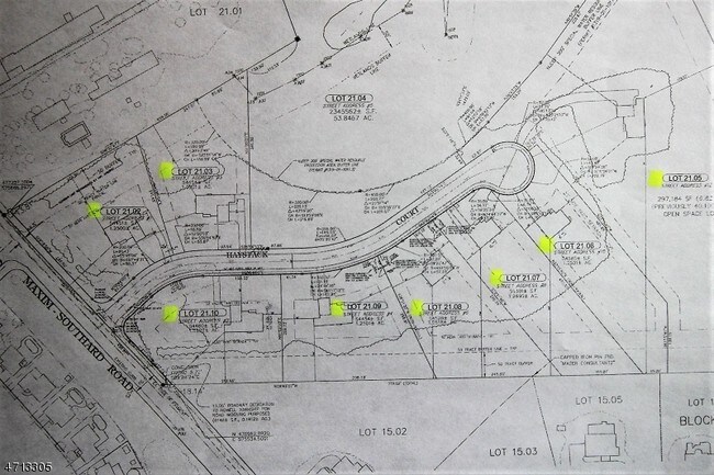
Maxim-Southard Rd
21-00035-58-00018
FACILITY NAME: MUNICIPAL BLDG.
Governmentalpublicusegeneral
Monmouth
X
New Jersey
34025C0314F
18
0
7.59 AC
2025
Western Monmouth
811402
Northern New Jersey
168 SF
New York-Jersey City-White Plains, NY-NJ
DEMOGRAPHICS near Maxim-Southard Rd
1 Mile
3 Mile
5 Mile
2024 Total Population
5,167
51,961
160,771
2029 Population
5,088
52,443
164,561
Pop Growth 2024-2029
(1.53%)
+ 0.93%
+ 2.36%
Average Age
39
31
30
2024 Total Households
1,701
13,387
41,556
HH Growth 2024-2029
(1.76%)
(0.23%)
+ 1.40%
Median Household Inc
$132,868
$102,069
$83,833
Avg Household Size
3.00
3.50
3.50
2024 Avg HH Vehicles
2.00
2.00
2.00
Median Home Value
$376,567
$405,892
$391,789
Median Year Built
1978
1981
1984
Nearby Places
Map Layers
Map Styles
 Street
 Aerial
- Restaurants
- Banks
- Shops
- Fitness
- Groceries
SALE & LEASE HISTORY
LISTING DATE
SALE/LEASE

Oct 04, 2017
For Sale
Aug 21, 2017
For Sale
Aug 04, 2017
For Sale
Nearby Properties
Address
Land Use
TOTAL SIZE
Lot Size
Zoning
Address
Land Use
TOTAL SIZE
Lot Size
Zoning
24.15 AC
MF
Address
Land Use
TOTAL SIZE
Lot Size
Zoning
105.04 AC
SED
Address
Land Use
TOTAL SIZE
Lot Size
Zoning
161,340 SF
35.35 AC
HD-1
Address
Land Use
TOTAL SIZE
Lot Size
Zoning
21,876 SF
22.26 AC
B3
Address
Land Use
TOTAL SIZE
Lot Size
Zoning
36.25 AC
R12
Address
Land Use
TOTAL SIZE
Lot Size
Zoning
28.99 AC
HD-1
Address
Land Use
TOTAL SIZE
Lot Size
Zoning
14.73 AC
R-5
Address
Land Use
TOTAL SIZE
Lot Size
Zoning
37,202 SF
14.79 AC
B3
Address
Land Use
TOTAL SIZE
Lot Size
Zoning
8,784 SF
16.16 AC
R-LM
Address
Land Use
TOTAL SIZE
Lot Size
Zoning
360,400 SF
35.98 AC
SED
Address
Land Use
TOTAL SIZE
Lot Size
Zoning
2,736 SF
18.04 AC
R15
Address
Land Use
TOTAL SIZE
Lot Size
Zoning
3.64 AC
R10
Address
Land Use
TOTAL SIZE
Lot Size
Zoning
98,731 SF
13.65 AC
HD
Address
Land Use
TOTAL SIZE
Lot Size
Zoning
83,396 SF
9.51 AC
R15
Address
Land Use
TOTAL SIZE
Lot Size
Zoning
141,437 SF
13.35 AC
HD-1
Address
Land Use
TOTAL SIZE
Lot Size
Zoning
125,379 SF
22.16 AC
HD
Address
Land Use
TOTAL SIZE
Lot Size
Zoning
51,531 SF
13.30 AC
HD
Address
Land Use
TOTAL SIZE
Lot Size
Zoning
24,630 SF
6.93 AC
HD-1
Address
Land Use
TOTAL SIZE
Lot Size
Zoning
1,124 SF
7.80 AC
B4
Address
Land Use
TOTAL SIZE
Lot Size
Zoning
13,350 SF
71.10 AC
ARE6
Address
Land Use
TOTAL SIZE
Lot Size
Zoning
123,578 SF
9.28 AC
HD-1
Address
Land Use
TOTAL SIZE
Lot Size
Zoning
8.96 AC
HD
Address
Land Use
TOTAL SIZE
Lot Size
Zoning
6.59 AC
B3
Address
Land Use
TOTAL SIZE
Lot Size
Zoning
52,692 SF
4.67 AC
B3
Address
Land Use
TOTAL SIZE
Lot Size
Zoning
46,490 SF
3.72 AC
B3
Address
Land Use
TOTAL SIZE
Lot Size
Zoning
35.06 AC
HD-1
Address
Land Use
TOTAL SIZE
Lot Size
Zoning
30,529 SF
1.41 AC
HD-1
Address
Land Use
TOTAL SIZE
Lot Size
Zoning
13.24 AC
SED
Address
Land Use
TOTAL SIZE
Lot Size
Zoning
65.74 AC
SED
Address
Land Use
TOTAL SIZE
Lot Size
Zoning
5,787 SF
8.01 AC
R12
The World's #1 Commercial Real Estate Marketplace
Connect with us
© 2025 CoStar Group
The information above has been obtained from sources believed reliable. While we do not doubt its accuracy we have not verified it and make no guarantee, warranty or representation about it. It is your responsibility to independently confirm its accuracy and completeness. Any projections, opinions, assumptions, or estimates used are for example only and do not represent the current or future performance of the property. The value of this transaction to you depends on tax and other factors which should be evaluated by your tax, financial, and legal advisors. You and your advisors should conduct a careful, independent investigation of the property to determine to your satisfaction the suitability of the property for your needs.