Property Record
Mayfield Metropolis Rd, Paducah, KY 42001

Property Detail
Mayfield Metropolis Rd
Paducah, KY-IL
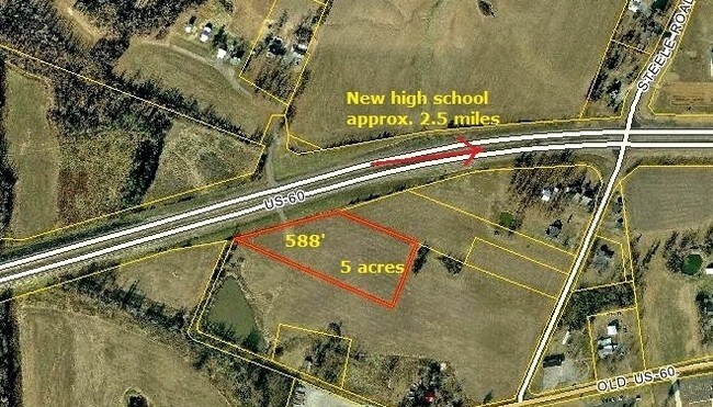
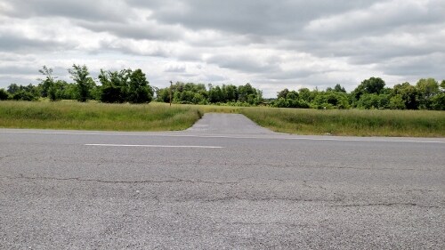
19-22-4C 31.14 AC MAYFIELD METROPOLIS RD
066-00-00-033.01
MCCRACKEN
Farms
Kentucky
B and X Area of moderate flood hazard, usually the area between the limits of the 100-year and 500-year floods.
31.14 AC
2025
Kentucky West Area
2025
Other Market Areas
031402
NEARBY LISTINGS FOR SALE OR LEASE
DEMOGRAPHICS near Mayfield Metropolis Rd
1 mile
3 mile
5 mile
2025 Total Population
841
8,694
23,019
2030 Population
849
8,706
22,947
Pop Growth 2025-2030
+ 0.95%
+ 0.14%
(0.31%)
Average Age
44
43
42
2025 Total Households
319
3,866
9,820
HH Growth 2025-2030
+ 1.25%
+ 0.13%
(0.27%)
Median Household Inc
$89,938
$73,129
$75,930
Avg Household Size
2.50
2.20
2.30
2025 Avg HH Vehicles
3.00
2.00
2.00
Median Home Value
$160,937
$208,446
$227,602
Median Year Built
1995
1992
1986
Nearby Places
Map Layers
Map Styles
 Street
 Aerial
Layers
 Traffic
 Biking
Places
Listings with unknown addresses are not visible on the map
- Restaurants
- Banks
- Shops
- Fitness
- Groceries
SALE & LEASE HISTORY
LISTING DATE
SALE/LEASE

Sep 05, 2017
For Sale
Mar 29, 2017
For Sale
Mar 20, 2017
For Sale
Jul 20, 2017
For Sale
Dec 15, 2016
For Sale
Nearby Properties
Address
Land Use
TOTAL SIZE
Lot Size
Zoning
Address
Land Use
TOTAL SIZE
Lot Size
Zoning
Address
Land Use
TOTAL SIZE
Lot Size
Zoning
157.47 AC
Address
Land Use
TOTAL SIZE
Lot Size
Zoning
65.20 AC
Address
Land Use
TOTAL SIZE
Lot Size
Zoning
11.84 AC
Address
Land Use
TOTAL SIZE
Lot Size
Zoning
5,500 AC
Address
Land Use
TOTAL SIZE
Lot Size
Zoning
23.42 AC
Address
Land Use
TOTAL SIZE
Lot Size
Zoning
11.81 AC
Address
Land Use
TOTAL SIZE
Lot Size
Zoning
Address
Land Use
TOTAL SIZE
Lot Size
Zoning
18.20 AC
Address
Land Use
TOTAL SIZE
Lot Size
Zoning
28.04 AC
Address
Land Use
TOTAL SIZE
Lot Size
Zoning
21.88 AC
Address
Land Use
TOTAL SIZE
Lot Size
Zoning
10.45 AC
Address
Land Use
TOTAL SIZE
Lot Size
Zoning
12.32 AC
Address
Land Use
TOTAL SIZE
Lot Size
Zoning
5.66 AC
Address
Land Use
TOTAL SIZE
Lot Size
Zoning
15.55 AC
Address
Land Use
TOTAL SIZE
Lot Size
Zoning
13.77 AC
Address
Land Use
TOTAL SIZE
Lot Size
Zoning
9.45 AC
Address
Land Use
TOTAL SIZE
Lot Size
Zoning
18.10 AC
Address
Land Use
TOTAL SIZE
Lot Size
Zoning
42.03 AC
Address
Land Use
TOTAL SIZE
Lot Size
Zoning
Address
Land Use
TOTAL SIZE
Lot Size
Zoning
1.54 AC
Address
Land Use
TOTAL SIZE
Lot Size
Zoning
5.62 AC
Address
Land Use
TOTAL SIZE
Lot Size
Zoning
Address
Land Use
TOTAL SIZE
Lot Size
Zoning
23.32 AC
Address
Land Use
TOTAL SIZE
Lot Size
Zoning
9.74 AC
Address
Land Use
TOTAL SIZE
Lot Size
Zoning
149.56 AC
Address
Land Use
TOTAL SIZE
Lot Size
Zoning
2.60 AC
Address
Land Use
TOTAL SIZE
Lot Size
Zoning
9.18 AC
Address
Land Use
TOTAL SIZE
Lot Size
Zoning
6.39 AC
Address
Land Use
TOTAL SIZE
Lot Size
Zoning
The World's #1 Commercial Real Estate Marketplace
Connect with us
© 2026 CoStar Group
The information above has been obtained from sources believed reliable. While we do not doubt its accuracy we have not verified it and make no guarantee, warranty or representation about it. It is your responsibility to independently confirm its accuracy and completeness. Any projections, opinions, assumptions, or estimates used are for example only and do not represent the current or future performance of the property. The value of this transaction to you depends on tax and other factors which should be evaluated by your tax, financial, and legal advisors. You and your advisors should conduct a careful, independent investigation of the property to determine to your satisfaction the suitability of the property for your needs.