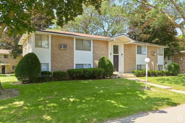
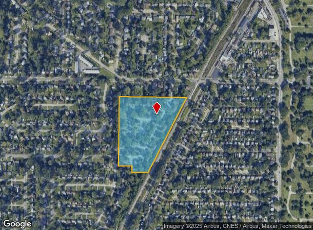
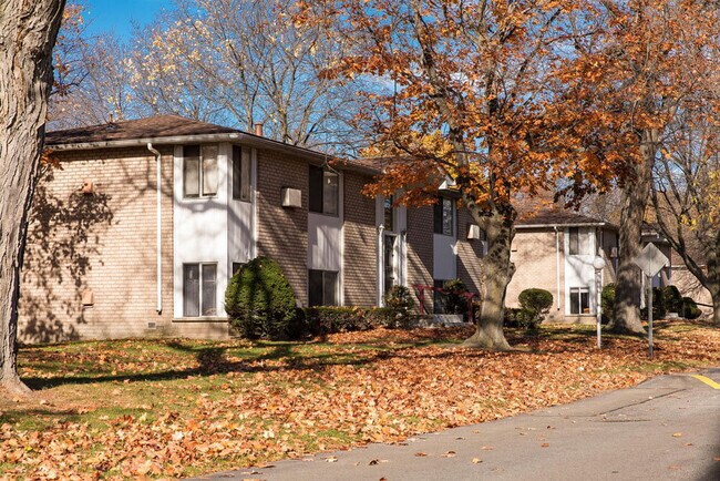
Property Record
Mc Call Rd, Rochester, NY 14616
NEARBY LISTINGS FOR SALE OR LEASE
Property Detail
Mc Call Rd
Rochester, NY
Mill Seat Tract & Phelps & Gorham Purcha
262800-075-650-0001-001-000
20TR L58,59 T1
Apartment
Monroe
X
New York
36055C0184G
1.000
2025
10.20 AC
2024
Outer Greece/Northwest Monroe County
013601
Rochester
3,750 SF
DEMOGRAPHICS near Mc Call Rd
1 Mile
3 Mile
5 Mile
2024 Total Population
13,990
119,856
285,887
2029 Population
13,894
118,007
281,821
Pop Growth 2024-2029
(0.69%)
(1.54%)
(1.42%)
Average Age
39
39
40
2024 Total Households
6,475
50,355
122,654
HH Growth 2024-2029
(0.73%)
(1.59%)
(1.42%)
Median Household Inc
$50,021
$50,651
$51,091
Avg Household Size
2.10
2.30
2.20
2024 Avg HH Vehicles
1.00
1.00
1.00
Median Home Value
$100,179
$129,722
$136,760
Median Year Built
1957
1954
1955
Nearby Places
- Restaurants
- Banks
- Shops
- Fitness
- Groceries
PUBLIC TRANSPORTATION
COMMUTER RAIL
Rochester (Empire Service - VIA Rail, Lake Shore Limited - VIA Rail, Maple Leaf - VIA Rail, Toronto - New York - VIA Rail)
DRIVE
WALK
Distance
Rochester (Empire Service - VIA Rail, Lake Shore Limited - VIA Rail, Maple Leaf - VIA Rail, Toronto - New York - VIA Rail)
9 min
4.9 mi
AIRPORT
Frederick Douglass/Greater Rochester International
DRIVE
WALK
Distance
Frederick Douglass/Greater Rochester International
15 min
8.7 mi
Freight Ports
Albany, NY Port
DRIVE
WALK
Distance
Albany, NY Port
275 min
232.5 mi
Nearby Properties
Address
Land Use
TOTAL SIZE
Lot Size
Zoning
Address
Land Use
TOTAL SIZE
Lot Size
Zoning
181,500 SF
57.85 AC
Address
Land Use
TOTAL SIZE
Lot Size
Zoning
64,041 SF
42.66 AC
Address
Land Use
TOTAL SIZE
Lot Size
Zoning
270,150 SF
34.40 AC
02 - SINGL
Address
Land Use
TOTAL SIZE
Lot Size
Zoning
18,831 SF
70.63 AC
Address
Land Use
TOTAL SIZE
Lot Size
Zoning
Address
Land Use
TOTAL SIZE
Lot Size
Zoning
13.10 AC
Address
Land Use
TOTAL SIZE
Lot Size
Zoning
0.01 AC
Address
Land Use
TOTAL SIZE
Lot Size
Zoning
37,487 SF
47.63 AC
Address
Land Use
TOTAL SIZE
Lot Size
Zoning
491,375 SF
5.90 AC
Address
Land Use
TOTAL SIZE
Lot Size
Zoning
410,400 SF
2.88 AC
Address
Land Use
TOTAL SIZE
Lot Size
Zoning
225,793 SF
32.60 AC
Address
Land Use
TOTAL SIZE
Lot Size
Zoning
227,808 SF
69.10 AC
Address
Land Use
TOTAL SIZE
Lot Size
Zoning
1.06 AC
Address
Land Use
TOTAL SIZE
Lot Size
Zoning
2.63 AC
Address
Land Use
TOTAL SIZE
Lot Size
Zoning
273,663 SF
80.37 AC
Address
Land Use
TOTAL SIZE
Lot Size
Zoning
274,700 SF
24.79 AC
Address
Land Use
TOTAL SIZE
Lot Size
Zoning
6,617 SF
275.73 AC
Address
Land Use
TOTAL SIZE
Lot Size
Zoning
148,440 SF
4.18 AC
Address
Land Use
TOTAL SIZE
Lot Size
Zoning
215,405 SF
10.56 AC
Address
Land Use
TOTAL SIZE
Lot Size
Zoning
391,478 SF
29.27 AC
Address
Land Use
TOTAL SIZE
Lot Size
Zoning
1,899,594 SF
87.90 AC
Address
Land Use
TOTAL SIZE
Lot Size
Zoning
205,616 SF
3.10 AC
Address
Land Use
TOTAL SIZE
Lot Size
Zoning
Address
Land Use
TOTAL SIZE
Lot Size
Zoning
2,855 SF
243.50 AC
Address
Land Use
TOTAL SIZE
Lot Size
Zoning
179,837 SF
8.01 AC
Address
Land Use
TOTAL SIZE
Lot Size
Zoning
521,507 SF
37.98 AC
Address
Land Use
TOTAL SIZE
Lot Size
Zoning
187.40 AC
Address
Land Use
TOTAL SIZE
Lot Size
Zoning
104,880 SF
9 AC
05 - COMME
Address
Land Use
TOTAL SIZE
Lot Size
Zoning
145,943 SF
16.15 AC
05 - COMME
Address
Land Use
TOTAL SIZE
Lot Size
Zoning
922 SF
98.75 AC
The World's #1 Commercial Real Estate Marketplace
Connect with us
© 2025 CoStar Group
The information above has been obtained from sources believed reliable. While we do not doubt its accuracy we have not verified it and make no guarantee, warranty or representation about it. It is your responsibility to independently confirm its accuracy and completeness. Any projections, opinions, assumptions, or estimates used are for example only and do not represent the current or future performance of the property. The value of this transaction to you depends on tax and other factors which should be evaluated by your tax, financial, and legal advisors. You and your advisors should conduct a careful, independent investigation of the property to determine to your satisfaction the suitability of the property for your needs.