Property Record
Mcangus Rd, Del Valle, TX 78617


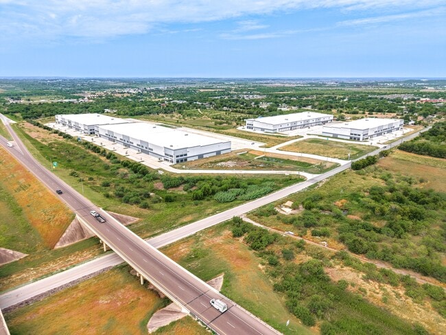
Property Detail
Mcangus Rd
298934
ABS 479 SUR 2 LEWIS W ACR 34.4968
Industrialgeneral
TRAVIS
C and X Area of minimal flood hazard, usually depicted on FIRMs as above the 500-year flood level.
Texas
2025
34.50 AC
2025
Southeast
002453
Austin
407,700 SF
Austin-Round Rock-San Marcos, TX
NEARBY LISTINGS FOR SALE OR LEASE
DEMOGRAPHICS near Mcangus Rd
1 mile
3 mile
5 mile
2024 Total Population
1,120
14,194
45,349
2029 Population
1,174
15,264
48,993
Pop Growth 2024-2029
+ 4.82%
+ 7.54%
+ 8.04%
Average Age
36
35
35
2024 Total Households
309
4,106
13,915
HH Growth 2024-2029
+ 5.50%
+ 8.62%
+ 8.98%
Median Household Inc
$70,499
$95,753
$99,265
Avg Household Size
3.40
3.30
3.10
2024 Avg HH Vehicles
2.00
2.00
2.00
Median Home Value
$329,411
$360,094
$370,346
Median Year Built
1997
2010
2010
Nearby Places
Map Layers
Map Styles
 Street
 Aerial
Transit
 Traffic
 Biking
Places
Listings with unknown addresses are not visible on the map
- Restaurants
- Banks
- Shops
- Fitness
- Groceries
PUBLIC TRANSPORTATION
AIRPORT
Austin-Bergstrom International
Drive
Walk
Distance
Austin-Bergstrom International
13 min
4.4 mi
Freight Ports
Calhoun Port
Drive
Walk
Distance
Calhoun Port
175 min
146.2 mi
Nearby Properties
Address
Land Use
TOTAL SIZE
Lot Size
Zoning
Address
Land Use
TOTAL SIZE
Lot Size
Zoning
942.08 AC
Address
Land Use
TOTAL SIZE
Lot Size
Zoning
801,840 SF
63.90 AC
Address
Land Use
TOTAL SIZE
Lot Size
Zoning
602,470 SF
67.47 AC
Address
Land Use
TOTAL SIZE
Lot Size
Zoning
241,920 SF
23.37 AC
Address
Land Use
TOTAL SIZE
Lot Size
Zoning
562,830 SF
213.88 AC
Address
Land Use
TOTAL SIZE
Lot Size
Zoning
241,725 SF
16.76 AC
Address
Land Use
TOTAL SIZE
Lot Size
Zoning
351,255 SF
12.45 AC
Address
Land Use
TOTAL SIZE
Lot Size
Zoning
231,000 SF
13.07 AC
Address
Land Use
TOTAL SIZE
Lot Size
Zoning
247,500 SF
15.78 AC
Address
Land Use
TOTAL SIZE
Lot Size
Zoning
198,000 SF
11.72 AC
Address
Land Use
TOTAL SIZE
Lot Size
Zoning
7,366 SF
88.64 AC
Address
Land Use
TOTAL SIZE
Lot Size
Zoning
356,800 SF
40.79 AC
Address
Land Use
TOTAL SIZE
Lot Size
Zoning
295,980 SF
47.98 AC
Address
Land Use
TOTAL SIZE
Lot Size
Zoning
Address
Land Use
TOTAL SIZE
Lot Size
Zoning
121,950 SF
11.92 AC
Address
Land Use
TOTAL SIZE
Lot Size
Zoning
157,500 SF
10.59 AC
Address
Land Use
TOTAL SIZE
Lot Size
Zoning
162,786 SF
15.43 AC
Address
Land Use
TOTAL SIZE
Lot Size
Zoning
152,817 SF
13.49 AC
Address
Land Use
TOTAL SIZE
Lot Size
Zoning
146,160 SF
8.53 AC
Address
Land Use
TOTAL SIZE
Lot Size
Zoning
116.40 AC
Address
Land Use
TOTAL SIZE
Lot Size
Zoning
95,049 SF
15 AC
Address
Land Use
TOTAL SIZE
Lot Size
Zoning
118,018 SF
8.90 AC
Address
Land Use
TOTAL SIZE
Lot Size
Zoning
126,304 SF
28.30 AC
Address
Land Use
TOTAL SIZE
Lot Size
Zoning
168,000 SF
11.79 AC
Address
Land Use
TOTAL SIZE
Lot Size
Zoning
56.32 AC
Address
Land Use
TOTAL SIZE
Lot Size
Zoning
126,000 SF
11.31 AC
Address
Land Use
TOTAL SIZE
Lot Size
Zoning
86.29 AC
Address
Land Use
TOTAL SIZE
Lot Size
Zoning
72,159 SF
Address
Land Use
TOTAL SIZE
Lot Size
Zoning
99,000 SF
7.07 AC
The World's #1 Commercial Real Estate Marketplace
Connect with us
© 2026 CoStar Group
The information above has been obtained from sources believed reliable. While we do not doubt its accuracy we have not verified it and make no guarantee, warranty or representation about it. It is your responsibility to independently confirm its accuracy and completeness. Any projections, opinions, assumptions, or estimates used are for example only and do not represent the current or future performance of the property. The value of this transaction to you depends on tax and other factors which should be evaluated by your tax, financial, and legal advisors. You and your advisors should conduct a careful, independent investigation of the property to determine to your satisfaction the suitability of the property for your needs.