Property Record
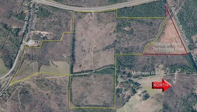
Mcbrayer Rd, Buchanan, GA 30113


Property Detail
Mcbrayer Rd
0075-0044V
93.78 ACS
Miscellaneous
HARALSON
BUC
Georgia
B and X Area of moderate flood hazard, usually the area between the limits of the 100-year and 500-year floods.
93.78 AC
0
Haralson County
2025
Atlanta
010100
Atlanta-Sandy Springs-Roswell, GA
NEARBY LISTINGS FOR SALE OR LEASE
DEMOGRAPHICS near Mcbrayer Rd
1 mile
3 mile
5 mile
2025 Total Population
642
3,704
10,496
2030 Population
687
3,968
11,231
Pop Growth 2025-2030
+ 7.01%
+ 7.13%
+ 7.00%
Average Age
40
41
41
2025 Total Households
248
1,429
4,002
HH Growth 2025-2030
+ 7.26%
+ 7.21%
+ 7.05%
Median Household Inc
$74,062
$58,581
$66,984
Avg Household Size
2.60
2.60
2.60
2025 Avg HH Vehicles
3.00
2.00
2.00
Median Home Value
$267,307
$299,692
$320,794
Median Year Built
1983
1983
1990
Nearby Places
Map Layers
Map Styles
 Street
 Aerial
Layers
 Traffic
 Biking
Places
Listings with unknown addresses are not visible on the map
- Restaurants
- Banks
- Shops
- Fitness
- Groceries
SALE & LEASE HISTORY
LISTING DATE
SALE/LEASE

Sep 24, 2016
For Sale
Nearby Properties
Address
Land Use
TOTAL SIZE
Lot Size
Zoning
Address
Land Use
TOTAL SIZE
Lot Size
Zoning
73,062 SF
27 AC
BUC
Address
Land Use
TOTAL SIZE
Lot Size
Zoning
270,000 SF
95.69 AC
BUC
Address
Land Use
TOTAL SIZE
Lot Size
Zoning
5,311 SF
14.69 AC
I-1
Address
Land Use
TOTAL SIZE
Lot Size
Zoning
14,252 SF
17.18 AC
BUC
Address
Land Use
TOTAL SIZE
Lot Size
Zoning
4,836 SF
57.50 AC
A-1
Address
Land Use
TOTAL SIZE
Lot Size
Zoning
18,600 SF
5 AC
BUC
Address
Land Use
TOTAL SIZE
Lot Size
Zoning
1,428 SF
3 AC
BUC
Address
Land Use
TOTAL SIZE
Lot Size
Zoning
655 AC
A-1
Address
Land Use
TOTAL SIZE
Lot Size
Zoning
10,726 SF
0.92 AC
BUC
Address
Land Use
TOTAL SIZE
Lot Size
Zoning
28.80 AC
A-1
Address
Land Use
TOTAL SIZE
Lot Size
Zoning
370.39 AC
A-1
Address
Land Use
TOTAL SIZE
Lot Size
Zoning
8,500 SF
175.50 AC
BUC
Address
Land Use
TOTAL SIZE
Lot Size
Zoning
4,000 SF
3.75 AC
BUC
Address
Land Use
TOTAL SIZE
Lot Size
Zoning
261 AC
A-1
Address
Land Use
TOTAL SIZE
Lot Size
Zoning
6,060 SF
0.42 AC
BUC
Address
Land Use
TOTAL SIZE
Lot Size
Zoning
139.06 AC
A-1
Address
Land Use
TOTAL SIZE
Lot Size
Zoning
183.53 AC
A-1
Address
Land Use
TOTAL SIZE
Lot Size
Zoning
143.77 AC
A-1
Address
Land Use
TOTAL SIZE
Lot Size
Zoning
35,058 SF
1.49 AC
BUC
Address
Land Use
TOTAL SIZE
Lot Size
Zoning
15,364 SF
1.03 AC
BUC
Address
Land Use
TOTAL SIZE
Lot Size
Zoning
8,993 SF
5 AC
A-1
Address
Land Use
TOTAL SIZE
Lot Size
Zoning
21,032 SF
2.03 AC
BUC
Address
Land Use
TOTAL SIZE
Lot Size
Zoning
6,000 SF
1.95 AC
BUC
Address
Land Use
TOTAL SIZE
Lot Size
Zoning
195.53 AC
A-1
Address
Land Use
TOTAL SIZE
Lot Size
Zoning
9,579 SF
4 AC
R-3
Address
Land Use
TOTAL SIZE
Lot Size
Zoning
4,250 SF
4.31 AC
BUC
Address
Land Use
TOTAL SIZE
Lot Size
Zoning
9,824 SF
4.50 AC
R-2
Address
Land Use
TOTAL SIZE
Lot Size
Zoning
38.96 AC
A-1
Address
Land Use
TOTAL SIZE
Lot Size
Zoning
9,422 SF
13.78 AC
BUC
The World's #1 Commercial Real Estate Marketplace
Connect with us
© 2026 CoStar Group
The information above has been obtained from sources believed reliable. While we do not doubt its accuracy we have not verified it and make no guarantee, warranty or representation about it. It is your responsibility to independently confirm its accuracy and completeness. Any projections, opinions, assumptions, or estimates used are for example only and do not represent the current or future performance of the property. The value of this transaction to you depends on tax and other factors which should be evaluated by your tax, financial, and legal advisors. You and your advisors should conduct a careful, independent investigation of the property to determine to your satisfaction the suitability of the property for your needs.