Property Record
Mckelvey Rd, , SC

Save to a Folder
{{folder.Name}}
{{folder.ListingIds.length}} Properties
{{folder.ListingIds.length}} Property
Create a New Folder
Property Detail
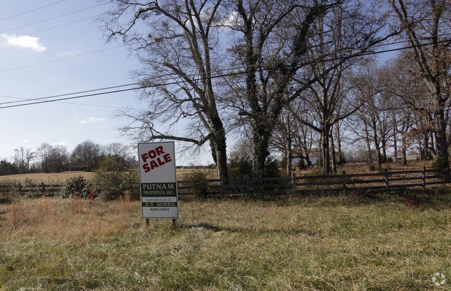
Mckelvey Rd
0568.01-01-010.00
TR 1
Agriculturalland
GREENVILLE
UNZONED
South Carolina
B and X Area of moderate flood hazard, usually the area between the limits of the 100-year and 500-year floods.
010.00
2025
82.17 AC
2025
Western Greenville County
003101
Greenville/Spartanburg
3,068 SF
Greenville-Anderson-Greer, SC
NEARBY LISTINGS FOR SALE OR LEASE
DEMOGRAPHICS near Mckelvey Rd
1 mile
3 mile
5 mile
2025 Total Population
796
6,796
35,064
2030 Population
863
7,370
37,942
Pop Growth 2025-2030
+ 8.42%
+ 8.45%
+ 8.21%
Average Age
42
42
40
2025 Total Households
294
2,512
13,012
HH Growth 2025-2030
+ 8.50%
+ 8.64%
+ 8.46%
Median Household Inc
$72,142
$79,717
$88,315
Avg Household Size
2.70
2.70
2.60
2025 Avg HH Vehicles
2.00
2.00
2.00
Median Home Value
$338,889
$362,820
$325,204
Median Year Built
1998
1998
2000
Nearby Places
Map Layers
Map Styles
 Street
 Aerial
Layers
 Traffic
 Biking
Places
Listings with unknown addresses are not visible on the map
- Restaurants
- Banks
- Shops
- Fitness
- Groceries
PUBLIC TRANSPORTATION
AIRPORT
Greenville Spartanburg International
Drive
Walk
Distance
Greenville Spartanburg International
34 min
22.3 mi
Freight Ports
North Charleston Terminal
Drive
Walk
Distance
North Charleston Terminal
214 min
190.2 mi
SALE & LEASE HISTORY
LISTING DATE
SALE/LEASE

Sep 24, 2016
For Sale
Nearby Properties
Address
Land Use
TOTAL SIZE
Lot Size
Zoning
Address
Land Use
TOTAL SIZE
Lot Size
Zoning
211.65 AC
UNZONED
Address
Land Use
TOTAL SIZE
Lot Size
Zoning
95.12 AC
UNZONED
Address
Land Use
TOTAL SIZE
Lot Size
Zoning
56.25 AC
NZ
Address
Land Use
TOTAL SIZE
Lot Size
Zoning
58.66 AC
UNZONED
Address
Land Use
TOTAL SIZE
Lot Size
Zoning
14.16 AC
UNZONED
Address
Land Use
TOTAL SIZE
Lot Size
Zoning
2,984 SF
13.50 AC
RS
Address
Land Use
TOTAL SIZE
Lot Size
Zoning
Address
Land Use
TOTAL SIZE
Lot Size
Zoning
6.47 AC
UNZONED
Address
Land Use
TOTAL SIZE
Lot Size
Zoning
6.80 AC
RS
Address
Land Use
TOTAL SIZE
Lot Size
Zoning
1,939 SF
6.56 AC
RS
Address
Land Use
TOTAL SIZE
Lot Size
Zoning
1,421 SF
6.43 AC
UNZONED
Address
Land Use
TOTAL SIZE
Lot Size
Zoning
1,084 SF
23.12 AC
S1
Address
Land Use
TOTAL SIZE
Lot Size
Zoning
8.90 AC
RR3
Address
Land Use
TOTAL SIZE
Lot Size
Zoning
45.61 AC
RS
Address
Land Use
TOTAL SIZE
Lot Size
Zoning
7.80 AC
UNZONED
Address
Land Use
TOTAL SIZE
Lot Size
Zoning
1.77 AC
RR1
Address
Land Use
TOTAL SIZE
Lot Size
Zoning
2.20 AC
NZ
Address
Land Use
TOTAL SIZE
Lot Size
Zoning
4.85 AC
Address
Land Use
TOTAL SIZE
Lot Size
Zoning
Address
Land Use
TOTAL SIZE
Lot Size
Zoning
1,952 SF
72.40 AC
RS
Address
Land Use
TOTAL SIZE
Lot Size
Zoning
88.65 AC
Address
Land Use
TOTAL SIZE
Lot Size
Zoning
1,554 SF
1.90 AC
UNZONED
Address
Land Use
TOTAL SIZE
Lot Size
Zoning
4.14 AC
UNZONED
Address
Land Use
TOTAL SIZE
Lot Size
Zoning
2.47 AC
RS
Address
Land Use
TOTAL SIZE
Lot Size
Zoning
0.40 AC
UNZONED
Address
Land Use
TOTAL SIZE
Lot Size
Zoning
3,254 SF
4.92 AC
RR1
Address
Land Use
TOTAL SIZE
Lot Size
Zoning
3.78 AC
RR3
Address
Land Use
TOTAL SIZE
Lot Size
Zoning
1.37 AC
NZ
Address
Land Use
TOTAL SIZE
Lot Size
Zoning
0.40 AC
NZ
Address
Land Use
TOTAL SIZE
Lot Size
Zoning
44.58 AC
RR3
The World's #1 Commercial Real Estate Marketplace
Connect with us
© 2026 CoStar Group
The information above has been obtained from sources believed reliable. While we do not doubt its accuracy we have not verified it and make no guarantee, warranty or representation about it. It is your responsibility to independently confirm its accuracy and completeness. Any projections, opinions, assumptions, or estimates used are for example only and do not represent the current or future performance of the property. The value of this transaction to you depends on tax and other factors which should be evaluated by your tax, financial, and legal advisors. You and your advisors should conduct a careful, independent investigation of the property to determine to your satisfaction the suitability of the property for your needs.