Property Record
Mcneal Rd, Hoschton, GA 30548

NEARBY LISTINGS FOR SALE OR LEASE
Property Detail
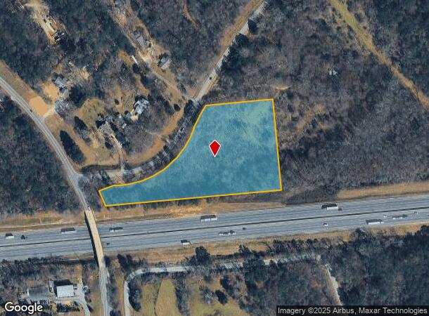
Mcneal Rd
111-027A
5 ACRES PLAT BOOK 57 PAGE 47
Residentialacreage
Jackson
X
Georgia
13139C0350G
5 AC
2025
Jackson County
2024
Atlanta
010106
Jefferson, GA
DEMOGRAPHICS near Mcneal Rd
1 Mile
3 Mile
5 Mile
2024 Total Population
950
13,226
30,617
2029 Population
1,210
16,897
38,966
Pop Growth 2024-2029
+ 27.37%
+ 27.76%
+ 27.27%
Average Age
38
38
38
2024 Total Households
312
4,367
10,116
HH Growth 2024-2029
+ 25.64%
+ 26.27%
+ 25.84%
Median Household Inc
$65,000
$76,023
$84,470
Avg Household Size
2.90
2.90
3.00
2024 Avg HH Vehicles
3.00
3.00
2.00
Median Home Value
$321,951
$336,597
$337,992
Median Year Built
2004
2005
2005
Nearby Places
Map Layers
Map Styles
 Street
 Aerial
- Restaurants
- Banks
- Shops
- Fitness
- Groceries
SALE & LEASE HISTORY
LISTING DATE
SALE/LEASE

Apr 25, 2017
For Sale
Nearby Properties
Address
Land Use
TOTAL SIZE
Lot Size
Zoning
Address
Land Use
TOTAL SIZE
Lot Size
Zoning
500,000 SF
137.67 AC
E1
Address
Land Use
TOTAL SIZE
Lot Size
Zoning
474,720 SF
40.19 AC
A1
Address
Land Use
TOTAL SIZE
Lot Size
Zoning
341,330 SF
71.15 AC
001
Address
Land Use
TOTAL SIZE
Lot Size
Zoning
750 SF
001
Address
Land Use
TOTAL SIZE
Lot Size
Zoning
810,600 SF
62.08 AC
M1
Address
Land Use
TOTAL SIZE
Lot Size
Zoning
462,000 SF
30.12 AC
M1
Address
Land Use
TOTAL SIZE
Lot Size
Zoning
438,375 SF
32.69 AC
Address
Land Use
TOTAL SIZE
Lot Size
Zoning
360,290 SF
35.90 AC
C
Address
Land Use
TOTAL SIZE
Lot Size
Zoning
71,246 SF
10.10 AC
001
Address
Land Use
TOTAL SIZE
Lot Size
Zoning
60,128 SF
2.48 AC
001
Address
Land Use
TOTAL SIZE
Lot Size
Zoning
35.12 AC
001
Address
Land Use
TOTAL SIZE
Lot Size
Zoning
22.23 AC
001
Address
Land Use
TOTAL SIZE
Lot Size
Zoning
5.95 AC
CRC
Address
Land Use
TOTAL SIZE
Lot Size
Zoning
10.34 AC
CRC
Address
Land Use
TOTAL SIZE
Lot Size
Zoning
9,749 SF
7.48 AC
C2
Address
Land Use
TOTAL SIZE
Lot Size
Zoning
23.70 AC
004
Address
Land Use
TOTAL SIZE
Lot Size
Zoning
23.70 AC
004
Address
Land Use
TOTAL SIZE
Lot Size
Zoning
46,884 SF
4.06 AC
004
Address
Land Use
TOTAL SIZE
Lot Size
Zoning
13,776 SF
1.10 AC
B2
Address
Land Use
TOTAL SIZE
Lot Size
Zoning
10,092 SF
2.97 AC
002
Address
Land Use
TOTAL SIZE
Lot Size
Zoning
25,252 SF
2.42 AC
001
Address
Land Use
TOTAL SIZE
Lot Size
Zoning
12,144 SF
1.52 AC
001
Address
Land Use
TOTAL SIZE
Lot Size
Zoning
14,789 SF
2.52 AC
001
Address
Land Use
TOTAL SIZE
Lot Size
Zoning
200.40 AC
A1
Address
Land Use
TOTAL SIZE
Lot Size
Zoning
13,792 SF
1 AC
C
Address
Land Use
TOTAL SIZE
Lot Size
Zoning
14,215 SF
2.26 AC
CRC
Address
Land Use
TOTAL SIZE
Lot Size
Zoning
8,662 SF
1.27 AC
CRC
Address
Land Use
TOTAL SIZE
Lot Size
Zoning
10,080 SF
8.30 AC
A1
Address
Land Use
TOTAL SIZE
Lot Size
Zoning
18,088 SF
13.69 AC
C
Address
Land Use
TOTAL SIZE
Lot Size
Zoning
13,628 SF
1.48 AC
001
The World's #1 Commercial Real Estate Marketplace
Connect with us
© 2025 CoStar Group
The information above has been obtained from sources believed reliable. While we do not doubt its accuracy we have not verified it and make no guarantee, warranty or representation about it. It is your responsibility to independently confirm its accuracy and completeness. Any projections, opinions, assumptions, or estimates used are for example only and do not represent the current or future performance of the property. The value of this transaction to you depends on tax and other factors which should be evaluated by your tax, financial, and legal advisors. You and your advisors should conduct a careful, independent investigation of the property to determine to your satisfaction the suitability of the property for your needs.