Property Record
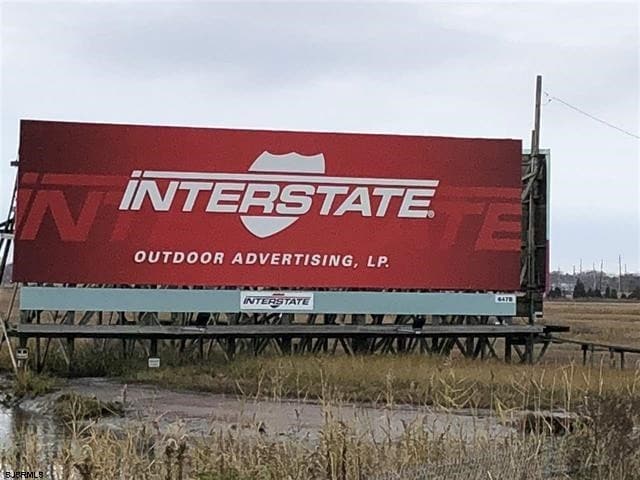
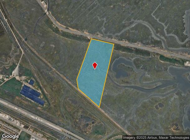
Meadow Trak, Atlantic City, NJ 08401
NEARBY LISTINGS FOR SALE OR LEASE
Property Detail
Meadow Trak
02-00799-0000-00007
Atlantic
Vacantlandnec
New Jersey
ARE
7
34001C0338F
51.54 AC
2024
Atlantic City/Hammonton
2025
Philadelphia
002300
Atlantic City-Hammonton, NJ
DEMOGRAPHICS near Meadow Trak
1 Mile
3 Mile
5 Mile
2024 Total Population
143
43,382
113,313
2029 Population
141
42,706
114,907
Pop Growth 2024-2029
(1.40%)
(1.56%)
+ 1.41%
Average Age
40
38
42
2024 Total Households
51
15,790
46,511
HH Growth 2024-2029
(1.96%)
(1.90%)
+ 1.64%
Median Household Inc
$44,999
$43,350
$52,760
Avg Household Size
2.70
2.60
2.30
2024 Avg HH Vehicles
1.00
1.00
1.00
Median Home Value
$183,333
$183,461
$258,686
Median Year Built
1959
1960
1966
Nearby Places
Map Layers
Map Styles
 Street
 Aerial
- Restaurants
- Banks
- Shops
- Fitness
- Groceries
PUBLIC TRANSPORTATION
COMMUTER RAIL
Atlantic City (Atlantic City Line - NJ Transit Commuter Rail (NJ Transit))
DRIVE
WALK
Distance
Atlantic City (Atlantic City Line - NJ Transit Commuter Rail (NJ Transit))
9 min
3.8 mi
Absecon (Atlantic City Line - NJ Transit Commuter Rail (NJ Transit))
DRIVE
WALK
Distance
Absecon (Atlantic City Line - NJ Transit Commuter Rail (NJ Transit))
10 min
6.2 mi
AIRPORT
Atlantic City International
DRIVE
WALK
Distance
Atlantic City International
40 min
14.6 mi
Freight Ports
Broadway Terminal - Pier 5
DRIVE
WALK
Distance
Broadway Terminal - Pier 5
72 min
56.3 mi
SALE & LEASE HISTORY
LISTING DATE
SALE/LEASE

Dec 29, 2017
For Sale
Nearby Properties
Address
Land Use
TOTAL SIZE
Lot Size
Zoning
Address
Land Use
TOTAL SIZE
Lot Size
Zoning
25.97 AC
HNRA
Address
Land Use
TOTAL SIZE
Lot Size
Zoning
Address
Land Use
TOTAL SIZE
Lot Size
Zoning
2,497,916 SF
6.96 AC
CBD
Address
Land Use
TOTAL SIZE
Lot Size
Zoning
11.04 AC
HNRA
Address
Land Use
TOTAL SIZE
Lot Size
Zoning
5,364 SF
142.55 AC
BFRA
Address
Land Use
TOTAL SIZE
Lot Size
Zoning
14.71 AC
RS-C
Address
Land Use
TOTAL SIZE
Lot Size
Zoning
69.16 AC
HNRA
Address
Land Use
TOTAL SIZE
Lot Size
Zoning
6,552 SF
3.61 AC
RS
Address
Land Use
TOTAL SIZE
Lot Size
Zoning
3.54 AC
HNRA
Address
Land Use
TOTAL SIZE
Lot Size
Zoning
387,249 SF
49.56 AC
HW-C
Address
Land Use
TOTAL SIZE
Lot Size
Zoning
Address
Land Use
TOTAL SIZE
Lot Size
Zoning
40.29 AC
IND
Address
Land Use
TOTAL SIZE
Lot Size
Zoning
0.78 AC
RS-C
Address
Land Use
TOTAL SIZE
Lot Size
Zoning
2.44 AC
RS-C
Address
Land Use
TOTAL SIZE
Lot Size
Zoning
28,520 SF
47.40 AC
M-C
Address
Land Use
TOTAL SIZE
Lot Size
Zoning
2.75 AC
Address
Land Use
TOTAL SIZE
Lot Size
Zoning
43,980 SF
1.80 AC
R-3
Address
Land Use
TOTAL SIZE
Lot Size
Zoning
8.35 AC
HNRA
Address
Land Use
TOTAL SIZE
Lot Size
Zoning
Address
Land Use
TOTAL SIZE
Lot Size
Zoning
2.67 AC
R-1
Address
Land Use
TOTAL SIZE
Lot Size
Zoning
2.04 AC
HNRA
Address
Land Use
TOTAL SIZE
Lot Size
Zoning
Address
Land Use
TOTAL SIZE
Lot Size
Zoning
70,780 SF
1.52 AC
NC-2
Address
Land Use
TOTAL SIZE
Lot Size
Zoning
4,320 SF
0.84 AC
UEZC
Address
Land Use
TOTAL SIZE
Lot Size
Zoning
9,318 SF
1.38 AC
UEZC
Address
Land Use
TOTAL SIZE
Lot Size
Zoning
17,312 SF
14.95 AC
MF
Address
Land Use
TOTAL SIZE
Lot Size
Zoning
5.56 AC
R-50
Address
Land Use
TOTAL SIZE
Lot Size
Zoning
95,102 SF
2.09 AC
R-3
Address
Land Use
TOTAL SIZE
Lot Size
Zoning
1.95 AC
UEZC
Address
Land Use
TOTAL SIZE
Lot Size
Zoning
100,812 SF
3.82 AC
RM-2
The World's #1 Commercial Real Estate Marketplace
Connect with us
© 2025 CoStar Group
The information above has been obtained from sources believed reliable. While we do not doubt its accuracy we have not verified it and make no guarantee, warranty or representation about it. It is your responsibility to independently confirm its accuracy and completeness. Any projections, opinions, assumptions, or estimates used are for example only and do not represent the current or future performance of the property. The value of this transaction to you depends on tax and other factors which should be evaluated by your tax, financial, and legal advisors. You and your advisors should conduct a careful, independent investigation of the property to determine to your satisfaction the suitability of the property for your needs.