Property Record
Melrose Dr, Vista, CA 92083


Save to a Folder
{{folder.Name}}
{{folder.ListingIds.length}} Properties
{{folder.ListingIds.length}} Property
Create a New Folder
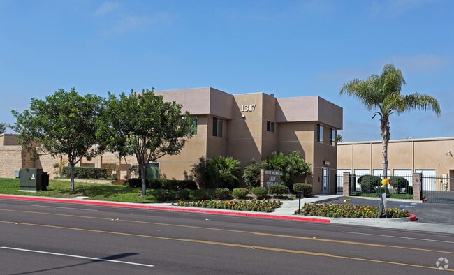
Property Detail
Melrose Dr
161-071-28
PAR E DOC2018-0212506 IN TR PM11853
Industrialacreage
SAN DIEGO
SP-08
California
B and X Area of moderate flood hazard, usually the area between the limits of the 100-year and 500-year floods.
1.65 AC
2025
Vista
2026
San Diego
019702
San Diego-Chula Vista-Carlsbad, CA
NEARBY LISTINGS FOR SALE OR LEASE
DEMOGRAPHICS near Melrose Dr
1 mile
3 mile
5 mile
2025 Total Population
23,487
138,031
263,259
2030 Population
23,633
138,518
264,253
Pop Growth 2025-2030
+ 0.62%
+ 0.35%
+ 0.38%
Average Age
37
39
40
2025 Total Households
6,903
43,781
89,105
HH Growth 2025-2030
+ 0.55%
+ 0.17%
+ 0.25%
Median Household Inc
$95,080
$100,440
$101,933
Avg Household Size
3.20
3.00
2.80
2025 Avg HH Vehicles
2.00
2.00
2.00
Median Home Value
$708,529
$737,520
$761,221
Median Year Built
1983
1982
1984
Nearby Places
Map Layers
Map Styles
 Street
 Aerial
Layers
 Traffic
 Biking
Places
Listings with unknown addresses are not visible on the map
- Restaurants
- Banks
- Shops
- Fitness
- Groceries
PUBLIC TRANSPORTATION
TRANSIT/SUBWAY
Melrose (Sprinter - San Diego North County Transit District (Coaster/Sprinter/Breeze))
Drive
Walk
Distance
Melrose (Sprinter - San Diego North County Transit District (Coaster/Sprinter/Breeze))
2 min
13 min
0.7 mi
COMMUTER RAIL
Carlsbad Village (Coaster - San Diego North County Transit District (Coaster/Sprinter/Breeze))
Drive
Walk
Distance
Carlsbad Village (Coaster - San Diego North County Transit District (Coaster/Sprinter/Breeze))
15 min
9.1 mi
Freight Ports
Port of San Diego
Drive
Walk
Distance
Port of San Diego
58 min
45.6 mi
Nearby Properties
Address
Land Use
TOTAL SIZE
Lot Size
Zoning
Address
Land Use
TOTAL SIZE
Lot Size
Zoning
9,999 SF
20.96 AC
SP-1-84 (I
Address
Land Use
TOTAL SIZE
Lot Size
Zoning
9,999 SF
20.10 AC
M-U
Address
Land Use
TOTAL SIZE
Lot Size
Zoning
9,999 SF
11.17 AC
M-U
Address
Land Use
TOTAL SIZE
Lot Size
Zoning
9,999 SF
10.39 AC
M-U (40)
Address
Land Use
TOTAL SIZE
Lot Size
Zoning
9,999 SF
18.89 AC
PD-1 (Res)
Address
Land Use
TOTAL SIZE
Lot Size
Zoning
9,999 SF
15.74 AC
SP-1-84 (I
Address
Land Use
TOTAL SIZE
Lot Size
Zoning
9,999 SF
31.94 AC
RM-B
Address
Land Use
TOTAL SIZE
Lot Size
Zoning
9,999 SF
38.61 AC
PD-1 (IL)
Address
Land Use
TOTAL SIZE
Lot Size
Zoning
21.44 AC
C-1
Address
Land Use
TOTAL SIZE
Lot Size
Zoning
9,999 SF
1.23 AC
SPI
Address
Land Use
TOTAL SIZE
Lot Size
Zoning
9,999 SF
7.97 AC
SPI-DV
Address
Land Use
TOTAL SIZE
Lot Size
Zoning
9,999 SF
7.57 AC
R-M
Address
Land Use
TOTAL SIZE
Lot Size
Zoning
9,999 SF
5.10 AC
R-M
Address
Land Use
TOTAL SIZE
Lot Size
Zoning
9,999 SF
6.87 AC
CN-SP-EQ
Address
Land Use
TOTAL SIZE
Lot Size
Zoning
9,999 SF
9.48 AC
R-M
Address
Land Use
TOTAL SIZE
Lot Size
Zoning
9,999 SF
14.08 AC
RH
Address
Land Use
TOTAL SIZE
Lot Size
Zoning
9,999 SF
8.67 AC
R-M
Address
Land Use
TOTAL SIZE
Lot Size
Zoning
9,999 SF
10.38 AC
R-M
Address
Land Use
TOTAL SIZE
Lot Size
Zoning
9,999 SF
6.55 AC
R-M
Address
Land Use
TOTAL SIZE
Lot Size
Zoning
9,999 SF
15.02 AC
SP-1-84 (I
Address
Land Use
TOTAL SIZE
Lot Size
Zoning
9,999 SF
25.16 AC
SP-1-84 (I
Address
Land Use
TOTAL SIZE
Lot Size
Zoning
9,999 SF
11.60 AC
RM-C
Address
Land Use
TOTAL SIZE
Lot Size
Zoning
7,472 SF
4.96 AC
RM-A
Address
Land Use
TOTAL SIZE
Lot Size
Zoning
9,999 SF
15.81 AC
SP-1-84 (I
Address
Land Use
TOTAL SIZE
Lot Size
Zoning
9,999 SF
10.05 AC
RM-B
Address
Land Use
TOTAL SIZE
Lot Size
Zoning
7.43 AC
C-6
Address
Land Use
TOTAL SIZE
Lot Size
Zoning
9,999 SF
10.59 AC
RH
Address
Land Use
TOTAL SIZE
Lot Size
Zoning
9,999 SF
3.99 AC
M-U
Address
Land Use
TOTAL SIZE
Lot Size
Zoning
8,256 SF
5.67 AC
RM-A
Address
Land Use
TOTAL SIZE
Lot Size
Zoning
5,156 SF
2.52 AC
PD-1 (IL)
The World's #1 Commercial Real Estate Marketplace
Connect with us
© 2026 CoStar Group
The information above has been obtained from sources believed reliable. While we do not doubt its accuracy we have not verified it and make no guarantee, warranty or representation about it. It is your responsibility to independently confirm its accuracy and completeness. Any projections, opinions, assumptions, or estimates used are for example only and do not represent the current or future performance of the property. The value of this transaction to you depends on tax and other factors which should be evaluated by your tax, financial, and legal advisors. You and your advisors should conduct a careful, independent investigation of the property to determine to your satisfaction the suitability of the property for your needs.