Property Record
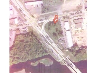
Menomonie St, Eau Claire, WI 54703

NEARBY LISTINGS FOR SALE OR LEASE
Property Detail
Menomonie St
Eau Claire, WI
PRT OF A PCL KNOWN AS PCL B CSM 414517 RECD VOL 1 PG 13 LOC IN THE SW-SW SEC 19-27-9 IN GOVT LOT 5 SEC 30-27-9 IN THE SE-SE S
04-0260
Eau Claire
Commercialnec
Wisconsin
X
1,5
55017C0725E
2.03 AC
2024
Downtown Eau Claire
2024
Other Market Areas
000600
DEMOGRAPHICS near Menomonie St
1 Mile
3 Mile
5 Mile
2024 Total Population
5,666
47,486
84,347
2029 Population
5,843
49,227
87,696
Pop Growth 2024-2029
+ 3.12%
+ 3.67%
+ 3.97%
Average Age
31
36
38
2024 Total Households
2,064
19,271
34,846
HH Growth 2024-2029
+ 3.29%
+ 3.80%
+ 4.05%
Median Household Inc
$41,701
$56,906
$62,652
Avg Household Size
2.30
2.20
2.20
2024 Avg HH Vehicles
2.00
2.00
2.00
Median Home Value
$191,666
$216,414
$230,442
Median Year Built
1974
1967
1975
Nearby Places
Map Layers
Map Styles
 Street
 Aerial
- Restaurants
- Banks
- Shops
- Fitness
- Groceries
Nearby Properties
Address
Land Use
TOTAL SIZE
Lot Size
Zoning
Address
Land Use
TOTAL SIZE
Lot Size
Zoning
119.93 AC
Address
Land Use
TOTAL SIZE
Lot Size
Zoning
203,723 SF
Address
Land Use
TOTAL SIZE
Lot Size
Zoning
361,759 SF
8.46 AC
Address
Land Use
TOTAL SIZE
Lot Size
Zoning
206,042 SF
5.59 AC
Address
Land Use
TOTAL SIZE
Lot Size
Zoning
21.83 AC
I1
Address
Land Use
TOTAL SIZE
Lot Size
Zoning
1.36 AC
CBD
Address
Land Use
TOTAL SIZE
Lot Size
Zoning
114,683 SF
5.47 AC
C3H
Address
Land Use
TOTAL SIZE
Lot Size
Zoning
81,260 SF
2.32 AC
R4
Address
Land Use
TOTAL SIZE
Lot Size
Zoning
199,534 SF
7.23 AC
Address
Land Use
TOTAL SIZE
Lot Size
Zoning
1.05 AC
P
Address
Land Use
TOTAL SIZE
Lot Size
Zoning
105,434 SF
1.55 AC
CBD
Address
Land Use
TOTAL SIZE
Lot Size
Zoning
66,393 SF
12.95 AC
Address
Land Use
TOTAL SIZE
Lot Size
Zoning
65,378 SF
1.83 AC
Address
Land Use
TOTAL SIZE
Lot Size
Zoning
114,100 SF
2.64 AC
Address
Land Use
TOTAL SIZE
Lot Size
Zoning
68,024 SF
0.80 AC
CBD
Address
Land Use
TOTAL SIZE
Lot Size
Zoning
169,740 SF
19.59 AC
C3P
Address
Land Use
TOTAL SIZE
Lot Size
Zoning
88,350 SF
0.40 AC
Address
Land Use
TOTAL SIZE
Lot Size
Zoning
97,194 SF
7.39 AC
C3H
Address
Land Use
TOTAL SIZE
Lot Size
Zoning
66,497 SF
0.81 AC
CBDP
Address
Land Use
TOTAL SIZE
Lot Size
Zoning
7,084 SF
26.73 AC
I2P
Address
Land Use
TOTAL SIZE
Lot Size
Zoning
0.78 AC
Address
Land Use
TOTAL SIZE
Lot Size
Zoning
10.68 AC
I1P
Address
Land Use
TOTAL SIZE
Lot Size
Zoning
38,808 SF
11.65 AC
I1P
Address
Land Use
TOTAL SIZE
Lot Size
Zoning
103,890 SF
6.30 AC
R4P
Address
Land Use
TOTAL SIZE
Lot Size
Zoning
70,965 SF
0.78 AC
CBD
Address
Land Use
TOTAL SIZE
Lot Size
Zoning
14.28 AC
I1P
Address
Land Use
TOTAL SIZE
Lot Size
Zoning
73,414 SF
2.46 AC
C3P
Address
Land Use
TOTAL SIZE
Lot Size
Zoning
60,473 SF
1.83 AC
Address
Land Use
TOTAL SIZE
Lot Size
Zoning
84.65 AC
Address
Land Use
TOTAL SIZE
Lot Size
Zoning
77,311 SF
3.39 AC
C3H
The World's #1 Commercial Real Estate Marketplace
Connect with us
© 2026 CoStar Group
The information above has been obtained from sources believed reliable. While we do not doubt its accuracy we have not verified it and make no guarantee, warranty or representation about it. It is your responsibility to independently confirm its accuracy and completeness. Any projections, opinions, assumptions, or estimates used are for example only and do not represent the current or future performance of the property. The value of this transaction to you depends on tax and other factors which should be evaluated by your tax, financial, and legal advisors. You and your advisors should conduct a careful, independent investigation of the property to determine to your satisfaction the suitability of the property for your needs.