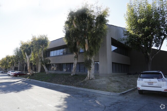
Property Record
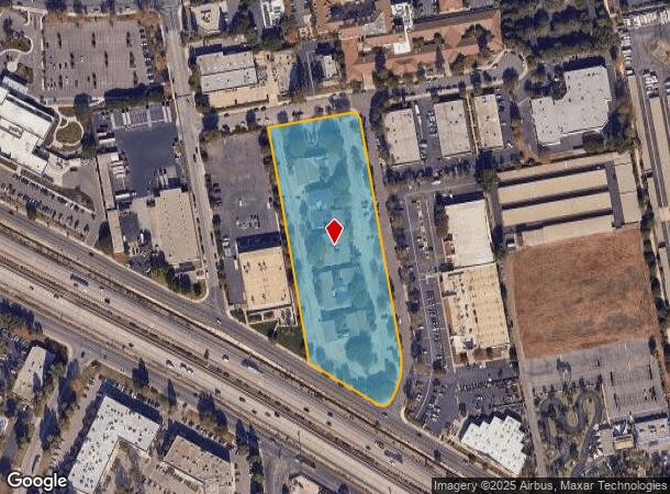
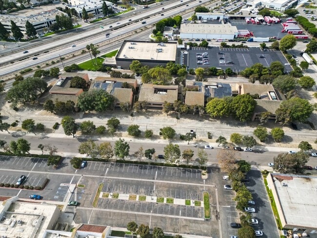
1655 Mesa Verde Ave, Ventura, CA 93003

NEARBY LISTINGS FOR SALE OR LEASE
Property Detail
1655 Mesa Verde Ave
Oxnard-Thousand Oaks-Ventura, CA
City Of San Buenaventura
137-0-030-105
LOT: 29 REF: 018PM 008
Officebuilding
Ventura
X
California
06111C0765E
29
2024
4.95 AC
2025
Ventura
001509
Los Angeles
64,251 SF
DEMOGRAPHICS near 1655 Mesa Verde Ave
1 Mile
3 Mile
5 Mile
2024 Total Population
14,422
95,064
205,596
2029 Population
14,131
94,303
203,388
Pop Growth 2024-2029
(2.02%)
(0.80%)
(1.07%)
Average Age
41
42
40
2024 Total Households
5,362
34,936
69,742
HH Growth 2024-2029
(2.24%)
(0.84%)
(1.00%)
Median Household Inc
$72,011
$99,956
$92,987
Avg Household Size
2.50
2.70
2.80
2024 Avg HH Vehicles
2.00
2.00
2.00
Median Home Value
$568,483
$712,331
$707,035
Median Year Built
1978
1976
1975
Nearby Places
Map Layers
Map Styles
 Street
 Aerial
- Restaurants
- Banks
- Shops
- Fitness
- Groceries
PUBLIC TRANSPORTATION
COMMUTER RAIL
DRIVE
WALK
Distance
3 min
20 min
1.0 mi
Oxnard (Ventura County Line - Southern California Regional Rail Authority (Metrolink))
DRIVE
WALK
Distance
Oxnard (Ventura County Line - Southern California Regional Rail Authority (Metrolink))
11 min
5.8 mi
Freight Ports
The Port of Hueneme
DRIVE
WALK
Distance
The Port of Hueneme
18 min
9.5 mi
Nearby Properties
Address
Land Use
TOTAL SIZE
Lot Size
Zoning
Address
Land Use
TOTAL SIZE
Lot Size
Zoning
1.99 AC
Address
Land Use
TOTAL SIZE
Lot Size
Zoning
4.19 AC
H
Address
Land Use
TOTAL SIZE
Lot Size
Zoning
8.03 AC
CPD
Address
Land Use
TOTAL SIZE
Lot Size
Zoning
480,733 SF
14.26 AC
Address
Land Use
TOTAL SIZE
Lot Size
Zoning
43,284 SF
14.34 AC
RPD28
Address
Land Use
TOTAL SIZE
Lot Size
Zoning
95,637 SF
40.70 AC
Address
Land Use
TOTAL SIZE
Lot Size
Zoning
195,798 SF
15.40 AC
RPD15
Address
Land Use
TOTAL SIZE
Lot Size
Zoning
6.14 AC
Address
Land Use
TOTAL SIZE
Lot Size
Zoning
233,168 SF
13.94 AC
RPD-
Address
Land Use
TOTAL SIZE
Lot Size
Zoning
176,598 SF
9.22 AC
Address
Land Use
TOTAL SIZE
Lot Size
Zoning
3.96 AC
Address
Land Use
TOTAL SIZE
Lot Size
Zoning
2.63 AC
Address
Land Use
TOTAL SIZE
Lot Size
Zoning
3.12 AC
Address
Land Use
TOTAL SIZE
Lot Size
Zoning
49,296 SF
11.08 AC
Address
Land Use
TOTAL SIZE
Lot Size
Zoning
24,154 SF
12.67 AC
R3-1
Address
Land Use
TOTAL SIZE
Lot Size
Zoning
1,675 SF
18.62 AC
Address
Land Use
TOTAL SIZE
Lot Size
Zoning
110,434 SF
3.81 AC
Address
Land Use
TOTAL SIZE
Lot Size
Zoning
3.01 AC
Address
Land Use
TOTAL SIZE
Lot Size
Zoning
40,110 SF
8.04 AC
MPD
Address
Land Use
TOTAL SIZE
Lot Size
Zoning
138,475 SF
2.77 AC
Address
Land Use
TOTAL SIZE
Lot Size
Zoning
138,475 SF
2.77 AC
Address
Land Use
TOTAL SIZE
Lot Size
Zoning
89,643 SF
14.27 AC
Address
Land Use
TOTAL SIZE
Lot Size
Zoning
13,530 SF
10.85 AC
Address
Land Use
TOTAL SIZE
Lot Size
Zoning
25,401 SF
2.74 AC
C1AD
Address
Land Use
TOTAL SIZE
Lot Size
Zoning
81,671 SF
3.54 AC
Address
Land Use
TOTAL SIZE
Lot Size
Zoning
111,421 SF
3.80 AC
Address
Land Use
TOTAL SIZE
Lot Size
Zoning
107,360 SF
5.96 AC
RPD15
Address
Land Use
TOTAL SIZE
Lot Size
Zoning
36,186 SF
12.16 AC
Address
Land Use
TOTAL SIZE
Lot Size
Zoning
14,098 SF
6.46 AC
The World's #1 Commercial Real Estate Marketplace
Connect with us
© 2025 CoStar Group
The information above has been obtained from sources believed reliable. While we do not doubt its accuracy we have not verified it and make no guarantee, warranty or representation about it. It is your responsibility to independently confirm its accuracy and completeness. Any projections, opinions, assumptions, or estimates used are for example only and do not represent the current or future performance of the property. The value of this transaction to you depends on tax and other factors which should be evaluated by your tax, financial, and legal advisors. You and your advisors should conduct a careful, independent investigation of the property to determine to your satisfaction the suitability of the property for your needs.