Property Record
14405 Meyers Rd, Oregon City, OR 97045
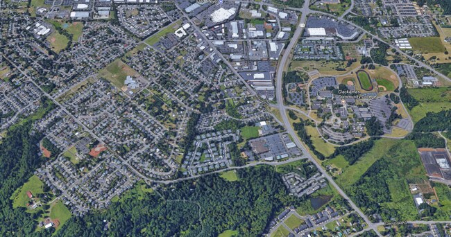

Property Detail
14405 Meyers Rd
Portland-Vancouver-Hillsboro, OR-WA
PARTITION PLAT 2021-003 PARCEL 2
00869698
Clackamas
Industrialacreage
Oregon
CI
200
B and X Area of moderate flood hazard, usually the area between the limits of the 100-year and 500-year floods.
7.94 AC
2025
SE Outlying
2025
Portland
022603
NEARBY LISTINGS FOR SALE OR LEASE
DEMOGRAPHICS near 14405 Meyers Rd
1 mile
3 mile
5 mile
2025 Total Population
8,754
40,166
81,941
2030 Population
8,782
40,194
81,820
Pop Growth 2025-2030
+ 0.32%
+ 0.07%
(0.15%)
Average Age
40
41
42
2025 Total Households
3,310
14,869
30,427
HH Growth 2025-2030
+ 0.33%
+ 0.03%
(0.20%)
Median Household Inc
$98,526
$99,340
$106,068
Avg Household Size
2.60
2.60
2.60
2025 Avg HH Vehicles
2.00
2.00
2.00
Median Home Value
$649,316
$596,961
$651,924
Median Year Built
1995
1987
1985
Nearby Places
Map Layers
Map Styles
 Street
 Aerial
Transit
 Traffic
 Biking
Places
Listings with unknown addresses are not visible on the map
- Restaurants
- Banks
- Shops
- Fitness
- Groceries
PUBLIC TRANSPORTATION
COMMUTER RAIL
Drive
Walk
Distance
9 min
4.6 mi
AIRPORT
Portland International
Drive
Walk
Distance
Portland International
33 min
21.4 mi
SALE & LEASE HISTORY
LISTING DATE
SALE/LEASE

Oct 19, 2017
For Sale
Nearby Properties
Address
Land Use
TOTAL SIZE
Lot Size
Zoning
Address
Land Use
TOTAL SIZE
Lot Size
Zoning
58 AC
MUE
Address
Land Use
TOTAL SIZE
Lot Size
Zoning
9,233 SF
8.27 AC
MUE
Address
Land Use
TOTAL SIZE
Lot Size
Zoning
20.28 AC
R2
Address
Land Use
TOTAL SIZE
Lot Size
Zoning
1,408 SF
7.12 AC
MUC2
Address
Land Use
TOTAL SIZE
Lot Size
Zoning
936 SF
10.25 AC
CI
Address
Land Use
TOTAL SIZE
Lot Size
Zoning
9.30 AC
C
Address
Land Use
TOTAL SIZE
Lot Size
Zoning
15.29 AC
R2
Address
Land Use
TOTAL SIZE
Lot Size
Zoning
Address
Land Use
TOTAL SIZE
Lot Size
Zoning
Address
Land Use
TOTAL SIZE
Lot Size
Zoning
4 AC
MUE
Address
Land Use
TOTAL SIZE
Lot Size
Zoning
1.67 AC
MUE
Address
Land Use
TOTAL SIZE
Lot Size
Zoning
4.12 AC
MUC2
Address
Land Use
TOTAL SIZE
Lot Size
Zoning
8 AC
R2
Address
Land Use
TOTAL SIZE
Lot Size
Zoning
17.99 AC
C
Address
Land Use
TOTAL SIZE
Lot Size
Zoning
Address
Land Use
TOTAL SIZE
Lot Size
Zoning
5.38 AC
C
Address
Land Use
TOTAL SIZE
Lot Size
Zoning
1,114 SF
3.11 AC
R2
Address
Land Use
TOTAL SIZE
Lot Size
Zoning
3 AC
MUE
Address
Land Use
TOTAL SIZE
Lot Size
Zoning
Address
Land Use
TOTAL SIZE
Lot Size
Zoning
1.92 AC
MUC1
Address
Land Use
TOTAL SIZE
Lot Size
Zoning
Address
Land Use
TOTAL SIZE
Lot Size
Zoning
5.35 AC
R2
Address
Land Use
TOTAL SIZE
Lot Size
Zoning
2,094 SF
7.10 AC
MUC2
Address
Land Use
TOTAL SIZE
Lot Size
Zoning
3 AC
MUE
Address
Land Use
TOTAL SIZE
Lot Size
Zoning
Address
Land Use
TOTAL SIZE
Lot Size
Zoning
4 AC
GI
Address
Land Use
TOTAL SIZE
Lot Size
Zoning
6.76 AC
MUE
Address
Land Use
TOTAL SIZE
Lot Size
Zoning
2 AC
GI
Address
Land Use
TOTAL SIZE
Lot Size
Zoning
644 SF
1.80 AC
C
Address
Land Use
TOTAL SIZE
Lot Size
Zoning
3.37 AC
R2
The World's #1 Commercial Real Estate Marketplace
Connect with us
© 2026 CoStar Group
The information above has been obtained from sources believed reliable. While we do not doubt its accuracy we have not verified it and make no guarantee, warranty or representation about it. It is your responsibility to independently confirm its accuracy and completeness. Any projections, opinions, assumptions, or estimates used are for example only and do not represent the current or future performance of the property. The value of this transaction to you depends on tax and other factors which should be evaluated by your tax, financial, and legal advisors. You and your advisors should conduct a careful, independent investigation of the property to determine to your satisfaction the suitability of the property for your needs.