Property Record
Michael Dr, Chesapeake, VA 23323
Property Detail
Michael Dr
0254005000350
PARCEL 4 SUBD MICHAEL DRIVE INDUSTRIAL PARK 7.113 AC
Commercialacreage
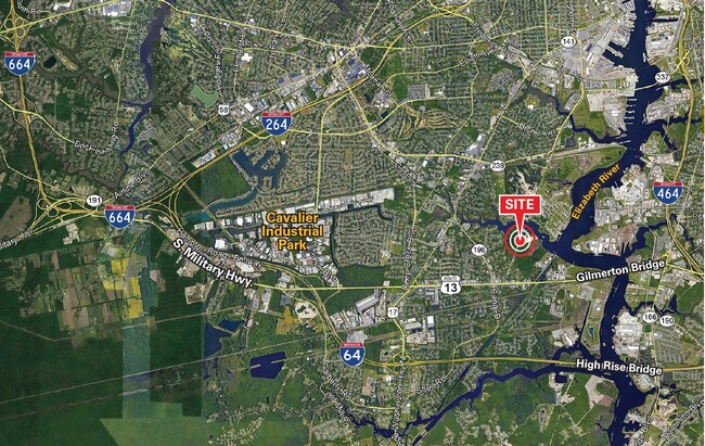
CHESAPEAKE
M1: LIGHT
Virginia
AE The base floodplain where base flood elevations are provided. AE Zones are now used on new format FIRMs instead of A1-A30 Zones.
7.11 AC
2024
Southern Chesapeake
2025
Hampton Roads
021402
Virginia Beach-Chesapeake-Norfolk, VA-NC
NEARBY LISTINGS FOR SALE OR LEASE
-
-
-
-
-
-
No Photo
-
-
View all Chesapeake listings for lease on LoopNet.com
DEMOGRAPHICS near Michael Dr
1 mile
3 mile
5 mile
2025 Total Population
6,626
66,816
190,154
2030 Population
6,698
67,401
191,204
Pop Growth 2025-2030
+ 1.09%
+ 0.88%
+ 0.55%
Average Age
37
38
38
2025 Total Households
2,456
24,245
73,777
HH Growth 2025-2030
+ 1.18%
+ 0.85%
+ 0.49%
Median Household Inc
$64,977
$64,292
$66,153
Avg Household Size
2.60
2.70
2.50
2025 Avg HH Vehicles
2.00
2.00
2.00
Median Home Value
$289,830
$263,873
$284,969
Median Year Built
1969
1972
1976
Nearby Places
Map Layers
Map Styles
 Street
 Aerial
Transit
 Traffic
 Biking
Places
Listings with unknown addresses are not visible on the map
- Restaurants
- Banks
- Shops
- Fitness
- Groceries
PUBLIC TRANSPORTATION
COMMUTER RAIL
Norfolk (Northeast Regional - Amtrak)
Drive
Walk
Distance
Norfolk (Northeast Regional - Amtrak)
15 min
8.4 mi
AIRPORT
Norfolk International
Drive
Walk
Distance
Norfolk International
26 min
14.4 mi
Newport News/Williamsburg International
Drive
Walk
Distance
Newport News/Williamsburg International
51 min
36.6 mi
Freight Ports
Virginia Port Authority - Portsmouth
Drive
Walk
Distance
Virginia Port Authority - Portsmouth
18 min
8.3 mi
SALE & LEASE HISTORY
LISTING DATE
SALE/LEASE

Sep 24, 2016
For Sale
Mar 14, 2018
For Lease
Feb 19, 2020
For Sale
Apr 16, 2021
For Lease
Nearby Properties
Address
Land Use
TOTAL SIZE
Lot Size
Zoning
Address
Land Use
TOTAL SIZE
Lot Size
Zoning
250,000 SF
38 AC
MUH
Address
Land Use
TOTAL SIZE
Lot Size
Zoning
482.38 AC
MULTI: MUL
Address
Land Use
TOTAL SIZE
Lot Size
Zoning
258,000 SF
1.38 AC
M2: GENERA
Address
Land Use
TOTAL SIZE
Lot Size
Zoning
252,524 SF
20 AC
R8S: RESID
Address
Land Use
TOTAL SIZE
Lot Size
Zoning
92,723 SF
28.83 AC
R6: RESIDE
Address
Land Use
TOTAL SIZE
Lot Size
Zoning
120,471 SF
10.32 AC
M1: LIGHT
Address
Land Use
TOTAL SIZE
Lot Size
Zoning
142,656 SF
22.17 AC
RMF1: MULT
Address
Land Use
TOTAL SIZE
Lot Size
Zoning
295,000 SF
27.89 AC
M1: LIGHT
Address
Land Use
TOTAL SIZE
Lot Size
Zoning
178,068 SF
14.72 AC
M1: LIGHT
Address
Land Use
TOTAL SIZE
Lot Size
Zoning
264,975 SF
50.36 AC
R10S: RESI
Address
Land Use
TOTAL SIZE
Lot Size
Zoning
28,253 SF
32.34 AC
M3: WATERF
Address
Land Use
TOTAL SIZE
Lot Size
Zoning
180,000 SF
23.84 AC
M2: GENERA
Address
Land Use
TOTAL SIZE
Lot Size
Zoning
143,220 SF
44.78 AC
M1: LIGHT
Address
Land Use
TOTAL SIZE
Lot Size
Zoning
130,510 SF
33.74 AC
M1: LIGHT
Address
Land Use
TOTAL SIZE
Lot Size
Zoning
2,434 SF
39.25 AC
B2: GENERA
Address
Land Use
TOTAL SIZE
Lot Size
Zoning
1,000 SF
13.68 AC
M2: GENERA
Address
Land Use
TOTAL SIZE
Lot Size
Zoning
151,250 SF
17.47 AC
M2: GENERA
Address
Land Use
TOTAL SIZE
Lot Size
Zoning
85,266 SF
10.10 AC
M1: LIGHT
Address
Land Use
TOTAL SIZE
Lot Size
Zoning
1,352 SF
86 AC
MULTI: MUL
Address
Land Use
TOTAL SIZE
Lot Size
Zoning
3,316 SF
30.19 AC
RMF1: MULT
Address
Land Use
TOTAL SIZE
Lot Size
Zoning
266,400 SF
12.10 AC
MULTI: MUL
Address
Land Use
TOTAL SIZE
Lot Size
Zoning
58,680 SF
8.84 AC
UR
Address
Land Use
TOTAL SIZE
Lot Size
Zoning
387,092 SF
55.92 AC
URM
Address
Land Use
TOTAL SIZE
Lot Size
Zoning
36,525 SF
56.65 AC
M2: GENERA
Address
Land Use
TOTAL SIZE
Lot Size
Zoning
126,250 SF
31.69 AC
R10S: RESI
Address
Land Use
TOTAL SIZE
Lot Size
Zoning
193,534 SF
17.99 AC
M1: LIGHT
Address
Land Use
TOTAL SIZE
Lot Size
Zoning
228,040 SF
8.71 AC
M2: GENERA
Address
Land Use
TOTAL SIZE
Lot Size
Zoning
167,400 SF
10.74 AC
M1: LIGHT
Address
Land Use
TOTAL SIZE
Lot Size
Zoning
197,533 SF
15 AC
M1: LIGHT
Address
Land Use
TOTAL SIZE
Lot Size
Zoning
98,715 SF
20.64 AC
UR
The World's #1 Commercial Real Estate Marketplace
Connect with us
© 2026 CoStar Group
The information above has been obtained from sources believed reliable. While we do not doubt its accuracy we have not verified it and make no guarantee, warranty or representation about it. It is your responsibility to independently confirm its accuracy and completeness. Any projections, opinions, assumptions, or estimates used are for example only and do not represent the current or future performance of the property. The value of this transaction to you depends on tax and other factors which should be evaluated by your tax, financial, and legal advisors. You and your advisors should conduct a careful, independent investigation of the property to determine to your satisfaction the suitability of the property for your needs.