Property Record
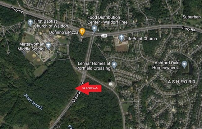
Middletown Rd, Waldorf, MD 20602

This Property Is For Sale
NEARBY LISTINGS FOR SALE OR LEASE
Property Detail
Middletown Rd
Washington-Arlington-Alexandria, DC-VA-MD-WV
Town Of La Plata
06-037445
28.7055 AC MIDDLETOWN RD
Commercialnec
Charles
AE
Maryland
24033C0340E
28.70 AC
2025
Charles County
2025
Washington, DC
850906
DEMOGRAPHICS near Middletown Rd
1 mile
3 mile
5 mile
2024 Total Population
6,856
44,860
108,495
2029 Population
7,158
46,666
111,834
Pop Growth 2024-2029
+ 4.40%
+ 4.03%
+ 3.08%
Average Age
38
38
38
2024 Total Households
2,145
15,293
37,852
HH Growth 2024-2029
+ 4.34%
+ 3.98%
+ 3.08%
Median Household Inc
$138,608
$120,521
$110,638
Avg Household Size
3.10
2.90
2.80
2024 Avg HH Vehicles
2.00
2.00
2.00
Median Home Value
$392,250
$380,587
$373,474
Median Year Built
1996
1995
1991
Nearby Places
Map Layers
Map Styles
 Street
 Aerial
Transit
 Traffic
 Biking
Places
Listings with unknown addresses are not visible on the map
- Restaurants
- Banks
- Shops
- Fitness
- Groceries
PUBLIC TRANSPORTATION
AIRPORT
Ronald Reagan Washington Ntl
Drive
Walk
Distance
Ronald Reagan Washington Ntl
42 min
23.8 mi
Freight Ports
Port of Baltimore
Drive
Walk
Distance
Port of Baltimore
86 min
58.1 mi
Nearby Properties
Address
Land Use
TOTAL SIZE
Lot Size
Zoning
Address
Land Use
TOTAL SIZE
Lot Size
Zoning
714,134 SF
29.53 AC
PUD
Address
Land Use
TOTAL SIZE
Lot Size
Zoning
311,000 SF
79.06 AC
WCD
Address
Land Use
TOTAL SIZE
Lot Size
Zoning
477,958 SF
47.50 AC
CB
Address
Land Use
TOTAL SIZE
Lot Size
Zoning
267,264 SF
26.49 AC
PUD
Address
Land Use
TOTAL SIZE
Lot Size
Zoning
312,478 SF
54.26 AC
PUD
Address
Land Use
TOTAL SIZE
Lot Size
Zoning
392,124 SF
38.73 AC
PUD
Address
Land Use
TOTAL SIZE
Lot Size
Zoning
206,966 SF
32.61 AC
CB
Address
Land Use
TOTAL SIZE
Lot Size
Zoning
198,230 SF
62.59 AC
BP
Address
Land Use
TOTAL SIZE
Lot Size
Zoning
188,284 SF
9.02 AC
RM
Address
Land Use
TOTAL SIZE
Lot Size
Zoning
262,779 SF
26.84 AC
CB
Address
Land Use
TOTAL SIZE
Lot Size
Zoning
103,737 SF
43.94 AC
WCD
Address
Land Use
TOTAL SIZE
Lot Size
Zoning
136,192 SF
17.85 AC
PUD
Address
Land Use
TOTAL SIZE
Lot Size
Zoning
134,542 SF
51.88 AC
WCD
Address
Land Use
TOTAL SIZE
Lot Size
Zoning
186,500 SF
52.67 AC
PUD
Address
Land Use
TOTAL SIZE
Lot Size
Zoning
160,985 SF
24.85 AC
CB
Address
Land Use
TOTAL SIZE
Lot Size
Zoning
112,736 SF
16.71 AC
PUD
Address
Land Use
TOTAL SIZE
Lot Size
Zoning
143,728 SF
19.71 AC
CB
Address
Land Use
TOTAL SIZE
Lot Size
Zoning
87,100 SF
22.22 AC
WCD
Address
Land Use
TOTAL SIZE
Lot Size
Zoning
109,304 SF
9.09 AC
PUD
Address
Land Use
TOTAL SIZE
Lot Size
Zoning
116,828 SF
10.78 AC
PUD
Address
Land Use
TOTAL SIZE
Lot Size
Zoning
123,290 SF
8.25 AC
PUD
Address
Land Use
TOTAL SIZE
Lot Size
Zoning
90,238 SF
4.50 AC
CB
Address
Land Use
TOTAL SIZE
Lot Size
Zoning
53,990 SF
6.20 AC
PUD
Address
Land Use
TOTAL SIZE
Lot Size
Zoning
178,412 SF
12.03 AC
PUD
Address
Land Use
TOTAL SIZE
Lot Size
Zoning
51,522 SF
3.52 AC
PUD
Address
Land Use
TOTAL SIZE
Lot Size
Zoning
72,430 SF
19.36 AC
PUD
Address
Land Use
TOTAL SIZE
Lot Size
Zoning
21,642 SF
10.01 AC
MX
Address
Land Use
TOTAL SIZE
Lot Size
Zoning
128,250 SF
9.70 AC
PUD
Address
Land Use
TOTAL SIZE
Lot Size
Zoning
107,792 SF
2.47 AC
MX
Address
Land Use
TOTAL SIZE
Lot Size
Zoning
49,068 SF
3.80 AC
RO
The World's #1 Commercial Real Estate Marketplace
Connect with us
© 2026 CoStar Group
The information above has been obtained from sources believed reliable. While we do not doubt its accuracy we have not verified it and make no guarantee, warranty or representation about it. It is your responsibility to independently confirm its accuracy and completeness. Any projections, opinions, assumptions, or estimates used are for example only and do not represent the current or future performance of the property. The value of this transaction to you depends on tax and other factors which should be evaluated by your tax, financial, and legal advisors. You and your advisors should conduct a careful, independent investigation of the property to determine to your satisfaction the suitability of the property for your needs.