Property Record
Middletown Blvd, Langhorne, PA 19047

Save to a Folder
{{folder.Name}}
{{folder.ListingIds.length}} Properties
{{folder.ListingIds.length}} Property
Create a New Folder
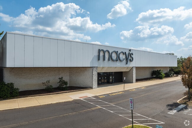
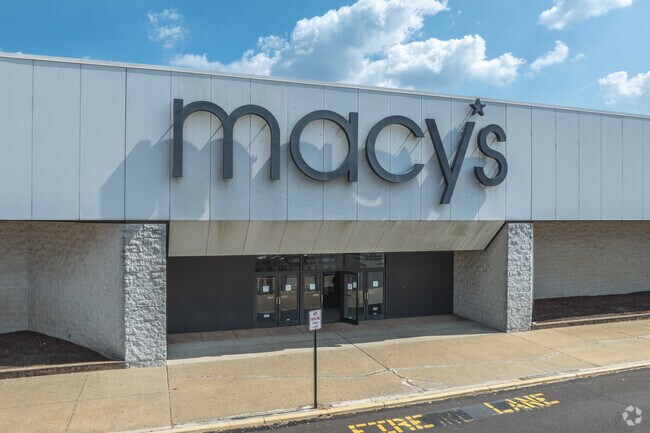
Property Detail
Middletown Blvd
22-057-045
13.9159A 2100 NE WOOD- BOURNE RD 2200 NW SR213
Departmentstore
BUCKS
GB
Pennsylvania
B and X Area of moderate flood hazard, usually the area between the limits of the 100-year and 500-year floods.
13.92 AC
2025
Lower Bucks County
2026
Philadelphia
100807
Philadelphia-Camden-Wilmington, PA-NJ-DE-MD
208,060 SF
NEARBY LISTINGS FOR SALE OR LEASE
DEMOGRAPHICS near Middletown Blvd
1 mile
3 mile
5 mile
2025 Total Population
6,199
79,157
209,748
2030 Population
6,330
79,348
210,025
Pop Growth 2025-2030
+ 2.11%
+ 0.24%
+ 0.13%
Average Age
43
43
43
2025 Total Households
2,659
29,669
79,321
HH Growth 2025-2030
+ 1.73%
+ 0.21%
+ 0.09%
Median Household Inc
$109,738
$109,331
$109,512
Avg Household Size
2.30
2.60
2.60
2025 Avg HH Vehicles
2.00
2.00
2.00
Median Home Value
$421,679
$408,119
$410,297
Median Year Built
1977
1969
1971
Nearby Places
Map Layers
Map Styles
 Street
 Aerial
Layers
 Traffic
 Biking
Places
Listings with unknown addresses are not visible on the map
- Restaurants
- Banks
- Shops
- Fitness
- Groceries
PUBLIC TRANSPORTATION
COMMUTER RAIL
Woodbourne (West Trenton Line - SEPTA)
Drive
Walk
Distance
Woodbourne (West Trenton Line - SEPTA)
4 min
1.7 mi
Langhorne (West Trenton Line - SEPTA)
Drive
Walk
Distance
Langhorne (West Trenton Line - SEPTA)
6 min
2.9 mi
AIRPORT
Trenton Mercer
Drive
Walk
Distance
Trenton Mercer
19 min
10.2 mi
Philadelphia International
Drive
Walk
Distance
Philadelphia International
53 min
35.1 mi
Freight Ports
Port of Philadelphia
Drive
Walk
Distance
Port of Philadelphia
33 min
21.5 mi
SALE & LEASE HISTORY
LISTING DATE
SALE/LEASE

Apr 28, 2025
For Sale
Nearby Properties
Address
Land Use
TOTAL SIZE
Lot Size
Zoning
Address
Land Use
TOTAL SIZE
Lot Size
Zoning
271,979 SF
10.96 AC
GB
Address
Land Use
TOTAL SIZE
Lot Size
Zoning
32,912 SF
42.06 AC
AO
Address
Land Use
TOTAL SIZE
Lot Size
Zoning
356,045 SF
7.67 AC
MOZ1
Address
Land Use
TOTAL SIZE
Lot Size
Zoning
4,982 SF
39 AC
C
Address
Land Use
TOTAL SIZE
Lot Size
Zoning
10,350 SF
35.55 AC
R4
Address
Land Use
TOTAL SIZE
Lot Size
Zoning
21.78 AC
R4
Address
Land Use
TOTAL SIZE
Lot Size
Zoning
119,300 SF
2.65 AC
MI
Address
Land Use
TOTAL SIZE
Lot Size
Zoning
282,799 SF
24.77 AC
GB
Address
Land Use
TOTAL SIZE
Lot Size
Zoning
202,400 SF
20.98 AC
C
Address
Land Use
TOTAL SIZE
Lot Size
Zoning
730,540 SF
82.69 AC
GB
Address
Land Use
TOTAL SIZE
Lot Size
Zoning
267,936 SF
19.22 AC
M1
Address
Land Use
TOTAL SIZE
Lot Size
Zoning
43.54 AC
LI
Address
Land Use
TOTAL SIZE
Lot Size
Zoning
104,466 SF
1.81 AC
OR
Address
Land Use
TOTAL SIZE
Lot Size
Zoning
132,780 SF
11.09 AC
R3
Address
Land Use
TOTAL SIZE
Lot Size
Zoning
3,490 SF
15.80 AC
R1
Address
Land Use
TOTAL SIZE
Lot Size
Zoning
102,348 SF
0.60 AC
RA
Address
Land Use
TOTAL SIZE
Lot Size
Zoning
143,428 SF
24.06 AC
HR
Address
Land Use
TOTAL SIZE
Lot Size
Zoning
100,736 SF
25 AC
C 1
Address
Land Use
TOTAL SIZE
Lot Size
Zoning
163,779 SF
20.10 AC
MI
Address
Land Use
TOTAL SIZE
Lot Size
Zoning
37,550 SF
5.18 AC
M1
Address
Land Use
TOTAL SIZE
Lot Size
Zoning
92,479 SF
11.48 AC
Address
Land Use
TOTAL SIZE
Lot Size
Zoning
99,124 SF
10.14 AC
C
Address
Land Use
TOTAL SIZE
Lot Size
Zoning
124,830 SF
2.83 AC
C
Address
Land Use
TOTAL SIZE
Lot Size
Zoning
116,120 SF
2.70 AC
MZO1
Address
Land Use
TOTAL SIZE
Lot Size
Zoning
80,071 SF
17.46 AC
R2
Address
Land Use
TOTAL SIZE
Lot Size
Zoning
15,905 SF
8.43 AC
M1
Address
Land Use
TOTAL SIZE
Lot Size
Zoning
102,908 SF
9.11 AC
C
Address
Land Use
TOTAL SIZE
Lot Size
Zoning
75,089 SF
2.03 AC
R2
Address
Land Use
TOTAL SIZE
Lot Size
Zoning
91,910 SF
6.05 AC
GB
Address
Land Use
TOTAL SIZE
Lot Size
Zoning
299,192 SF
20.28 AC
PIP
The World's #1 Commercial Real Estate Marketplace
Connect with us
© 2026 CoStar Group
The information above has been obtained from sources believed reliable. While we do not doubt its accuracy we have not verified it and make no guarantee, warranty or representation about it. It is your responsibility to independently confirm its accuracy and completeness. Any projections, opinions, assumptions, or estimates used are for example only and do not represent the current or future performance of the property. The value of this transaction to you depends on tax and other factors which should be evaluated by your tax, financial, and legal advisors. You and your advisors should conduct a careful, independent investigation of the property to determine to your satisfaction the suitability of the property for your needs.