Property Record
132 Mildred St, Brewton, AL 36426

Property Detail
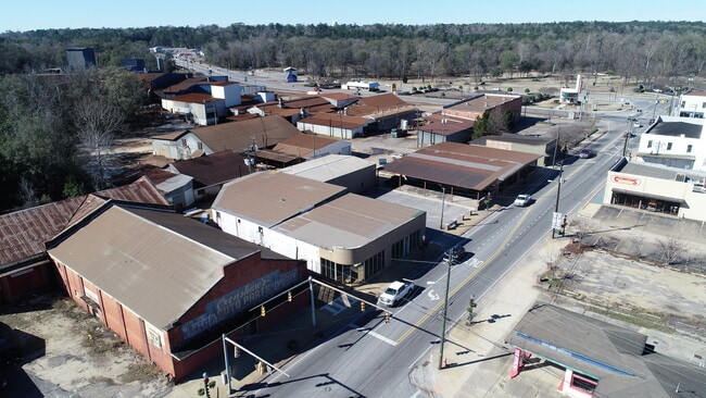
132 Mildred St
15-08-28-3-012-003.000
START INT SW LINE MILDRED ST & SE RR R W TH SW ALONG RR R W 100 TO POB TH SW 8 87 S SE 210 S NE 97 S NW 160 SW 10 NW 50 TO
Manufacturinglight
ESCAMBIA
AE The base floodplain where base flood elevations are provided. AE Zones are now used on new format FIRMs instead of A1-A30 Zones.
Alabama
2024
2 AC
2025
Alabama South Area
970100
Other Market Areas
10,628 SF
NEARBY LISTINGS FOR SALE OR LEASE
-
-
View all Brewton listings for sale on LoopNet.com
DEMOGRAPHICS near 132 Mildred St
1 mile
3 mile
5 mile
2025 Total Population
1,182
8,125
10,527
2030 Population
1,194
8,146
10,552
Pop Growth 2025-2030
+ 1.02%
+ 0.26%
+ 0.24%
Average Age
42
42
42
2025 Total Households
460
3,361
4,344
HH Growth 2025-2030
+ 1.09%
+ 0.27%
+ 0.28%
Median Household Inc
$43,233
$47,112
$49,534
Avg Household Size
2.20
2.30
2.30
2025 Avg HH Vehicles
2.00
2.00
2.00
Median Home Value
$131,507
$147,500
$150,382
Median Year Built
1984
1986
1987
Nearby Places
Map Layers
Map Styles
 Street
 Aerial
Layers
 Traffic
 Biking
Places
Listings with unknown addresses are not visible on the map
- Restaurants
- Banks
- Shops
- Fitness
- Groceries
SALE & LEASE HISTORY
LISTING DATE
SALE/LEASE

Feb 21, 2023
For Sale
Nearby Properties
Address
Land Use
TOTAL SIZE
Lot Size
Zoning
Address
Land Use
TOTAL SIZE
Lot Size
Zoning
841 SF
312 AC
Address
Land Use
TOTAL SIZE
Lot Size
Zoning
Address
Land Use
TOTAL SIZE
Lot Size
Zoning
71,500 SF
66 AC
Address
Land Use
TOTAL SIZE
Lot Size
Zoning
51,186 SF
3 AC
Address
Land Use
TOTAL SIZE
Lot Size
Zoning
47,100 SF
4 AC
Address
Land Use
TOTAL SIZE
Lot Size
Zoning
63,789 SF
21 AC
Address
Land Use
TOTAL SIZE
Lot Size
Zoning
98,091 SF
17 AC
Address
Land Use
TOTAL SIZE
Lot Size
Zoning
28,298 SF
1 AC
Address
Land Use
TOTAL SIZE
Lot Size
Zoning
54,565 SF
3 AC
Address
Land Use
TOTAL SIZE
Lot Size
Zoning
125,000 SF
12 AC
Address
Land Use
TOTAL SIZE
Lot Size
Zoning
15,252 SF
8.40 AC
Address
Land Use
TOTAL SIZE
Lot Size
Zoning
34,870 SF
2 AC
Address
Land Use
TOTAL SIZE
Lot Size
Zoning
54,850 SF
77 AC
Address
Land Use
TOTAL SIZE
Lot Size
Zoning
20,314 SF
1 AC
Address
Land Use
TOTAL SIZE
Lot Size
Zoning
55,500 SF
14 AC
Address
Land Use
TOTAL SIZE
Lot Size
Zoning
44,076 SF
4 AC
Address
Land Use
TOTAL SIZE
Lot Size
Zoning
15,216 SF
1.33 AC
Address
Land Use
TOTAL SIZE
Lot Size
Zoning
18,288 SF
1 AC
Address
Land Use
TOTAL SIZE
Lot Size
Zoning
13,574 SF
2.15 AC
Address
Land Use
TOTAL SIZE
Lot Size
Zoning
15,019 SF
0.56 AC
Address
Land Use
TOTAL SIZE
Lot Size
Zoning
94,564 SF
6.60 AC
Address
Land Use
TOTAL SIZE
Lot Size
Zoning
7,600 SF
0.06 AC
Address
Land Use
TOTAL SIZE
Lot Size
Zoning
633 AC
Address
Land Use
TOTAL SIZE
Lot Size
Zoning
3,228 SF
2.10 AC
Address
Land Use
TOTAL SIZE
Lot Size
Zoning
15,074 SF
0.32 AC
Address
Land Use
TOTAL SIZE
Lot Size
Zoning
3,376 SF
83 AC
Address
Land Use
TOTAL SIZE
Lot Size
Zoning
8,160 SF
2 AC
Address
Land Use
TOTAL SIZE
Lot Size
Zoning
16,674 SF
0.50 AC
The World's #1 Commercial Real Estate Marketplace
Connect with us
© 2026 CoStar Group
The information above has been obtained from sources believed reliable. While we do not doubt its accuracy we have not verified it and make no guarantee, warranty or representation about it. It is your responsibility to independently confirm its accuracy and completeness. Any projections, opinions, assumptions, or estimates used are for example only and do not represent the current or future performance of the property. The value of this transaction to you depends on tax and other factors which should be evaluated by your tax, financial, and legal advisors. You and your advisors should conduct a careful, independent investigation of the property to determine to your satisfaction the suitability of the property for your needs.