Property Record
Milestrip Rd, Orchard Park, NY 14127
NEARBY LISTINGS FOR SALE OR LEASE
-
-
View all Orchard Park listings for sale on LoopNet.com
Property Detail
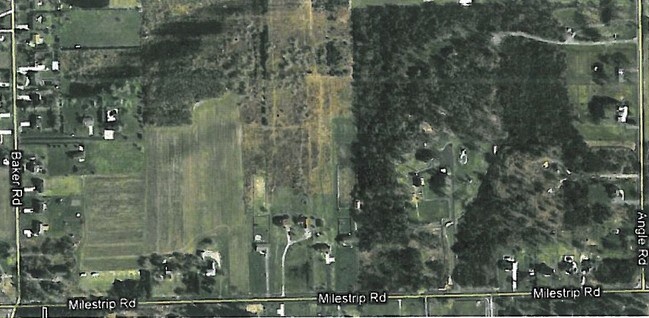
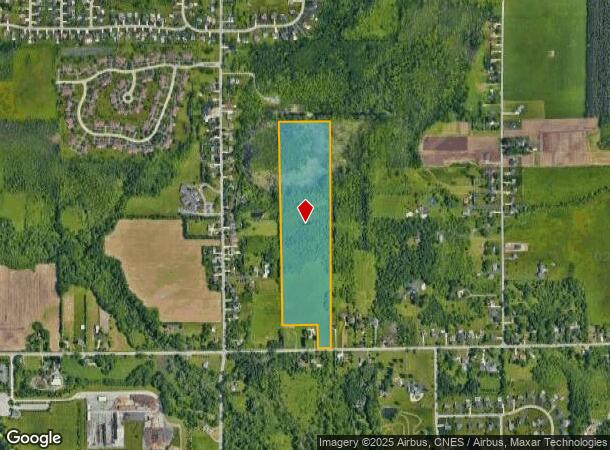
Milestrip Rd
Buffalo-Cheektowaga-Niagara Falls, NY
Holland Land Companys Survey
146089-153-190-0001-023-000
Erie
Residentialacreage
New York
X
23.000
36029C0361H
31.29 AC
2025
South
2024
Buffalo/Niagara Falls
013600
DEMOGRAPHICS near Milestrip Rd
1 Mile
3 Mile
5 Mile
2024 Total Population
2,486
33,089
86,660
2029 Population
2,493
33,073
86,414
Pop Growth 2024-2029
+ 0.28%
(0.05%)
(0.28%)
Average Age
45
44
44
2024 Total Households
1,056
13,728
36,918
HH Growth 2024-2029
+ 0.19%
(0.11%)
(0.33%)
Median Household Inc
$76,902
$85,769
$76,713
Avg Household Size
2.30
2.40
2.30
2024 Avg HH Vehicles
2.00
2.00
2.00
Median Home Value
$359,689
$257,525
$236,701
Median Year Built
1987
1974
1970
Nearby Places
- Restaurants
- Banks
- Shops
- Fitness
- Groceries
PUBLIC TRANSPORTATION
AIRPORT
Buffalo Niagara International
DRIVE
WALK
Distance
Buffalo Niagara International
28 min
14.3 mi
Niagara Falls International
DRIVE
WALK
Distance
Niagara Falls International
49 min
30.4 mi
Freight Ports
Albany, NY Port
DRIVE
WALK
Distance
Albany, NY Port
348 min
290.7 mi
Nearby Properties
Address
Land Use
TOTAL SIZE
Lot Size
Zoning
Address
Land Use
TOTAL SIZE
Lot Size
Zoning
13,152 SF
496 AC
08 - GOVER
Address
Land Use
TOTAL SIZE
Lot Size
Zoning
124,112 SF
53.10 AC
05 - COMME
Address
Land Use
TOTAL SIZE
Lot Size
Zoning
149,065 SF
21.53 AC
B2
Address
Land Use
TOTAL SIZE
Lot Size
Zoning
145,881 SF
29.40 AC
10
Address
Land Use
TOTAL SIZE
Lot Size
Zoning
202,597 SF
24.22 AC
Address
Land Use
TOTAL SIZE
Lot Size
Zoning
3,268 SF
1.68 AC
Address
Land Use
TOTAL SIZE
Lot Size
Zoning
191,026 SF
32.60 AC
10
Address
Land Use
TOTAL SIZE
Lot Size
Zoning
235,940 SF
62.47 AC
R2
Address
Land Use
TOTAL SIZE
Lot Size
Zoning
3,361 SF
28.04 AC
R3
Address
Land Use
TOTAL SIZE
Lot Size
Zoning
87,835 SF
21.86 AC
Address
Land Use
TOTAL SIZE
Lot Size
Zoning
134,680 SF
16.47 AC
B2
Address
Land Use
TOTAL SIZE
Lot Size
Zoning
53,511 SF
5.01 AC
B1
Address
Land Use
TOTAL SIZE
Lot Size
Zoning
Address
Land Use
TOTAL SIZE
Lot Size
Zoning
284,403 SF
27.29 AC
I1
Address
Land Use
TOTAL SIZE
Lot Size
Zoning
9,322 SF
4.70 AC
B2
Address
Land Use
TOTAL SIZE
Lot Size
Zoning
9,224 SF
19.25 AC
01 - NOT Z
Address
Land Use
TOTAL SIZE
Lot Size
Zoning
118,891 SF
8.99 AC
I1
Address
Land Use
TOTAL SIZE
Lot Size
Zoning
64,283 SF
18.67 AC
10
Address
Land Use
TOTAL SIZE
Lot Size
Zoning
Address
Land Use
TOTAL SIZE
Lot Size
Zoning
9,952 SF
8.70 AC
10
Address
Land Use
TOTAL SIZE
Lot Size
Zoning
10,771 SF
13.10 AC
B2
Address
Land Use
TOTAL SIZE
Lot Size
Zoning
82,348 SF
6.49 AC
SR
Address
Land Use
TOTAL SIZE
Lot Size
Zoning
27,340 SF
21.18 AC
B2
Address
Land Use
TOTAL SIZE
Lot Size
Zoning
6,512 SF
15.21 AC
R3
Address
Land Use
TOTAL SIZE
Lot Size
Zoning
23,989 SF
9.15 AC
B2
Address
Land Use
TOTAL SIZE
Lot Size
Zoning
56,140 SF
13.73 AC
B2
Address
Land Use
TOTAL SIZE
Lot Size
Zoning
Address
Land Use
TOTAL SIZE
Lot Size
Zoning
103,824 SF
13.90 AC
10
Address
Land Use
TOTAL SIZE
Lot Size
Zoning
27,640 SF
1.85 AC
B1
Address
Land Use
TOTAL SIZE
Lot Size
Zoning
The World's #1 Commercial Real Estate Marketplace
Connect with us
© 2025 CoStar Group
The information above has been obtained from sources believed reliable. While we do not doubt its accuracy we have not verified it and make no guarantee, warranty or representation about it. It is your responsibility to independently confirm its accuracy and completeness. Any projections, opinions, assumptions, or estimates used are for example only and do not represent the current or future performance of the property. The value of this transaction to you depends on tax and other factors which should be evaluated by your tax, financial, and legal advisors. You and your advisors should conduct a careful, independent investigation of the property to determine to your satisfaction the suitability of the property for your needs.