Property Record
Milhaven Dr, Henrico, VA 23238


NEARBY LISTINGS FOR SALE OR LEASE
Property Detail
Milhaven Dr
731-749-7446
00760A0000 0003A; W S GAYTON RD AC 18.813 68 A1 21
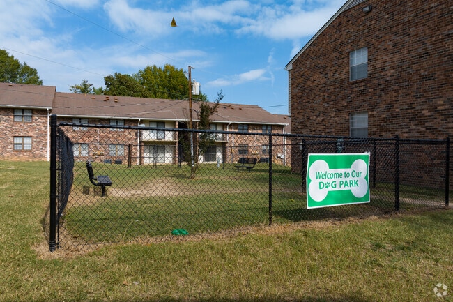
Apartment
Henrico
X
Virginia
51075C0307C
18.81 AC
0
Western Henrico County
2025
Richmond VA
200135
Richmond, VA
271,263 SF
DEMOGRAPHICS near Milhaven Dr
1 Mile
3 Mile
5 Mile
2024 Total Population
10,956
53,673
123,008
2029 Population
10,962
54,289
124,473
Pop Growth 2024-2029
+ 0.05%
+ 1.15%
+ 1.19%
Average Age
44
42
41
2024 Total Households
4,888
21,624
49,071
HH Growth 2024-2029
+ 0.06%
+ 1.21%
+ 1.22%
Median Household Inc
$73,447
$109,712
$103,407
Avg Household Size
2.10
2.40
2.40
2024 Avg HH Vehicles
2.00
2.00
2.00
Median Home Value
$300,601
$429,362
$453,465
Median Year Built
1984
1989
1989
Nearby Places
Map Layers
Map Styles
 Street
 Aerial
- Restaurants
- Banks
- Shops
- Fitness
- Groceries
PUBLIC TRANSPORTATION
AIRPORT
Richmond International
DRIVE
WALK
Distance
Richmond International
38 min
24.2 mi
Freight Ports
Virginia Port Authority - Richmond
DRIVE
WALK
Distance
Virginia Port Authority - Richmond
36 min
22.5 mi
Nearby Properties
Address
Land Use
TOTAL SIZE
Lot Size
Zoning
Address
Land Use
TOTAL SIZE
Lot Size
Zoning
10,290 SF
56.53 AC
B-3C
Address
Land Use
TOTAL SIZE
Lot Size
Zoning
3,300 SF
286.94 AC
M1-INDUS/L
Address
Land Use
TOTAL SIZE
Lot Size
Zoning
93.75 AC
M1-INDUS/L
Address
Land Use
TOTAL SIZE
Lot Size
Zoning
37.36 AC
R-5C
Address
Land Use
TOTAL SIZE
Lot Size
Zoning
22.47 AC
M1-INDUS/L
Address
Land Use
TOTAL SIZE
Lot Size
Zoning
230,955 SF
48.48 AC
MIXE
Address
Land Use
TOTAL SIZE
Lot Size
Zoning
57,104 SF
0.02 AC
UMUC
Address
Land Use
TOTAL SIZE
Lot Size
Zoning
18 AC
M1-INDUS/L
Address
Land Use
TOTAL SIZE
Lot Size
Zoning
577,728 SF
34.86 AC
R-5
Address
Land Use
TOTAL SIZE
Lot Size
Zoning
3,077 SF
19.89 AC
M1-INDUS/L
Address
Land Use
TOTAL SIZE
Lot Size
Zoning
268,461 SF
17.09 AC
R-5
Address
Land Use
TOTAL SIZE
Lot Size
Zoning
311,196 SF
27.62 AC
R-5
Address
Land Use
TOTAL SIZE
Lot Size
Zoning
289,752 SF
24.72 AC
R-5C
Address
Land Use
TOTAL SIZE
Lot Size
Zoning
26,163 SF
12.02 AC
A-1
Address
Land Use
TOTAL SIZE
Lot Size
Zoning
352,296 SF
23.62 AC
R-5
Address
Land Use
TOTAL SIZE
Lot Size
Zoning
243,000 SF
130.85 AC
M1-INDUS/L
Address
Land Use
TOTAL SIZE
Lot Size
Zoning
5,590 SF
11.54 AC
B-2C
Address
Land Use
TOTAL SIZE
Lot Size
Zoning
179,920 SF
16.23 AC
R-5
Address
Land Use
TOTAL SIZE
Lot Size
Zoning
1,456 SF
11.71 AC
R-5
Address
Land Use
TOTAL SIZE
Lot Size
Zoning
220,895 SF
77.14 AC
A-1
Address
Land Use
TOTAL SIZE
Lot Size
Zoning
55,769 SF
14.13 AC
MIXE
Address
Land Use
TOTAL SIZE
Lot Size
Zoning
111,487 SF
2.92 AC
B-2C
Address
Land Use
TOTAL SIZE
Lot Size
Zoning
23,378 SF
0.02 AC
UMUC
Address
Land Use
TOTAL SIZE
Lot Size
Zoning
20,864 SF
15.28 AC
MIXE
Address
Land Use
TOTAL SIZE
Lot Size
Zoning
176,520 SF
17.61 AC
R-5
Address
Land Use
TOTAL SIZE
Lot Size
Zoning
10,282 SF
2.13 AC
B-3C
Address
Land Use
TOTAL SIZE
Lot Size
Zoning
35.54 AC
B1-BUS/GEN
Address
Land Use
TOTAL SIZE
Lot Size
Zoning
104,758 SF
15.92 AC
R-5
Address
Land Use
TOTAL SIZE
Lot Size
Zoning
97,890 SF
9.87 AC
R-6
The World's #1 Commercial Real Estate Marketplace
Connect with us
© 2026 CoStar Group
The information above has been obtained from sources believed reliable. While we do not doubt its accuracy we have not verified it and make no guarantee, warranty or representation about it. It is your responsibility to independently confirm its accuracy and completeness. Any projections, opinions, assumptions, or estimates used are for example only and do not represent the current or future performance of the property. The value of this transaction to you depends on tax and other factors which should be evaluated by your tax, financial, and legal advisors. You and your advisors should conduct a careful, independent investigation of the property to determine to your satisfaction the suitability of the property for your needs.