Property Record
Mill Ave N, Blooming Prairie, MN 55917
Property Detail
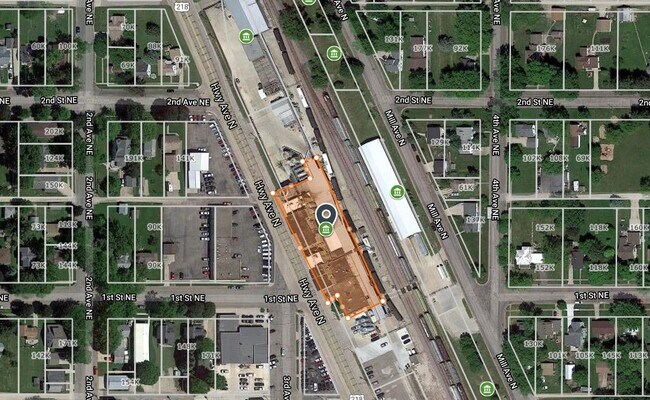
Mill Ave N
Owatonna, MN
BEG75'SELY OF SECOR.L8,BLK1,ORG..TWN SELY673.35'NELY79.40'NWLY424.64'NWLY 237.94';9.50'WFRCTRSPURNWLY249.50'PL
14-025-2009
STEELE
Industrialgeneral
Minnesota
B and X Area of moderate flood hazard, usually the area between the limits of the 100-year and 500-year floods.
0.49 AC
2025
Minnesota South Area
2025
Other Market Areas
960800
NEARBY LISTINGS FOR SALE OR LEASE
DEMOGRAPHICS near Mill Ave N
1 mile
3 mile
5 mile
2025 Total Population
2,012
2,366
2,839
2030 Population
2,014
2,362
2,826
Pop Growth 2025-2030
+ 0.10%
(0.17%)
(0.46%)
Average Age
41
41
41
2025 Total Households
813
946
1,125
HH Growth 2025-2030
+ 0.12%
(0.21%)
(0.36%)
Median Household Inc
$66,176
$68,796
$71,965
Avg Household Size
2.40
2.50
2.50
2025 Avg HH Vehicles
2.00
2.00
2.00
Median Home Value
$163,009
$175,591
$189,285
Median Year Built
1959
1958
1957
Nearby Places
Map Layers
Map Styles
 Street
 Aerial
Layers
 Traffic
 Biking
Places
Listings with unknown addresses are not visible on the map
- Restaurants
- Banks
- Shops
- Fitness
- Groceries
PUBLIC TRANSPORTATION
AIRPORT
Rochester International
Drive
Walk
Distance
Rochester International
44 min
32.2 mi
Freight Ports
Port Milwaukee
Drive
Walk
Distance
Port Milwaukee
347 min
310.3 mi
Nearby Properties
Address
Land Use
TOTAL SIZE
Lot Size
Zoning
Address
Land Use
TOTAL SIZE
Lot Size
Zoning
108,737 SF
26.66 AC
Address
Land Use
TOTAL SIZE
Lot Size
Zoning
68,459 SF
2.45 AC
Address
Land Use
TOTAL SIZE
Lot Size
Zoning
1,440 SF
2.66 AC
Address
Land Use
TOTAL SIZE
Lot Size
Zoning
25,547 SF
4.76 AC
Address
Land Use
TOTAL SIZE
Lot Size
Zoning
24,292 SF
4.24 AC
Address
Land Use
TOTAL SIZE
Lot Size
Zoning
10,768 SF
2.11 AC
Address
Land Use
TOTAL SIZE
Lot Size
Zoning
Address
Land Use
TOTAL SIZE
Lot Size
Zoning
Address
Land Use
TOTAL SIZE
Lot Size
Zoning
61,600 SF
10.02 AC
Address
Land Use
TOTAL SIZE
Lot Size
Zoning
Address
Land Use
TOTAL SIZE
Lot Size
Zoning
31,875 SF
3.79 AC
Address
Land Use
TOTAL SIZE
Lot Size
Zoning
Address
Land Use
TOTAL SIZE
Lot Size
Zoning
8,800 SF
3.10 AC
Address
Land Use
TOTAL SIZE
Lot Size
Zoning
Address
Land Use
TOTAL SIZE
Lot Size
Zoning
145.99 AC
Address
Land Use
TOTAL SIZE
Lot Size
Zoning
17,488 SF
0.68 AC
Address
Land Use
TOTAL SIZE
Lot Size
Zoning
Address
Land Use
TOTAL SIZE
Lot Size
Zoning
9,241 SF
1.35 AC
Address
Land Use
TOTAL SIZE
Lot Size
Zoning
1,568 SF
40 AC
Address
Land Use
TOTAL SIZE
Lot Size
Zoning
11,579 SF
0.47 AC
Address
Land Use
TOTAL SIZE
Lot Size
Zoning
5,874 SF
0.47 AC
Address
Land Use
TOTAL SIZE
Lot Size
Zoning
Address
Land Use
TOTAL SIZE
Lot Size
Zoning
Address
Land Use
TOTAL SIZE
Lot Size
Zoning
15,265 SF
1.19 AC
Address
Land Use
TOTAL SIZE
Lot Size
Zoning
Address
Land Use
TOTAL SIZE
Lot Size
Zoning
Address
Land Use
TOTAL SIZE
Lot Size
Zoning
Address
Land Use
TOTAL SIZE
Lot Size
Zoning
1,389 SF
77.15 AC
Address
Land Use
TOTAL SIZE
Lot Size
Zoning
117.68 AC
The World's #1 Commercial Real Estate Marketplace
Connect with us
© 2026 CoStar Group
The information above has been obtained from sources believed reliable. While we do not doubt its accuracy we have not verified it and make no guarantee, warranty or representation about it. It is your responsibility to independently confirm its accuracy and completeness. Any projections, opinions, assumptions, or estimates used are for example only and do not represent the current or future performance of the property. The value of this transaction to you depends on tax and other factors which should be evaluated by your tax, financial, and legal advisors. You and your advisors should conduct a careful, independent investigation of the property to determine to your satisfaction the suitability of the property for your needs.