Property Record
Millersville Rd, , PA


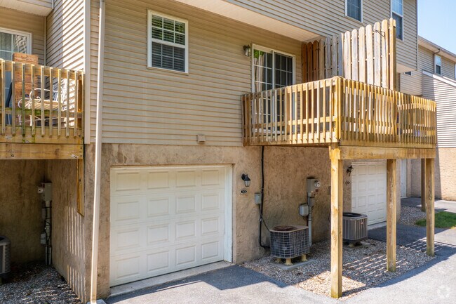
Property Detail
Millersville Rd
340-16462-0-0000
MILLERSVILLE RD
Apartment
LANCASTER
R-3
Pennsylvania
B and X Area of moderate flood hazard, usually the area between the limits of the 100-year and 500-year floods.
2
2024
11.80 AC
2025
Outer Lancaster
000001
Philadelphia
122,820 SF
Lancaster, PA
NEARBY LISTINGS FOR SALE OR LEASE
DEMOGRAPHICS near Millersville Rd
1 mile
3 mile
5 mile
2025 Total Population
7,456
77,811
158,494
2030 Population
7,618
79,284
160,927
Pop Growth 2025-2030
+ 2.17%
+ 1.89%
+ 1.54%
Average Age
37
38
40
2025 Total Households
2,353
29,127
61,227
HH Growth 2025-2030
+ 1.87%
+ 1.93%
+ 1.47%
Median Household Inc
$82,329
$69,407
$75,489
Avg Household Size
2.40
2.40
2.40
2025 Avg HH Vehicles
2.00
2.00
2.00
Median Home Value
$270,813
$251,186
$279,778
Median Year Built
1979
1960
1966
Nearby Places
Map Layers
Map Styles
 Street
 Aerial
Layers
 Traffic
 Biking
Places
Listings with unknown addresses are not visible on the map
- Restaurants
- Banks
- Shops
- Fitness
- Groceries
PUBLIC TRANSPORTATION
COMMUTER RAIL
Lancaster (Keystone Service - Amtrak, Pennsylvanian - Amtrak)
Drive
Walk
Distance
Lancaster (Keystone Service - Amtrak, Pennsylvanian - Amtrak)
11 min
5.0 mi
AIRPORT
Harrisburg International
Drive
Walk
Distance
Harrisburg International
48 min
33.9 mi
Freight Ports
Port of Wilmington, RI
Drive
Walk
Distance
Port of Wilmington, RI
93 min
65.2 mi
Nearby Properties
Address
Land Use
TOTAL SIZE
Lot Size
Zoning
Address
Land Use
TOTAL SIZE
Lot Size
Zoning
2,008,418 SF
76.74 AC
Address
Land Use
TOTAL SIZE
Lot Size
Zoning
206,666 SF
1 AC
CB1
Address
Land Use
TOTAL SIZE
Lot Size
Zoning
269,860 SF
0.90 AC
CB1
Address
Land Use
TOTAL SIZE
Lot Size
Zoning
610,085 SF
57.70 AC
R1A
Address
Land Use
TOTAL SIZE
Lot Size
Zoning
941,905 SF
144.38 AC
Address
Land Use
TOTAL SIZE
Lot Size
Zoning
224,054 SF
71 AC
Address
Land Use
TOTAL SIZE
Lot Size
Zoning
307,696 SF
29 AC
R1
Address
Land Use
TOTAL SIZE
Lot Size
Zoning
178,234 SF
0.78 AC
CB
Address
Land Use
TOTAL SIZE
Lot Size
Zoning
288,628 SF
27.80 AC
R1A
Address
Land Use
TOTAL SIZE
Lot Size
Zoning
35,920 SF
35.68 AC
Address
Land Use
TOTAL SIZE
Lot Size
Zoning
135,998 SF
28.64 AC
HR
Address
Land Use
TOTAL SIZE
Lot Size
Zoning
199,107 SF
26.20 AC
CC
Address
Land Use
TOTAL SIZE
Lot Size
Zoning
138,618 SF
9.53 AC
Address
Land Use
TOTAL SIZE
Lot Size
Zoning
256,905 SF
1.57 AC
CB1
Address
Land Use
TOTAL SIZE
Lot Size
Zoning
216,206 SF
17.88 AC
Address
Land Use
TOTAL SIZE
Lot Size
Zoning
98,798 SF
42.19 AC
Address
Land Use
TOTAL SIZE
Lot Size
Zoning
123,664 SF
1.60 AC
R1A
Address
Land Use
TOTAL SIZE
Lot Size
Zoning
166,685 SF
14.90 AC
R1A
Address
Land Use
TOTAL SIZE
Lot Size
Zoning
182,532 SF
0.80 AC
Address
Land Use
TOTAL SIZE
Lot Size
Zoning
62,250 SF
1.09 AC
CB1
Address
Land Use
TOTAL SIZE
Lot Size
Zoning
172,568 SF
9.76 AC
R3
Address
Land Use
TOTAL SIZE
Lot Size
Zoning
152,451 SF
0.84 AC
CB1
Address
Land Use
TOTAL SIZE
Lot Size
Zoning
139,557 SF
0.76 AC
Address
Land Use
TOTAL SIZE
Lot Size
Zoning
281,887 SF
19.29 AC
R-3
Address
Land Use
TOTAL SIZE
Lot Size
Zoning
244,922 SF
18.40 AC
MU
Address
Land Use
TOTAL SIZE
Lot Size
Zoning
175,971 SF
20.40 AC
Address
Land Use
TOTAL SIZE
Lot Size
Zoning
164,716 SF
0.47 AC
Address
Land Use
TOTAL SIZE
Lot Size
Zoning
461,643 SF
1 AC
CB1
Address
Land Use
TOTAL SIZE
Lot Size
Zoning
109,347 SF
12.70 AC
C-3
Address
Land Use
TOTAL SIZE
Lot Size
Zoning
127,301 SF
4.40 AC
R2
The World's #1 Commercial Real Estate Marketplace
Connect with us
© 2026 CoStar Group
The information above has been obtained from sources believed reliable. While we do not doubt its accuracy we have not verified it and make no guarantee, warranty or representation about it. It is your responsibility to independently confirm its accuracy and completeness. Any projections, opinions, assumptions, or estimates used are for example only and do not represent the current or future performance of the property. The value of this transaction to you depends on tax and other factors which should be evaluated by your tax, financial, and legal advisors. You and your advisors should conduct a careful, independent investigation of the property to determine to your satisfaction the suitability of the property for your needs.