Property Record
Mills Rd, Avon, OH 44011

Property Detail
Mills Rd
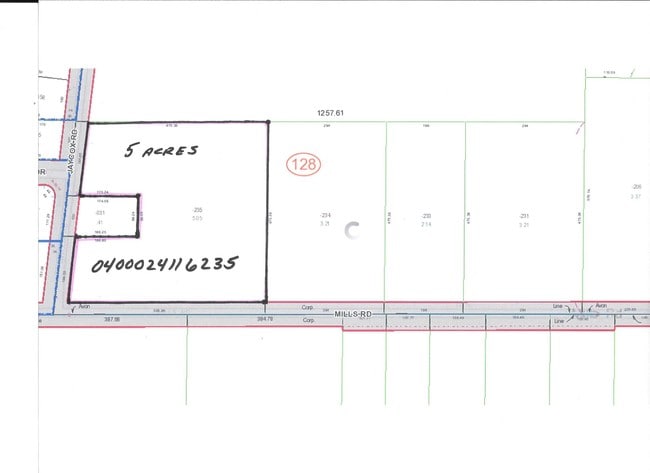
04-00-024-116-233
LORAIN
Industrialacreage
Ohio
C and X Area of minimal flood hazard, usually depicted on FIRMs as above the 500-year flood level.
2.14 AC
2024
Lorain County
2024
Cleveland
013201
Cleveland-Elyria, OH
NEARBY LISTINGS FOR SALE OR LEASE
DEMOGRAPHICS near Mills Rd
1 mile
3 mile
5 mile
2025 Total Population
5,812
45,344
126,246
2030 Population
5,891
46,085
127,778
Pop Growth 2025-2030
+ 1.36%
+ 1.63%
+ 1.21%
Average Age
43
43
43
2025 Total Households
2,240
17,396
50,623
HH Growth 2025-2030
+ 1.38%
+ 1.64%
+ 1.21%
Median Household Inc
$110,404
$111,756
$104,376
Avg Household Size
2.50
2.60
2.40
2025 Avg HH Vehicles
2.00
2.00
2.00
Median Home Value
$249,487
$300,016
$290,925
Median Year Built
1990
1992
1989
Nearby Places
Map Layers
Map Styles
 Street
 Aerial
Layers
 Traffic
 Biking
Places
Listings with unknown addresses are not visible on the map
- Restaurants
- Banks
- Shops
- Fitness
- Groceries
PUBLIC TRANSPORTATION
COMMUTER RAIL
Elyria Amtrak (Capitol Limited - Amtrak, Lake Shore Limited - Amtrak)
Drive
Walk
Distance
Elyria Amtrak (Capitol Limited - Amtrak, Lake Shore Limited - Amtrak)
13 min
7.2 mi
AIRPORT
Cleveland-Hopkins International
Drive
Walk
Distance
Cleveland-Hopkins International
20 min
9.6 mi
Freight Ports
Port of Toledo
Drive
Walk
Distance
Port of Toledo
118 min
97.6 mi
SALE & LEASE HISTORY
LISTING DATE
SALE/LEASE

Sep 18, 2018
For Sale
Sep 18, 2018
For Sale
Sep 14, 2018
For Sale
Jun 18, 2019
For Sale
Jul 26, 2019
For Sale
Feb 06, 2017
For Sale
Nearby Properties
Address
Land Use
TOTAL SIZE
Lot Size
Zoning
Address
Land Use
TOTAL SIZE
Lot Size
Zoning
634,322 SF
82.83 AC
Address
Land Use
TOTAL SIZE
Lot Size
Zoning
221,566 SF
26.09 AC
Address
Land Use
TOTAL SIZE
Lot Size
Zoning
156,541 SF
31.07 AC
Address
Land Use
TOTAL SIZE
Lot Size
Zoning
163,892 SF
46.81 AC
Address
Land Use
TOTAL SIZE
Lot Size
Zoning
176,857 SF
8.62 AC
B-2
Address
Land Use
TOTAL SIZE
Lot Size
Zoning
163,038 SF
21.16 AC
Address
Land Use
TOTAL SIZE
Lot Size
Zoning
50,668 SF
9.04 AC
Address
Land Use
TOTAL SIZE
Lot Size
Zoning
2.61 AC
Address
Land Use
TOTAL SIZE
Lot Size
Zoning
67,590 SF
23.66 AC
Address
Land Use
TOTAL SIZE
Lot Size
Zoning
146,094 SF
15.29 AC
Address
Land Use
TOTAL SIZE
Lot Size
Zoning
37,464 SF
11.14 AC
Address
Land Use
TOTAL SIZE
Lot Size
Zoning
71,304 SF
8.63 AC
Address
Land Use
TOTAL SIZE
Lot Size
Zoning
128,416 SF
13.42 AC
R-40
Address
Land Use
TOTAL SIZE
Lot Size
Zoning
10,978 SF
40.75 AC
Address
Land Use
TOTAL SIZE
Lot Size
Zoning
39,418 SF
6.05 AC
Address
Land Use
TOTAL SIZE
Lot Size
Zoning
88,501 SF
8.12 AC
F-1F80
Address
Land Use
TOTAL SIZE
Lot Size
Zoning
18,697 SF
4.47 AC
Address
Land Use
TOTAL SIZE
Lot Size
Zoning
75,636 SF
4.57 AC
Address
Land Use
TOTAL SIZE
Lot Size
Zoning
73,673 SF
6.80 AC
SR
Address
Land Use
TOTAL SIZE
Lot Size
Zoning
27,445 SF
2 AC
Address
Land Use
TOTAL SIZE
Lot Size
Zoning
50,064 SF
15.73 AC
Address
Land Use
TOTAL SIZE
Lot Size
Zoning
83,515 SF
3.20 AC
Address
Land Use
TOTAL SIZE
Lot Size
Zoning
99,422 SF
13.77 AC
Address
Land Use
TOTAL SIZE
Lot Size
Zoning
3,816 SF
17.08 AC
Address
Land Use
TOTAL SIZE
Lot Size
Zoning
15,272 SF
1.30 AC
F-1F80
Address
Land Use
TOTAL SIZE
Lot Size
Zoning
42,487 SF
33.33 AC
Address
Land Use
TOTAL SIZE
Lot Size
Zoning
29,024 SF
7.29 AC
Address
Land Use
TOTAL SIZE
Lot Size
Zoning
55,496 SF
6.29 AC
CRG
Address
Land Use
TOTAL SIZE
Lot Size
Zoning
93,980 SF
12.48 AC
Address
Land Use
TOTAL SIZE
Lot Size
Zoning
60,104 SF
7.16 AC
The World's #1 Commercial Real Estate Marketplace
Connect with us
© 2026 CoStar Group
The information above has been obtained from sources believed reliable. While we do not doubt its accuracy we have not verified it and make no guarantee, warranty or representation about it. It is your responsibility to independently confirm its accuracy and completeness. Any projections, opinions, assumptions, or estimates used are for example only and do not represent the current or future performance of the property. The value of this transaction to you depends on tax and other factors which should be evaluated by your tax, financial, and legal advisors. You and your advisors should conduct a careful, independent investigation of the property to determine to your satisfaction the suitability of the property for your needs.