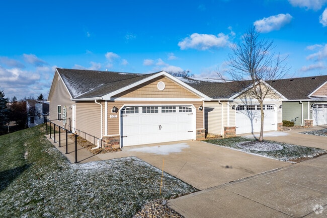
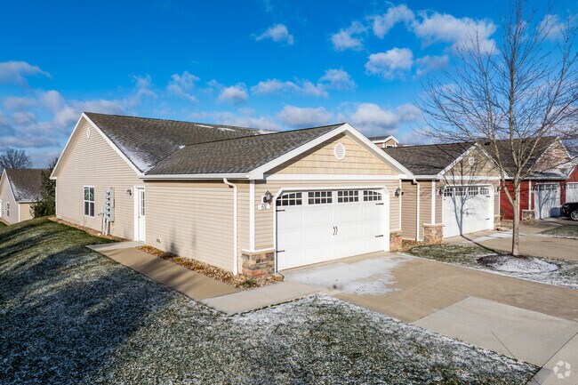
Property Record
Mindy Ln, Wooster, OH 44691

Property Detail
Mindy Ln
68-02448-016
LOT 9042 COTTAGEWOOD CONDOMINIUMS PH 4 60' 7.175A MP 137
Apartment
WAYNE
R4
Ohio
B and X Area of moderate flood hazard, usually the area between the limits of the 100-year and 500-year floods.
9042
2025
7.18 AC
2025
Ohio North Area
000200
Other Market Areas
6,631 SF
Wooster, OH
NEARBY LISTINGS FOR SALE OR LEASE
-
-
View all Wooster listings for sale on LoopNet.com
DEMOGRAPHICS near Mindy Ln
1 mile
3 mile
5 mile
2025 Total Population
5,221
28,817
37,913
2030 Population
5,259
28,952
38,050
Pop Growth 2025-2030
+ 0.73%
+ 0.47%
+ 0.36%
Average Age
44
41
42
2025 Total Households
2,361
11,876
15,396
HH Growth 2025-2030
+ 0.72%
+ 0.45%
+ 0.34%
Median Household Inc
$69,663
$67,121
$67,701
Avg Household Size
2.20
2.20
2.20
2025 Avg HH Vehicles
2.00
2.00
2.00
Median Home Value
$218,067
$222,475
$230,830
Median Year Built
1988
1974
1975
Nearby Places
Map Layers
Map Styles
 Street
 Aerial
Transit
 Traffic
 Biking
Places
Listings with unknown addresses are not visible on the map
- Restaurants
- Banks
- Shops
- Fitness
- Groceries
PUBLIC TRANSPORTATION
AIRPORT
Akron-Canton Regional
Drive
Walk
Distance
Akron-Canton Regional
59 min
44.9 mi
Freight Ports
Port of Toledo
Drive
Walk
Distance
Port of Toledo
165 min
118.9 mi
Nearby Properties
Address
Land Use
TOTAL SIZE
Lot Size
Zoning
Address
Land Use
TOTAL SIZE
Lot Size
Zoning
3,488 SF
43.72 AC
CF
Address
Land Use
TOTAL SIZE
Lot Size
Zoning
70,726 SF
9 AC
CF
Address
Land Use
TOTAL SIZE
Lot Size
Zoning
152,523 SF
74.14 AC
CF
Address
Land Use
TOTAL SIZE
Lot Size
Zoning
81,133 SF
41.43 AC
CF
Address
Land Use
TOTAL SIZE
Lot Size
Zoning
51.79 AC
M2
Address
Land Use
TOTAL SIZE
Lot Size
Zoning
7.28 AC
CF
Address
Land Use
TOTAL SIZE
Lot Size
Zoning
227,500 SF
58.38 AC
Address
Land Use
TOTAL SIZE
Lot Size
Zoning
48,096 SF
1.67 AC
C4
Address
Land Use
TOTAL SIZE
Lot Size
Zoning
46,230 SF
38.50 AC
CF
Address
Land Use
TOTAL SIZE
Lot Size
Zoning
109.56 AC
M2
Address
Land Use
TOTAL SIZE
Lot Size
Zoning
50,110 SF
19.26 AC
CF
Address
Land Use
TOTAL SIZE
Lot Size
Zoning
160,158 SF
14.21 AC
Address
Land Use
TOTAL SIZE
Lot Size
Zoning
25.14 AC
CF
Address
Land Use
TOTAL SIZE
Lot Size
Zoning
62,910 SF
11.24 AC
C5
Address
Land Use
TOTAL SIZE
Lot Size
Zoning
47,160 SF
3.22 AC
C4
Address
Land Use
TOTAL SIZE
Lot Size
Zoning
125,350 SF
17.20 AC
C5
Address
Land Use
TOTAL SIZE
Lot Size
Zoning
4,486 SF
5.57 AC
CF
Address
Land Use
TOTAL SIZE
Lot Size
Zoning
2,536 SF
16.79 AC
R4
Address
Land Use
TOTAL SIZE
Lot Size
Zoning
62,976 SF
10.46 AC
CF
Address
Land Use
TOTAL SIZE
Lot Size
Zoning
302,400 SF
24.51 AC
M2
Address
Land Use
TOTAL SIZE
Lot Size
Zoning
58,600 SF
6.30 AC
CF
Address
Land Use
TOTAL SIZE
Lot Size
Zoning
81,724 SF
19.59 AC
CF
Address
Land Use
TOTAL SIZE
Lot Size
Zoning
10.68 AC
M3
Address
Land Use
TOTAL SIZE
Lot Size
Zoning
71,511 SF
9.53 AC
CF
Address
Land Use
TOTAL SIZE
Lot Size
Zoning
41,173 SF
6.77 AC
Address
Land Use
TOTAL SIZE
Lot Size
Zoning
36,220 SF
2.68 AC
R1
Address
Land Use
TOTAL SIZE
Lot Size
Zoning
6,120 SF
12.43 AC
R4
Address
Land Use
TOTAL SIZE
Lot Size
Zoning
49,001 SF
9.79 AC
C5
Address
Land Use
TOTAL SIZE
Lot Size
Zoning
134,248 SF
14.37 AC
C5
Address
Land Use
TOTAL SIZE
Lot Size
Zoning
59,344 SF
1.91 AC
The World's #1 Commercial Real Estate Marketplace
Connect with us
© 2026 CoStar Group
The information above has been obtained from sources believed reliable. While we do not doubt its accuracy we have not verified it and make no guarantee, warranty or representation about it. It is your responsibility to independently confirm its accuracy and completeness. Any projections, opinions, assumptions, or estimates used are for example only and do not represent the current or future performance of the property. The value of this transaction to you depends on tax and other factors which should be evaluated by your tax, financial, and legal advisors. You and your advisors should conduct a careful, independent investigation of the property to determine to your satisfaction the suitability of the property for your needs.