Property Record
Mission Rd, Latrobe, PA 15650
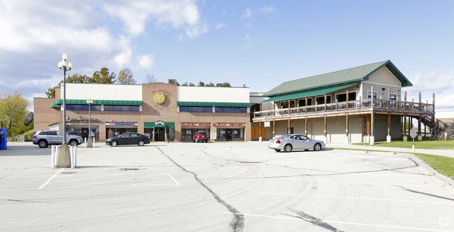
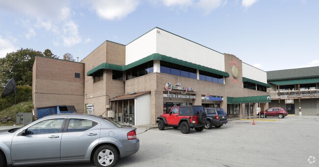
Property Detail
Mission Rd
Pittsburgh, PA
REST/STORES
61-14-00-0-021
WESTMORELAND
Residentialacreage
Pennsylvania
B and X Area of moderate flood hazard, usually the area between the limits of the 100-year and 500-year floods.
0.49 AC
2025
Westmoreland County
2026
Pittsburgh
807404
NEARBY LISTINGS FOR SALE OR LEASE
DEMOGRAPHICS near Mission Rd
1 mile
3 mile
5 mile
2025 Total Population
2,585
21,492
33,435
2030 Population
2,563
21,361
33,172
Pop Growth 2025-2030
(0.85%)
(0.61%)
(0.79%)
Average Age
48
45
45
2025 Total Households
1,131
9,246
14,193
HH Growth 2025-2030
(0.97%)
(0.70%)
(0.85%)
Median Household Inc
$63,863
$64,066
$68,213
Avg Household Size
2.20
2.10
2.20
2025 Avg HH Vehicles
2.00
2.00
2.00
Median Home Value
$213,303
$183,436
$206,989
Median Year Built
1962
1959
1965
Nearby Places
Map Layers
Map Styles
 Street
 Aerial
Layers
 Traffic
 Biking
Places
Listings with unknown addresses are not visible on the map
- Restaurants
- Banks
- Shops
- Fitness
- Groceries
PUBLIC TRANSPORTATION
COMMUTER RAIL
Latrobe Amtrak (Pennsylvanian - Amtrak)
Drive
Walk
Distance
Latrobe Amtrak (Pennsylvanian - Amtrak)
8 min
3.2 mi
Greensburg Amtrak (Pennsylvanian - Amtrak)
Drive
Walk
Distance
Greensburg Amtrak (Pennsylvanian - Amtrak)
15 min
9.0 mi
AIRPORT
Arnold Palmer Regional
Drive
Walk
Distance
Arnold Palmer Regional
5 min
1.7 mi
Freight Ports
Port of Baltimore
Drive
Walk
Distance
Port of Baltimore
259 min
198.9 mi
SALE & LEASE HISTORY
LISTING DATE
SALE/LEASE

Oct 26, 2016
For Lease
Nearby Properties
Address
Land Use
TOTAL SIZE
Lot Size
Zoning
Address
Land Use
TOTAL SIZE
Lot Size
Zoning
216.80 AC
Address
Land Use
TOTAL SIZE
Lot Size
Zoning
11.20 AC
Address
Land Use
TOTAL SIZE
Lot Size
Zoning
44,220 SF
79 AC
Address
Land Use
TOTAL SIZE
Lot Size
Zoning
Address
Land Use
TOTAL SIZE
Lot Size
Zoning
5.74 AC
Address
Land Use
TOTAL SIZE
Lot Size
Zoning
25.30 AC
Address
Land Use
TOTAL SIZE
Lot Size
Zoning
1.67 AC
Address
Land Use
TOTAL SIZE
Lot Size
Zoning
19.60 AC
Address
Land Use
TOTAL SIZE
Lot Size
Zoning
1,846,029 SF
18.68 AC
Address
Land Use
TOTAL SIZE
Lot Size
Zoning
40.10 AC
Address
Land Use
TOTAL SIZE
Lot Size
Zoning
52.70 AC
Address
Land Use
TOTAL SIZE
Lot Size
Zoning
Address
Land Use
TOTAL SIZE
Lot Size
Zoning
149,920 SF
30.53 AC
Address
Land Use
TOTAL SIZE
Lot Size
Zoning
16.30 AC
Address
Land Use
TOTAL SIZE
Lot Size
Zoning
2.50 AC
Address
Land Use
TOTAL SIZE
Lot Size
Zoning
Address
Land Use
TOTAL SIZE
Lot Size
Zoning
13.44 AC
Address
Land Use
TOTAL SIZE
Lot Size
Zoning
10.50 AC
Address
Land Use
TOTAL SIZE
Lot Size
Zoning
12.85 AC
Address
Land Use
TOTAL SIZE
Lot Size
Zoning
1.21 AC
Address
Land Use
TOTAL SIZE
Lot Size
Zoning
12.89 AC
Address
Land Use
TOTAL SIZE
Lot Size
Zoning
9.10 AC
Address
Land Use
TOTAL SIZE
Lot Size
Zoning
Address
Land Use
TOTAL SIZE
Lot Size
Zoning
1.39 AC
Address
Land Use
TOTAL SIZE
Lot Size
Zoning
7.80 AC
Address
Land Use
TOTAL SIZE
Lot Size
Zoning
2.16 AC
Address
Land Use
TOTAL SIZE
Lot Size
Zoning
0.51 AC
Address
Land Use
TOTAL SIZE
Lot Size
Zoning
12.64 AC
Address
Land Use
TOTAL SIZE
Lot Size
Zoning
40,671 SF
3.30 AC
Address
Land Use
TOTAL SIZE
Lot Size
Zoning
The World's #1 Commercial Real Estate Marketplace
Connect with us
© 2026 CoStar Group
The information above has been obtained from sources believed reliable. While we do not doubt its accuracy we have not verified it and make no guarantee, warranty or representation about it. It is your responsibility to independently confirm its accuracy and completeness. Any projections, opinions, assumptions, or estimates used are for example only and do not represent the current or future performance of the property. The value of this transaction to you depends on tax and other factors which should be evaluated by your tax, financial, and legal advisors. You and your advisors should conduct a careful, independent investigation of the property to determine to your satisfaction the suitability of the property for your needs.