Property Record
Mission Rd, San Antonio, TX 78210


NEARBY LISTINGS FOR SALE OR LEASE
Property Detail
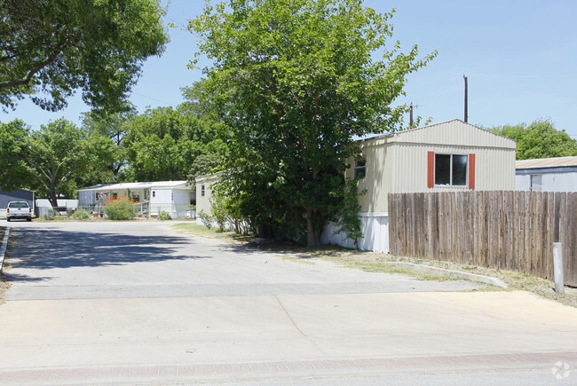
Mission Rd
San Antonio-New Braunfels, TX
Cheryl Ann Mboile Hm Park Bl A
00020-001-0601
NCB 20 LOT E IRR 20 FT OF 60 (.9627 AC) & E IRR 20 FT OF 61 (.0534 AC) (MELA) 2019-NEW PER PLAT 9727/165-169 FILED 3-12-18. JLF/GIS/4-9-18
Commercialnec
Bexar
AE
Texas
48029C0415G
371
0
1.02 AC
2025
Thelka
140400
San Antonio
DEMOGRAPHICS near Mission Rd
1 mile
3 mile
5 mile
2024 Total Population
14,140
139,558
326,801
2029 Population
15,262
148,871
348,774
Pop Growth 2024-2029
+ 7.93%
+ 6.67%
+ 6.72%
Average Age
39
38
38
2024 Total Households
5,055
50,863
115,848
HH Growth 2024-2029
+ 8.21%
+ 7.03%
+ 7.13%
Median Household Inc
$36,941
$40,706
$39,621
Avg Household Size
2.70
2.70
2.70
2024 Avg HH Vehicles
2.00
2.00
2.00
Median Home Value
$137,064
$126,814
$123,428
Median Year Built
1951
1955
1960
Nearby Places
Map Layers
Map Styles
 Street
 Aerial
Transit
 Traffic
 Biking
Places
Listings with unknown addresses are not visible on the map
- Restaurants
- Banks
- Shops
- Fitness
- Groceries
PUBLIC TRANSPORTATION
COMMUTER RAIL
San Antonio Amtrak Station (Sunset Limited - Amtrak, Texas Eagle - Amtrak)
Drive
Walk
Distance
San Antonio Amtrak Station (Sunset Limited - Amtrak, Texas Eagle - Amtrak)
8 min
3.6 mi
AIRPORT
San Antonio International
Drive
Walk
Distance
San Antonio International
17 min
11.4 mi
Freight Ports
Calhoun Port
Drive
Walk
Distance
Calhoun Port
182 min
147.4 mi
Nearby Properties
Address
Land Use
TOTAL SIZE
Lot Size
Zoning
Address
Land Use
TOTAL SIZE
Lot Size
Zoning
26.51 AC
Address
Land Use
TOTAL SIZE
Lot Size
Zoning
738,650 SF
2.93 AC
Address
Land Use
TOTAL SIZE
Lot Size
Zoning
1,049,861 SF
1.50 AC
Address
Land Use
TOTAL SIZE
Lot Size
Zoning
922,468 SF
10.78 AC
Address
Land Use
TOTAL SIZE
Lot Size
Zoning
Address
Land Use
TOTAL SIZE
Lot Size
Zoning
400,228 SF
0.78 AC
Address
Land Use
TOTAL SIZE
Lot Size
Zoning
8.10 AC
Address
Land Use
TOTAL SIZE
Lot Size
Zoning
387,443 SF
0.89 AC
Address
Land Use
TOTAL SIZE
Lot Size
Zoning
254,108 SF
2.40 AC
Address
Land Use
TOTAL SIZE
Lot Size
Zoning
15,468 SF
4.18 AC
Address
Land Use
TOTAL SIZE
Lot Size
Zoning
262,082 SF
1.60 AC
Address
Land Use
TOTAL SIZE
Lot Size
Zoning
7,018 SF
3.24 AC
Address
Land Use
TOTAL SIZE
Lot Size
Zoning
399,007 SF
22.03 AC
Address
Land Use
TOTAL SIZE
Lot Size
Zoning
156,480 SF
3.46 AC
Address
Land Use
TOTAL SIZE
Lot Size
Zoning
13,153 SF
2.62 AC
Address
Land Use
TOTAL SIZE
Lot Size
Zoning
349,678 SF
0.83 AC
Address
Land Use
TOTAL SIZE
Lot Size
Zoning
252,105 SF
0.47 AC
Address
Land Use
TOTAL SIZE
Lot Size
Zoning
240,394 SF
0.64 AC
Address
Land Use
TOTAL SIZE
Lot Size
Zoning
14,492 SF
6.62 AC
Address
Land Use
TOTAL SIZE
Lot Size
Zoning
291,374 SF
13.49 AC
Address
Land Use
TOTAL SIZE
Lot Size
Zoning
176,336 SF
18.74 AC
Address
Land Use
TOTAL SIZE
Lot Size
Zoning
331,500 SF
1.82 AC
Address
Land Use
TOTAL SIZE
Lot Size
Zoning
132,268 SF
0.14 AC
Address
Land Use
TOTAL SIZE
Lot Size
Zoning
2.93 AC
Address
Land Use
TOTAL SIZE
Lot Size
Zoning
7,542 SF
1.30 AC
Address
Land Use
TOTAL SIZE
Lot Size
Zoning
239,289 SF
1.50 AC
Address
Land Use
TOTAL SIZE
Lot Size
Zoning
14,560 SF
0.23 AC
Address
Land Use
TOTAL SIZE
Lot Size
Zoning
197,115 SF
2.29 AC
Address
Land Use
TOTAL SIZE
Lot Size
Zoning
229,634 SF
3.56 AC
Address
Land Use
TOTAL SIZE
Lot Size
Zoning
242,297 SF
7.45 AC
The World's #1 Commercial Real Estate Marketplace
Connect with us
© 2026 CoStar Group
The information above has been obtained from sources believed reliable. While we do not doubt its accuracy we have not verified it and make no guarantee, warranty or representation about it. It is your responsibility to independently confirm its accuracy and completeness. Any projections, opinions, assumptions, or estimates used are for example only and do not represent the current or future performance of the property. The value of this transaction to you depends on tax and other factors which should be evaluated by your tax, financial, and legal advisors. You and your advisors should conduct a careful, independent investigation of the property to determine to your satisfaction the suitability of the property for your needs.