Property Record
Modaus Rd, Decatur, AL 35603

NEARBY LISTINGS FOR SALE OR LEASE
Property Detail
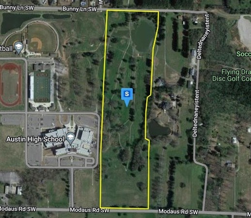
Modaus Rd
Decatur, AL
The Ridge
02-08-34-3-000-003.005
LOT 3A A RESUBDIVISION OF LOTS 3 & 4 THE RIDGE MB 2022 PG 33 SEC 34, T5S, R5W
Vacantlandnec
Morgan
X
Alabama
01103C0058F
3a
0
34 AC
2024
Alabama North Area
005109
Other Market Areas
DEMOGRAPHICS near Modaus Rd
1 Mile
3 Mile
5 Mile
2024 Total Population
1,387
25,337
55,635
2029 Population
1,382
25,373
55,934
Pop Growth 2024-2029
(0.36%)
+ 0.14%
+ 0.54%
Average Age
44
41
40
2024 Total Households
584
10,492
22,318
HH Growth 2024-2029
(0.34%)
+ 0.14%
+ 0.53%
Median Household Inc
$71,249
$57,904
$49,886
Avg Household Size
2.30
2.40
2.40
2024 Avg HH Vehicles
2.00
2.00
2.00
Median Home Value
$201,449
$170,146
$156,051
Median Year Built
1991
1985
1979
Nearby Places
Map Layers
Map Styles
 Street
 Aerial
- Restaurants
- Banks
- Shops
- Fitness
- Groceries
PUBLIC TRANSPORTATION
AIRPORT
Huntsville International-Carl T Jones Field
DRIVE
WALK
Distance
Huntsville International-Carl T Jones Field
37 min
21.6 mi
Freight Ports
Port of Mobile
DRIVE
WALK
Distance
Port of Mobile
375 min
338.3 mi
Nearby Properties
Address
Land Use
TOTAL SIZE
Lot Size
Zoning
Address
Land Use
TOTAL SIZE
Lot Size
Zoning
103,569 SF
6.69 AC
Address
Land Use
TOTAL SIZE
Lot Size
Zoning
35,727 SF
10 AC
Address
Land Use
TOTAL SIZE
Lot Size
Zoning
48,364 SF
1.80 AC
Address
Land Use
TOTAL SIZE
Lot Size
Zoning
54,544 SF
6.53 AC
Address
Land Use
TOTAL SIZE
Lot Size
Zoning
51,958 SF
14 AC
Address
Land Use
TOTAL SIZE
Lot Size
Zoning
377,685 SF
17 AC
Address
Land Use
TOTAL SIZE
Lot Size
Zoning
81,682 SF
13 AC
Address
Land Use
TOTAL SIZE
Lot Size
Zoning
205,279 SF
25.45 AC
Address
Land Use
TOTAL SIZE
Lot Size
Zoning
135,440 SF
6.76 AC
Address
Land Use
TOTAL SIZE
Lot Size
Zoning
40,008 SF
19.90 AC
Address
Land Use
TOTAL SIZE
Lot Size
Zoning
4,181 SF
6.70 AC
Address
Land Use
TOTAL SIZE
Lot Size
Zoning
81,042 SF
2.39 AC
Address
Land Use
TOTAL SIZE
Lot Size
Zoning
31,473 SF
2.90 AC
Address
Land Use
TOTAL SIZE
Lot Size
Zoning
19,198 SF
15 AC
Address
Land Use
TOTAL SIZE
Lot Size
Zoning
55,283 SF
4.48 AC
Address
Land Use
TOTAL SIZE
Lot Size
Zoning
33,878 SF
3.52 AC
Address
Land Use
TOTAL SIZE
Lot Size
Zoning
77,811 SF
9.34 AC
Address
Land Use
TOTAL SIZE
Lot Size
Zoning
30,076 SF
4.46 AC
Address
Land Use
TOTAL SIZE
Lot Size
Zoning
51,996 SF
2.30 AC
Address
Land Use
TOTAL SIZE
Lot Size
Zoning
100,525 SF
10.80 AC
Address
Land Use
TOTAL SIZE
Lot Size
Zoning
74,499 SF
4.13 AC
Address
Land Use
TOTAL SIZE
Lot Size
Zoning
48,536 SF
7.24 AC
Address
Land Use
TOTAL SIZE
Lot Size
Zoning
5,977 SF
1.37 AC
Address
Land Use
TOTAL SIZE
Lot Size
Zoning
20,058 SF
17 AC
Address
Land Use
TOTAL SIZE
Lot Size
Zoning
11,740 SF
3.67 AC
Address
Land Use
TOTAL SIZE
Lot Size
Zoning
77,618 SF
7.80 AC
Address
Land Use
TOTAL SIZE
Lot Size
Zoning
78,802 SF
6.50 AC
Address
Land Use
TOTAL SIZE
Lot Size
Zoning
90,211 SF
8.80 AC
Address
Land Use
TOTAL SIZE
Lot Size
Zoning
1,532 SF
6.90 AC
The World's #1 Commercial Real Estate Marketplace
Connect with us
© 2026 CoStar Group
The information above has been obtained from sources believed reliable. While we do not doubt its accuracy we have not verified it and make no guarantee, warranty or representation about it. It is your responsibility to independently confirm its accuracy and completeness. Any projections, opinions, assumptions, or estimates used are for example only and do not represent the current or future performance of the property. The value of this transaction to you depends on tax and other factors which should be evaluated by your tax, financial, and legal advisors. You and your advisors should conduct a careful, independent investigation of the property to determine to your satisfaction the suitability of the property for your needs.