Property Record
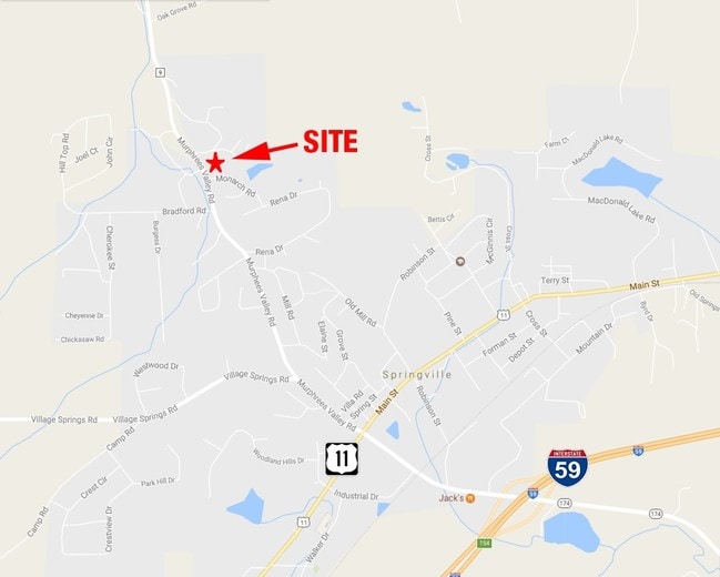
Monarch Rd, Springville, AL 35146


Property Detail
Monarch Rd
Birmingham, AL
BEG NW COR SW TH SE S 529 SW 872.99 N 761.59 E 896.2 TO POB 14 ACC 30-14-2
13-09-30-0-001-008.000
ST CLAIR
Vacantlandnec
Alabama
B and X Area of moderate flood hazard, usually the area between the limits of the 100-year and 500-year floods.
14 AC
2025
St Clair County
2025
Birmingham
040503
NEARBY LISTINGS FOR SALE OR LEASE
-
-
View all Springville listings for sale on LoopNet.com
DEMOGRAPHICS near Monarch Rd
1 mile
3 mile
5 mile
2025 Total Population
1,711
6,153
10,190
2030 Population
1,806
6,473
10,716
Pop Growth 2025-2030
+ 5.55%
+ 5.20%
+ 5.16%
Average Age
42
42
42
2025 Total Households
633
2,290
3,768
HH Growth 2025-2030
+ 5.53%
+ 5.24%
+ 5.18%
Median Household Inc
$112,671
$100,271
$97,468
Avg Household Size
2.60
2.70
2.70
2025 Avg HH Vehicles
3.00
2.00
2.00
Median Home Value
$322,847
$295,271
$274,157
Median Year Built
2001
1999
2000
Nearby Places
Map Layers
Map Styles
 Street
 Aerial
Layers
 Traffic
 Biking
Places
Listings with unknown addresses are not visible on the map
- Restaurants
- Banks
- Shops
- Fitness
- Groceries
PUBLIC TRANSPORTATION
AIRPORT
Birmingham-Shuttlesworth International
Drive
Walk
Distance
Birmingham-Shuttlesworth International
35 min
26.7 mi
Freight Ports
Port of Mobile
Drive
Walk
Distance
Port of Mobile
310 min
282.0 mi
SALE & LEASE HISTORY
LISTING DATE
SALE/LEASE

Apr 17, 2017
For Sale
Nearby Properties
Address
Land Use
TOTAL SIZE
Lot Size
Zoning
Address
Land Use
TOTAL SIZE
Lot Size
Zoning
91,680 SF
8.60 AC
Address
Land Use
TOTAL SIZE
Lot Size
Zoning
16,374 SF
4.29 AC
Address
Land Use
TOTAL SIZE
Lot Size
Zoning
4,650 SF
4.17 AC
Address
Land Use
TOTAL SIZE
Lot Size
Zoning
17.20 AC
Address
Land Use
TOTAL SIZE
Lot Size
Zoning
7,538 SF
1.25 AC
Address
Land Use
TOTAL SIZE
Lot Size
Zoning
16,996 SF
3.10 AC
Address
Land Use
TOTAL SIZE
Lot Size
Zoning
2,760 SF
7.50 AC
Address
Land Use
TOTAL SIZE
Lot Size
Zoning
6,988 SF
1 AC
Address
Land Use
TOTAL SIZE
Lot Size
Zoning
3,388 SF
1.12 AC
Address
Land Use
TOTAL SIZE
Lot Size
Zoning
480 SF
0.36 AC
Address
Land Use
TOTAL SIZE
Lot Size
Zoning
1,136 SF
8.40 AC
Address
Land Use
TOTAL SIZE
Lot Size
Zoning
5,250 SF
1.66 AC
Address
Land Use
TOTAL SIZE
Lot Size
Zoning
2,893 SF
0.89 AC
Address
Land Use
TOTAL SIZE
Lot Size
Zoning
3,807 SF
1.10 AC
Address
Land Use
TOTAL SIZE
Lot Size
Zoning
5,628 SF
1.30 AC
Address
Land Use
TOTAL SIZE
Lot Size
Zoning
6,889 SF
0.96 AC
Address
Land Use
TOTAL SIZE
Lot Size
Zoning
4,872 SF
1 AC
Address
Land Use
TOTAL SIZE
Lot Size
Zoning
3,111 SF
0.88 AC
Address
Land Use
TOTAL SIZE
Lot Size
Zoning
3,295 SF
0.70 AC
Address
Land Use
TOTAL SIZE
Lot Size
Zoning
4,651 SF
0.71 AC
Address
Land Use
TOTAL SIZE
Lot Size
Zoning
3,902 SF
2.58 AC
Address
Land Use
TOTAL SIZE
Lot Size
Zoning
3,000 SF
0.65 AC
Address
Land Use
TOTAL SIZE
Lot Size
Zoning
1,776 SF
0.80 AC
The World's #1 Commercial Real Estate Marketplace
Connect with us
© 2026 CoStar Group
The information above has been obtained from sources believed reliable. While we do not doubt its accuracy we have not verified it and make no guarantee, warranty or representation about it. It is your responsibility to independently confirm its accuracy and completeness. Any projections, opinions, assumptions, or estimates used are for example only and do not represent the current or future performance of the property. The value of this transaction to you depends on tax and other factors which should be evaluated by your tax, financial, and legal advisors. You and your advisors should conduct a careful, independent investigation of the property to determine to your satisfaction the suitability of the property for your needs.