Property Record
1000 Hosking Ave, Bakersfield, CA 93307


Property Detail
1000 Hosking Ave
Bakersfield-Delano, CA
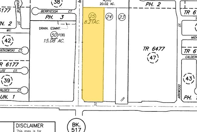
CITY BKSFM , BLOCK , LOT P 29
516-020-25-00-9
KERN
Vacantlandnec
California
B and X Area of moderate flood hazard, usually the area between the limits of the 100-year and 500-year floods.
p
2024
8.21 AC
2025
SE Outlying Kern County
003208
Bakersfield
NEARBY LISTINGS FOR SALE OR LEASE
DEMOGRAPHICS near 1000 Hosking Ave
1 mile
3 mile
5 mile
2025 Total Population
16,277
87,636
180,555
2030 Population
16,456
88,457
182,414
Pop Growth 2025-2030
+ 1.10%
+ 0.94%
+ 1.03%
Average Age
33
34
34
2025 Total Households
4,104
23,452
52,291
HH Growth 2025-2030
+ 1.05%
+ 0.90%
+ 0.96%
Median Household Inc
$82,542
$72,680
$68,788
Avg Household Size
3.90
3.60
3.40
2025 Avg HH Vehicles
2.00
2.00
2.00
Median Home Value
$326,483
$328,183
$323,441
Median Year Built
1996
1989
1982
Nearby Places
Map Layers
Map Styles
 Street
 Aerial
Layers
 Traffic
 Biking
Places
Listings with unknown addresses are not visible on the map
- Restaurants
- Banks
- Shops
- Fitness
- Groceries
PUBLIC TRANSPORTATION
COMMUTER RAIL
Bakersfield (San Joaquins - Amtrak)
Drive
Walk
Distance
Bakersfield (San Joaquins - Amtrak)
14 min
7.4 mi
AIRPORT
Meadows Field
Drive
Walk
Distance
Meadows Field
23 min
12.8 mi
Freight Ports
The Port of Hueneme
Drive
Walk
Distance
The Port of Hueneme
146 min
116.5 mi
SALE & LEASE HISTORY
LISTING DATE
SALE/LEASE

Feb 25, 2019
For Sale
Nearby Properties
Address
Land Use
TOTAL SIZE
Lot Size
Zoning
Address
Land Use
TOTAL SIZE
Lot Size
Zoning
269,429 SF
12.71 AC
R-2
Address
Land Use
TOTAL SIZE
Lot Size
Zoning
17.96 AC
C2
Address
Land Use
TOTAL SIZE
Lot Size
Zoning
218,345 SF
19.54 AC
PCD
Address
Land Use
TOTAL SIZE
Lot Size
Zoning
11,780 SF
11.25 AC
C1
Address
Land Use
TOTAL SIZE
Lot Size
Zoning
69,414 SF
4.47 AC
M1
Address
Land Use
TOTAL SIZE
Lot Size
Zoning
149,499 SF
13.20 AC
GC
Address
Land Use
TOTAL SIZE
Lot Size
Zoning
41,507 SF
10.37 AC
C2
Address
Land Use
TOTAL SIZE
Lot Size
Zoning
10,073 SF
15.48 AC
PCD
Address
Land Use
TOTAL SIZE
Lot Size
Zoning
1,100 SF
6.28 AC
R-3
Address
Land Use
TOTAL SIZE
Lot Size
Zoning
81,682 SF
12.27 AC
M-2
Address
Land Use
TOTAL SIZE
Lot Size
Zoning
34,306 SF
12.39 AC
R-2
Address
Land Use
TOTAL SIZE
Lot Size
Zoning
94,240 SF
4.95 AC
C-2
Address
Land Use
TOTAL SIZE
Lot Size
Zoning
149,777 SF
15.27 AC
C2
Address
Land Use
TOTAL SIZE
Lot Size
Zoning
7.62 AC
C2
Address
Land Use
TOTAL SIZE
Lot Size
Zoning
4.02 AC
C2
Address
Land Use
TOTAL SIZE
Lot Size
Zoning
5,000 SF
0.34 AC
Address
Land Use
TOTAL SIZE
Lot Size
Zoning
10.37 AC
C2
Address
Land Use
TOTAL SIZE
Lot Size
Zoning
41.06 AC
Address
Land Use
TOTAL SIZE
Lot Size
Zoning
41,231 SF
6 AC
M-1
Address
Land Use
TOTAL SIZE
Lot Size
Zoning
1,014 SF
3.78 AC
PUD
Address
Land Use
TOTAL SIZE
Lot Size
Zoning
106,562 SF
5.30 AC
R3
Address
Land Use
TOTAL SIZE
Lot Size
Zoning
74,294 SF
7.71 AC
C2
Address
Land Use
TOTAL SIZE
Lot Size
Zoning
50,719 SF
5 AC
C2
Address
Land Use
TOTAL SIZE
Lot Size
Zoning
4,415 SF
5.94 AC
R-1-CH
Address
Land Use
TOTAL SIZE
Lot Size
Zoning
53,620 SF
5.15 AC
M1
Address
Land Use
TOTAL SIZE
Lot Size
Zoning
14,736 SF
1.71 AC
C2
Address
Land Use
TOTAL SIZE
Lot Size
Zoning
1,792 SF
3.85 AC
PCD
Address
Land Use
TOTAL SIZE
Lot Size
Zoning
3,510 SF
4.66 AC
C2
Address
Land Use
TOTAL SIZE
Lot Size
Zoning
37,869 SF
4.80 AC
M-1
The World's #1 Commercial Real Estate Marketplace
Connect with us
© 2026 CoStar Group
The information above has been obtained from sources believed reliable. While we do not doubt its accuracy we have not verified it and make no guarantee, warranty or representation about it. It is your responsibility to independently confirm its accuracy and completeness. Any projections, opinions, assumptions, or estimates used are for example only and do not represent the current or future performance of the property. The value of this transaction to you depends on tax and other factors which should be evaluated by your tax, financial, and legal advisors. You and your advisors should conduct a careful, independent investigation of the property to determine to your satisfaction the suitability of the property for your needs.