Property Record
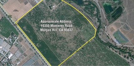
Monterey Rd, Morgan Hill, CA 95037
Property Detail
Monterey Rd
725-04-001
SANTA CLARA
Orchard
California
A-40A
9.20 AC
AO River or stream flood hazard areas, and areas with a 1% or greater chance of shallow flooding each year. These areas have a 26% chance of flooding over the life of a 30-year mortgage.
South San Jose
2025
South Bay/San Jose
2025
San Jose-Sunnyvale-Santa Clara, CA
512312
NEARBY LISTINGS FOR SALE OR LEASE
DEMOGRAPHICS near Monterey Rd
1 mile
3 mile
5 mile
2025 Total Population
485
10,157
39,644
2030 Population
468
10,375
40,563
Pop Growth 2025-2030
(3.51%)
+ 2.15%
+ 2.32%
Average Age
42
41
40
2025 Total Households
133
3,173
12,692
HH Growth 2025-2030
(3.76%)
+ 2.30%
+ 2.38%
Median Household Inc
$100,694
$177,207
$152,582
Avg Household Size
3.30
3.10
3.00
2025 Avg HH Vehicles
3.00
2.00
2.00
Median Home Value
$1,096,610
$1,067,058
$1,057,662
Median Year Built
1977
1994
1990
Nearby Places
Map Layers
Map Styles
 Street
 Aerial
Layers
 Traffic
 Biking
Places
Listings with unknown addresses are not visible on the map
- Restaurants
- Banks
- Shops
- Fitness
- Groceries
PUBLIC TRANSPORTATION
COMMUTER RAIL
Morgan Hill Caltrain Station Southbound (South Santa Clara County Connector - Caltrain (Caltrain))
Drive
Walk
Distance
Morgan Hill Caltrain Station Southbound (South Santa Clara County Connector - Caltrain (Caltrain))
11 min
6.4 mi
AIRPORT
Norman Y Mineta San Jose International
Drive
Walk
Distance
Norman Y Mineta San Jose International
29 min
21.4 mi
Freight Ports
Port of Redwood City
Drive
Walk
Distance
Port of Redwood City
50 min
39.5 mi
Nearby Properties
Address
Land Use
TOTAL SIZE
Lot Size
Zoning
Address
Land Use
TOTAL SIZE
Lot Size
Zoning
23.35 AC
PUD
Address
Land Use
TOTAL SIZE
Lot Size
Zoning
7.53 AC
CT
Address
Land Use
TOTAL SIZE
Lot Size
Zoning
19.50 AC
RAM
Address
Land Use
TOTAL SIZE
Lot Size
Zoning
8.65 AC
IL
Address
Land Use
TOTAL SIZE
Lot Size
Zoning
285,877 SF
16.30 AC
MPUD
Address
Land Use
TOTAL SIZE
Lot Size
Zoning
91,853 SF
5.30 AC
M
Address
Land Use
TOTAL SIZE
Lot Size
Zoning
79,059 SF
5.87 AC
M1
Address
Land Use
TOTAL SIZE
Lot Size
Zoning
85,456 SF
4.98 AC
M
Address
Land Use
TOTAL SIZE
Lot Size
Zoning
76,845 SF
2.43 AC
A140
Address
Land Use
TOTAL SIZE
Lot Size
Zoning
400 SF
756.21 AC
A(PD)
Address
Land Use
TOTAL SIZE
Lot Size
Zoning
151,242 SF
10.44 AC
ML
Address
Land Use
TOTAL SIZE
Lot Size
Zoning
4.95 AC
M
Address
Land Use
TOTAL SIZE
Lot Size
Zoning
82,446 SF
5.32 AC
M
Address
Land Use
TOTAL SIZE
Lot Size
Zoning
73,600 SF
5 AC
M
Address
Land Use
TOTAL SIZE
Lot Size
Zoning
4.30 AC
M
Address
Land Use
TOTAL SIZE
Lot Size
Zoning
120,000 SF
6.86 AC
ML
Address
Land Use
TOTAL SIZE
Lot Size
Zoning
155,353 SF
9.21 AC
IPUD
Address
Land Use
TOTAL SIZE
Lot Size
Zoning
4.93 AC
ML
Address
Land Use
TOTAL SIZE
Lot Size
Zoning
127,732 SF
4.74 AC
HC
Address
Land Use
TOTAL SIZE
Lot Size
Zoning
127,732 SF
6.26 AC
CT
Address
Land Use
TOTAL SIZE
Lot Size
Zoning
22,385 SF
2.45 AC
CT
Address
Land Use
TOTAL SIZE
Lot Size
Zoning
4,734 SF
20.32 AC
PVD
Address
Land Use
TOTAL SIZE
Lot Size
Zoning
61,198 SF
4.14 AC
M
Address
Land Use
TOTAL SIZE
Lot Size
Zoning
108,631 SF
13.90 AC
A-20A
Address
Land Use
TOTAL SIZE
Lot Size
Zoning
584 SF
21.16 AC
PUD
Address
Land Use
TOTAL SIZE
Lot Size
Zoning
74,825 SF
4.60 AC
M
Address
Land Use
TOTAL SIZE
Lot Size
Zoning
74,825 SF
4.10 AC
M
Address
Land Use
TOTAL SIZE
Lot Size
Zoning
2.44 AC
ML
Address
Land Use
TOTAL SIZE
Lot Size
Zoning
54,545 SF
3.02 AC
M
Address
Land Use
TOTAL SIZE
Lot Size
Zoning
80,640 SF
3 AC
M
The World's #1 Commercial Real Estate Marketplace
Connect with us
© 2026 CoStar Group
The information above has been obtained from sources believed reliable. While we do not doubt its accuracy we have not verified it and make no guarantee, warranty or representation about it. It is your responsibility to independently confirm its accuracy and completeness. Any projections, opinions, assumptions, or estimates used are for example only and do not represent the current or future performance of the property. The value of this transaction to you depends on tax and other factors which should be evaluated by your tax, financial, and legal advisors. You and your advisors should conduct a careful, independent investigation of the property to determine to your satisfaction the suitability of the property for your needs.