Property Record
Montgomery Rd, Cincinnati, OH 45242
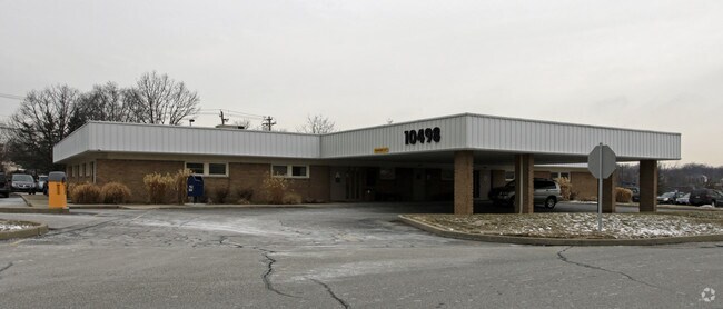


Property Detail
Montgomery Rd
603-0019-0004
ES MONTGOMERY RD 80,745 SQ FT R1-T4-S5 PARS 4-15 CONS
Parkingstructure
HAMILTON
O
Ohio
B and X Area of moderate flood hazard, usually the area between the limits of the 100-year and 500-year floods.
1.85 AC
2025
Kenwood
2025
Cincinnati/Dayton
023902
Cincinnati, OH-KY-IN
NEARBY LISTINGS FOR SALE OR LEASE
DEMOGRAPHICS near Montgomery Rd
1 mile
3 mile
5 mile
2025 Total Population
5,993
46,479
143,991
2030 Population
5,997
46,783
146,214
Pop Growth 2025-2030
+ 0.07%
+ 0.65%
+ 1.54%
Average Age
42
42
41
2025 Total Households
2,287
17,889
57,033
HH Growth 2025-2030
0.00%
+ 0.61%
+ 1.54%
Median Household Inc
$112,090
$120,416
$111,303
Avg Household Size
2.50
2.50
2.50
2025 Avg HH Vehicles
2.00
2.00
2.00
Median Home Value
$458,490
$458,018
$381,575
Median Year Built
1975
1979
1979
Nearby Places
Map Layers
Map Styles
 Street
 Aerial
Layers
 Traffic
 Biking
Places
Listings with unknown addresses are not visible on the map
- Restaurants
- Banks
- Shops
- Fitness
- Groceries
PUBLIC TRANSPORTATION
AIRPORT
Cincinnati/Northern Kentucky International
Drive
Walk
Distance
Cincinnati/Northern Kentucky International
47 min
28.5 mi
Nearby Properties
Address
Land Use
TOTAL SIZE
Lot Size
Zoning
Address
Land Use
TOTAL SIZE
Lot Size
Zoning
74.81 AC
Address
Land Use
TOTAL SIZE
Lot Size
Zoning
6.03 AC
Address
Land Use
TOTAL SIZE
Lot Size
Zoning
280,900 SF
11.14 AC
D2
Address
Land Use
TOTAL SIZE
Lot Size
Zoning
5.78 AC
Address
Land Use
TOTAL SIZE
Lot Size
Zoning
58.52 AC
Address
Land Use
TOTAL SIZE
Lot Size
Zoning
29.31 AC
DD
Address
Land Use
TOTAL SIZE
Lot Size
Zoning
35.74 AC
Address
Land Use
TOTAL SIZE
Lot Size
Zoning
29.79 AC
M1
Address
Land Use
TOTAL SIZE
Lot Size
Zoning
6.10 AC
H
Address
Land Use
TOTAL SIZE
Lot Size
Zoning
Address
Land Use
TOTAL SIZE
Lot Size
Zoning
124.81 AC
Address
Land Use
TOTAL SIZE
Lot Size
Zoning
29.95 AC
Address
Land Use
TOTAL SIZE
Lot Size
Zoning
Address
Land Use
TOTAL SIZE
Lot Size
Zoning
2.08 AC
Address
Land Use
TOTAL SIZE
Lot Size
Zoning
28.73 AC
DD
Address
Land Use
TOTAL SIZE
Lot Size
Zoning
10.87 AC
OO
Address
Land Use
TOTAL SIZE
Lot Size
Zoning
17,055 SF
6.51 AC
D1
Address
Land Use
TOTAL SIZE
Lot Size
Zoning
Address
Land Use
TOTAL SIZE
Lot Size
Zoning
Address
Land Use
TOTAL SIZE
Lot Size
Zoning
Address
Land Use
TOTAL SIZE
Lot Size
Zoning
555 SF
7.20 AC
M1
Address
Land Use
TOTAL SIZE
Lot Size
Zoning
14.15 AC
DD
Address
Land Use
TOTAL SIZE
Lot Size
Zoning
19.25 AC
E
Address
Land Use
TOTAL SIZE
Lot Size
Zoning
8.06 AC
Address
Land Use
TOTAL SIZE
Lot Size
Zoning
2,173 SF
22 AC
E
Address
Land Use
TOTAL SIZE
Lot Size
Zoning
16.76 AC
EE
Address
Land Use
TOTAL SIZE
Lot Size
Zoning
11,880 SF
23.07 AC
DD
Address
Land Use
TOTAL SIZE
Lot Size
Zoning
8.77 AC
O
Address
Land Use
TOTAL SIZE
Lot Size
Zoning
3,608 SF
8.05 AC
M1
Address
Land Use
TOTAL SIZE
Lot Size
Zoning
1,788 SF
9.55 AC
M1
The World's #1 Commercial Real Estate Marketplace
Connect with us
© 2026 CoStar Group
The information above has been obtained from sources believed reliable. While we do not doubt its accuracy we have not verified it and make no guarantee, warranty or representation about it. It is your responsibility to independently confirm its accuracy and completeness. Any projections, opinions, assumptions, or estimates used are for example only and do not represent the current or future performance of the property. The value of this transaction to you depends on tax and other factors which should be evaluated by your tax, financial, and legal advisors. You and your advisors should conduct a careful, independent investigation of the property to determine to your satisfaction the suitability of the property for your needs.