Property Record
Montgomery Rd, , OH

Property Detail
Montgomery Rd
600-0080-A001
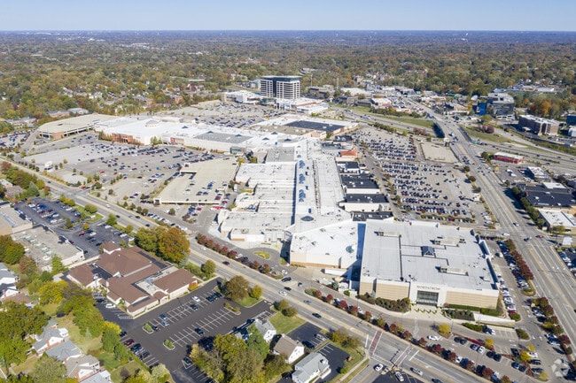
NEC MONTGOMERY RD & KENWOOD RDKENWOOD PLAZA SHOPPING CENTER 31.2597 ACS - R1 -T4 -S7 PARS 285-291-327 CONS
Regionalshoppingcenterormallwithanchorstore
HAMILTON
E
Ohio
B and X Area of moderate flood hazard, usually the area between the limits of the 100-year and 500-year floods.
15.91 AC
2025
Kenwood
2025
Cincinnati/Dayton
024001
Cincinnati, OH-KY-IN
NEARBY LISTINGS FOR SALE OR LEASE
DEMOGRAPHICS near Montgomery Rd
1 mile
3 mile
5 mile
2025 Total Population
11,350
66,081
168,776
2030 Population
11,523
66,729
170,219
Pop Growth 2025-2030
+ 1.52%
+ 0.98%
+ 0.85%
Average Age
42
42
41
2025 Total Households
4,669
27,707
73,917
HH Growth 2025-2030
+ 1.56%
+ 0.95%
+ 0.85%
Median Household Inc
$97,310
$95,543
$80,980
Avg Household Size
2.30
2.30
2.20
2025 Avg HH Vehicles
2.00
2.00
2.00
Median Home Value
$324,163
$318,588
$307,220
Median Year Built
1957
1958
1957
Nearby Places
Map Layers
Map Styles
 Street
 Aerial
Transit
 Traffic
 Biking
Places
Listings with unknown addresses are not visible on the map
- Restaurants
- Banks
- Shops
- Fitness
- Groceries
PUBLIC TRANSPORTATION
AIRPORT
Cincinnati/Northern Kentucky International
Drive
Walk
Distance
Cincinnati/Northern Kentucky International
44 min
26.0 mi
Freight Ports
Port of Toledo
Drive
Walk
Distance
Port of Toledo
236 min
201.3 mi
SALE & LEASE HISTORY
LISTING DATE
SALE/LEASE

May 13, 2019
For Lease
Mar 09, 2018
For Lease
Nearby Properties
Address
Land Use
TOTAL SIZE
Lot Size
Zoning
Address
Land Use
TOTAL SIZE
Lot Size
Zoning
31.26 AC
E
Address
Land Use
TOTAL SIZE
Lot Size
Zoning
8.11 AC
E
Address
Land Use
TOTAL SIZE
Lot Size
Zoning
317,592 SF
29.46 AC
E
Address
Land Use
TOTAL SIZE
Lot Size
Zoning
12.43 AC
OO
Address
Land Use
TOTAL SIZE
Lot Size
Zoning
Address
Land Use
TOTAL SIZE
Lot Size
Zoning
Address
Land Use
TOTAL SIZE
Lot Size
Zoning
49.51 AC
Address
Land Use
TOTAL SIZE
Lot Size
Zoning
119.08 AC
R1
Address
Land Use
TOTAL SIZE
Lot Size
Zoning
280,900 SF
11.14 AC
D2
Address
Land Use
TOTAL SIZE
Lot Size
Zoning
5.78 AC
Address
Land Use
TOTAL SIZE
Lot Size
Zoning
11,393 SF
56.95 AC
Address
Land Use
TOTAL SIZE
Lot Size
Zoning
1,238 SF
14.03 AC
Address
Land Use
TOTAL SIZE
Lot Size
Zoning
Address
Land Use
TOTAL SIZE
Lot Size
Zoning
0.26 AC
RM12
Address
Land Use
TOTAL SIZE
Lot Size
Zoning
35.74 AC
Address
Land Use
TOTAL SIZE
Lot Size
Zoning
6.10 AC
H
Address
Land Use
TOTAL SIZE
Lot Size
Zoning
5.79 AC
Address
Land Use
TOTAL SIZE
Lot Size
Zoning
2.08 AC
Address
Land Use
TOTAL SIZE
Lot Size
Zoning
17,055 SF
6.51 AC
D1
Address
Land Use
TOTAL SIZE
Lot Size
Zoning
0.77 AC
EE
Address
Land Use
TOTAL SIZE
Lot Size
Zoning
Address
Land Use
TOTAL SIZE
Lot Size
Zoning
Address
Land Use
TOTAL SIZE
Lot Size
Zoning
Address
Land Use
TOTAL SIZE
Lot Size
Zoning
4,599 SF
29.03 AC
R4
Address
Land Use
TOTAL SIZE
Lot Size
Zoning
138,040 SF
176.17 AC
Address
Land Use
TOTAL SIZE
Lot Size
Zoning
5.09 AC
Address
Land Use
TOTAL SIZE
Lot Size
Zoning
20.01 AC
Address
Land Use
TOTAL SIZE
Lot Size
Zoning
555 SF
7.20 AC
M1
Address
Land Use
TOTAL SIZE
Lot Size
Zoning
14.15 AC
DD
The World's #1 Commercial Real Estate Marketplace
Connect with us
© 2026 CoStar Group
The information above has been obtained from sources believed reliable. While we do not doubt its accuracy we have not verified it and make no guarantee, warranty or representation about it. It is your responsibility to independently confirm its accuracy and completeness. Any projections, opinions, assumptions, or estimates used are for example only and do not represent the current or future performance of the property. The value of this transaction to you depends on tax and other factors which should be evaluated by your tax, financial, and legal advisors. You and your advisors should conduct a careful, independent investigation of the property to determine to your satisfaction the suitability of the property for your needs.