Property Record
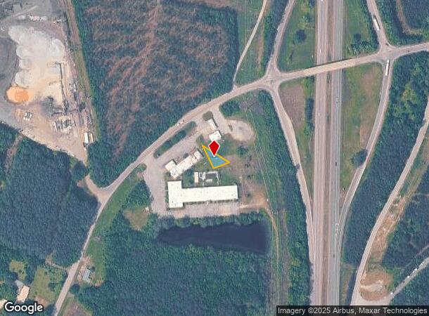
Moores Ferry Rd, Skippers, VA 23879

NEARBY LISTINGS FOR SALE OR LEASE
-
-
View all Skippers listings for sale on LoopNet.com
Property Detail
Moores Ferry Rd
44-59A1
PARCEL 1 NEAR S SIDE ST HWY 629 MOORES FERRY ROAD INST 060001372 PB 11/42 .11 ACRE
Vacantlandnec
Greensville
X
Virginia
51081C0300C
0.11 AC
2024
Virginia Regional
2024
Other Market Areas
880200
DEMOGRAPHICS near Moores Ferry Rd
1 Mile
3 Mile
5 Mile
2024 Total Population
58
672
2,673
2029 Population
57
659
2,595
Pop Growth 2024-2029
(1.72%)
(1.93%)
(2.92%)
Average Age
43
44
42
2024 Total Households
25
284
1,113
HH Growth 2024-2029
(4.00%)
(1.76%)
(2.70%)
Median Household Inc
$38,749
$46,250
$40,454
Avg Household Size
2.40
2.30
2.40
2024 Avg HH Vehicles
2.00
2.00
2.00
Median Home Value
$108,333
$117,857
$89,249
Median Year Built
1982
1981
1980
Nearby Places
Map Layers
Map Styles
 Street
 Aerial
- Restaurants
- Banks
- Shops
- Fitness
- Groceries
Nearby Properties
Address
Land Use
TOTAL SIZE
Lot Size
Zoning
Address
Land Use
TOTAL SIZE
Lot Size
Zoning
11,851 SF
40.72 AC
B-1
Address
Land Use
TOTAL SIZE
Lot Size
Zoning
4,080 SF
40.90 AC
B-2
Address
Land Use
TOTAL SIZE
Lot Size
Zoning
238.22 AC
A-1
Address
Land Use
TOTAL SIZE
Lot Size
Zoning
6,102 SF
2.90 AC
SPLT
Address
Land Use
TOTAL SIZE
Lot Size
Zoning
125 AC
A-1
Address
Land Use
TOTAL SIZE
Lot Size
Zoning
134.34 AC
SPLT
Address
Land Use
TOTAL SIZE
Lot Size
Zoning
8,492 SF
3.51 AC
B-1
Address
Land Use
TOTAL SIZE
Lot Size
Zoning
8,022 SF
8.70 AC
B-2
Address
Land Use
TOTAL SIZE
Lot Size
Zoning
6,668 SF
4.46 AC
A-1
Address
Land Use
TOTAL SIZE
Lot Size
Zoning
5,594 SF
2.72 AC
A-1
Address
Land Use
TOTAL SIZE
Lot Size
Zoning
7,092 SF
2.79 AC
A-1
Address
Land Use
TOTAL SIZE
Lot Size
Zoning
303.21 AC
A-1
Address
Land Use
TOTAL SIZE
Lot Size
Zoning
11.31 AC
A-1
Address
Land Use
TOTAL SIZE
Lot Size
Zoning
336.65 AC
A-1
Address
Land Use
TOTAL SIZE
Lot Size
Zoning
200.09 AC
SPLT
Address
Land Use
TOTAL SIZE
Lot Size
Zoning
249.66 AC
A-1
Address
Land Use
TOTAL SIZE
Lot Size
Zoning
244.03 AC
A-1
Address
Land Use
TOTAL SIZE
Lot Size
Zoning
4.48 AC
A-1
Address
Land Use
TOTAL SIZE
Lot Size
Zoning
4.35 AC
A-1
Address
Land Use
TOTAL SIZE
Lot Size
Zoning
6,096 SF
0.65 AC
HUBR
Address
Land Use
TOTAL SIZE
Lot Size
Zoning
150 AC
A-1
Address
Land Use
TOTAL SIZE
Lot Size
Zoning
0.56 AC
B-1
Address
Land Use
TOTAL SIZE
Lot Size
Zoning
22.32 AC
SPLT
Address
Land Use
TOTAL SIZE
Lot Size
Zoning
1,292 SF
1.42 AC
B-1
Address
Land Use
TOTAL SIZE
Lot Size
Zoning
123.73 AC
A-1
Address
Land Use
TOTAL SIZE
Lot Size
Zoning
139.91 AC
A-1
Address
Land Use
TOTAL SIZE
Lot Size
Zoning
170.59 AC
A-1
The World's #1 Commercial Real Estate Marketplace
Connect with us
© 2025 CoStar Group
The information above has been obtained from sources believed reliable. While we do not doubt its accuracy we have not verified it and make no guarantee, warranty or representation about it. It is your responsibility to independently confirm its accuracy and completeness. Any projections, opinions, assumptions, or estimates used are for example only and do not represent the current or future performance of the property. The value of this transaction to you depends on tax and other factors which should be evaluated by your tax, financial, and legal advisors. You and your advisors should conduct a careful, independent investigation of the property to determine to your satisfaction the suitability of the property for your needs.